Second major October snowstorm of the season for Vermont

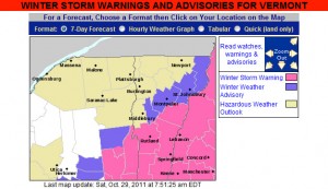
The map from the National Weather Service for Vermont Winter Storm Warnings and Advisories for October 29, 2011
Winter Storm Warnings and Winter Weather Advisories are up in Vermont for our second October snowstorm in three days.

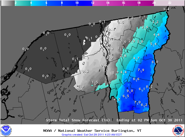
Our second significant snowstorm for October, and in fact our second significant snowstorm of the past three days, is on our doorstep.  As with the storm from Thursday, Vermont snowfall will again focused on the southern part of the state, and this is likely to be a record snowfall event for areas of Southern New England, and the Mid Atlantic Region.  Although this storm is still focused to our south, it is large enough that even our area is under its first Winter Weather Advisory of the season.  The winter weather advisory maps from the National Weather Service Office in Burlington have been added here, and more updates about this historic early-season winter storm can be found at their website.

A map of the expected snowfall totals from the National Weather Service in Vermont

For the full details on this storm, head to the detailed report at the winter weather section of our website.
Stowe, VT 11OCT2000

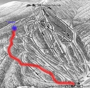
A map showing the route of my ski tour on Mt. Mansfield at Stowe Mountain Resort after an early October snowstorm delivered some powder snow for skiing
My route on Mt. Mansfield today took me up toward the Sunrise trail to enjoy some early October powder.

Today I went up to Mt. Mansfield to get some turns in the snow before it started to disappear.  A nice cold snap has dropped over a foot of new snow on some of the mountains, with snowfall reaching even down to Burlington.  Traveling on I-89, I first saw snow on the Robbins Mountain Power Line, up around 2,000′.  It was very patchy and hardly noticeable, so I was worried about how the lower elevations would be on Mt. Mansfield.  Things looked up as I entered Waterbury (~520′) and found traces of snow on the ground.  At the base of Mt. Mansfield (~1,600′) there was an inch or two of snow on the grassy surfaces.  I hiked up in the region of the triple, looking for slopes that had nicely mowed grass for the trip down – a map of my route is pictured along with this text.  At around 2,500′, the snow was over 6 inches deep so I threw on my snowshoes to make the going easier. I stopped my hike at around 2,920′ (see map) since it was time to head to work, but the snow depth had increased to about 8-10 inches.  The snow was fairly heavy (~11% H2O or so), but light enough to make powder turns.  I’m sure it was even better up at 4,000′ and above.  The first half of the run had the best snow, with much stickier stuff lower down, but I was still able to ski right back to the base of the triple and make a quick departure for Burlington.

Friday update:  From Burlington, I can see that they’ve lost some snow on the mountain, but as of yesterday evening there were still 9 inches at the stake.