Stowe, VT 11OCT2000

A map showing the route of my ski tour on Mt. Mansfield at Stowe Mountain Resort after an early October snowstorm delivered some powder snow for skiing
My route on Mt. Mansfield today took me up toward the Sunrise trail to enjoy some early October powder.

Today I went up to Mt. Mansfield to get some turns in the snow before it started to disappear.  A nice cold snap has dropped over a foot of new snow on some of the mountains, with snowfall reaching even down to Burlington.  Traveling on I-89, I first saw snow on the Robbins Mountain Power Line, up around 2,000′.  It was very patchy and hardly noticeable, so I was worried about how the lower elevations would be on Mt. Mansfield.  Things looked up as I entered Waterbury (~520′) and found traces of snow on the ground.  At the base of Mt. Mansfield (~1,600′) there was an inch or two of snow on the grassy surfaces.  I hiked up in the region of the triple, looking for slopes that had nicely mowed grass for the trip down – a map of my route is pictured along with this text.  At around 2,500′, the snow was over 6 inches deep so I threw on my snowshoes to make the going easier. I stopped my hike at around 2,920′ (see map) since it was time to head to work, but the snow depth had increased to about 8-10 inches.  The snow was fairly heavy (~11% H2O or so), but light enough to make powder turns.  I’m sure it was even better up at 4,000′ and above.  The first half of the run had the best snow, with much stickier stuff lower down, but I was still able to ski right back to the base of the triple and make a quick departure for Burlington.

Friday update:  From Burlington, I can see that they’ve lost some snow on the mountain, but as of yesterday evening there were still 9 inches at the stake.

Jay Peak, VT 09JAN1999

With the unknown element of mixed precipitation, we decided to head for Jay Peak on Saturday. Along with Bennett, we even pulled Mr. Mango Madness out for his first day of the season. In anticipation of bad roads, we loaded ourselves into Bennett’s big rig and headed north. Burlington had accumulated about 4 inches at this point, and although it was temporarily coming down only lightly, it picked up as we headed toward Jay Peak.

We were proud of ourselves for arriving on time (not easy), and took a run on the double before the tram opened. We headed down Green Mountain Boys (I think) and found about 4-6″ blown around by the wind; best on the sides. The powder was not super light, but not bad (and it was still snowing’ like crazy). By the time we got down, the tram was ready and we hopped aboard. We headed out on Vermonter, finding about 12″ of chowder, a tough ski, especially with the humidity and our goggles going crazy from the moist tram ride. I think I heard the term “skiing by Braille”, or some such out of somebody in the group. On a personal note, of course my goggles fogged up right in the middle, but if I turned my head sideways, I could look out the edge and see, really messed with the balance, but oh what fun.

After another run on the tram, we headed over to the triple, and headed for Timbuktu (one of our favorites). We hung to the right to catch fresh snow, but found plenty of ice storm damage in that area, and with the snow that had fallen so far, only very short lines were available, and even then it wasn’t a secure feeling with the fallen trees around. As we headed back left, we found that clearing had been much better, but this area was already getting pretty tracked.

We boarded the quad and found our best run of the day by far. North Glade must have just recently been opened because there were few tracks, and 8+ inches of powder; we left there wanting more (and trying to figure out where we were and how we got there.) We finished off the day with a couple of tram rides (amazingly, you could always get right on the tram with no line) and hit some areas that may not have been officially open, but didn’t exactly have ropes either. Oh well, there were three of us, and sometimes ignorance is bliss; in the form of untracked snow.

One of the highlight’s of the day was Mango simply exploding on a very flat section of Deer Run. It looked like a snow snake just jumped out and bit him; and the look of “what the…!” as he went down into a crumbled heap of man and equipment, was priceless. During one of our traverses that I was leading, I got ridiculed for my choice of line, something about “What rabbit made this!” as Bennett found himself stuck between a tree and a hard place.

During one of our tram rides, the ticket checker said that it was raining just about everywhere south of Jay. I was initially skeptical, then happy that we were at Jay Peak of course, then worried about what would happen at places like Sugarbush. Stay tuned for our Sunday installment in which the truth will be revealed!

Stowe, Hourglass Chute, & Hell Brook Trail, VT 22MAR1997

Well, the weather setup leading into this weekend was a 4 to 6 inch snowfall yesterday; so it came just in time for weekend turns.  Somehow, there came to be a bit of a crust on top, but unlike last weekend, it was paper thin and didn’t really affect the non-groomed terrain.

Today I caught up with Shawshank at Stowe sometime between 7:30 and 8:00 A.M. and we hit the usual stashes with other folks that we knew.  The big event came in the afternoon with a 1:00 P.M. meeting at the top of the Gondi and a hike into the swirling mists of The Chin.  Let’s just say, without the guidance of Shawshank, there would have been no way to find anything up there in the near zero visibility.  The wind was probably gusting to 40 mph at times, but it wasn’t bad for the top of a mountain, and by the time we reached the Hourglass Chute, we were protected altogether.  Hourglass was fun, although it seemed to be over so quickly.  I remember reaching this one point about as wide as the length of my skis (the narrow part of the hourglass) and four turns later we had to bang a left to make the connection to Hell Brook.  We traversed for about 50 feet, took a quick step up a short incline, then dropped a nice little section into the low point between the Adam’s Apple And The Chin (so I was told; still socked in).  After a bit more of a traverse, we found ourselves at the top of Hell Brook.  I thought that it was going to be a singletrack adventure down into the Notch; I was definitely wrong there.  As it turns out (at least at this time of year) it is much like an interconnected patchwork of trails, snowfields, and gullies which gradually narrows into a single gully towards the end.  Actually, a lot of it reminded me of the gullies at Alta or Snowbird, except that it was a lot longer and there were hardwoods about.  One could take this thing 20 times and still not know the whole maze; it makes for some very fun exploration.  A word of caution:  there were numerous spots where a wrong turn would mean a big drop or other hazards that could ruin your run so take it easy.  Shawshank lost his goggles in a little open water spot and before anyone knew what was up, they were down the brook and under the snow.  Damn.  We finally wound up on Route 108 for a mostly (one bit of uphill) downhill traverse back to the Gondola and nearly 3000′ of vertical in one run.  By the time we got back to the quad it was about 3:30 P.M. and we were kaput.

I stopped in at the Stowehof where my friend Chris was staying.  It’s a real quaint place with great views.  I think that the bar and restaurant are open to the public, but just walking around in there is a lot of fun.

Robbins Mountain Power Line, VT 30DEC1995

Today we skied the power line on Robbins Mountain (power for the airway beacon on top).  Here are the stats:

Base elevation: 340′
Summit elevation: 2060′
Vertical drop: 1720′
Length: 5544′
Slope: 31%

After kicking in steps yesterday evening (snowshoeless are we) to 1,100′, we hiked up to around 1,350′ today with skis. Unfortunately, above this point, the line hasn’t been cleared in a couple of years and its pretty thick with brush. Below this point though, its clear sailing, about 40 feet wide and untracked. The snow conditions were about 5 inches powder followed by that crust, then another 2-3 feet of thick powder below. From our starting point, the first 200 feet down are a little brushy (a la Goat) then the trail funnels into a 50 foot chute with steep drops on either side. After this chute, the line opens up for about 200 feet of blue-grade boulevard untracked (one of the best parts). The next 1,000′ consists of a few cliffs (5-10 feet high and easily bypassed if desired) with islands of brush that leave at least half of the trail open at a all times. At this point (elevation 700′) the main power line takes a dive into a stream bed, but fortunately there is a road, or riverbed or something that parallels the line and provides a nice clear route. The last 100 feet or so is a bit of a scramble out the road. Temps were in the 20s and light snow was falling today making for great conditions. 1,000 continuous vertical of untracked powder at no charge; sometimes it’s nice to earn turns by muscle instead of $$$$.

Stowe, VT 10DEC1995

Shawshank tells me that the lifts at Stowe will start running at an incredible 7:00 A.M for Sunday. OK, I’ll be there bright and early. Recording a possible record arrival, I get myself to the quad before 7:30 and find it humming right along with people returning from runs. After a warm-up attempt to get some freshies on Liftline/National, I ran into Andor & co. right in line. The rest of the morning consisted of Goat, Queebs, traverse, learn, Chin Clip, Goat?, Starr, Starr or something like that. I found myself happily buried more than once. At lunch we met up with Shawshank, ate some food and went back at it. Shawshank reported a multitude of freshies on hayride earlier in the day, so awaaaaaaaaaay we go. In my head and body I’m thinkin’ “Gawd I’m tired, a couple more runs should do it for me, I mean 7 something A.M was a long time ago.” Whoops look what we found, more fresh woods. Any thoughts of leaving were gone as we plowed our way through virtually untracked freshies on “Oh Shit”, “Major Jones”, and others. By connecting everything right, we had found top to bottom fresh woods off the quad “Who could leave?” The stake near “Oh shit” read 3 feet, 6 inches of snow and I whole heartedly believe it. When it finally became too dangerous to ski anymore, we called it. Through the magic of powder, I had managed to reel in over 30,000 vertical without ever realizing it. Now that’s a drug.

OK, back to reality. There was a harsh wind blowing up top, 0 degrees air temp + wind = -38 degree w.c.  The wind was also blowing some of the snow off the trails and exposing the ice underneath (more reason to stay off-trail). Lines were a bit long in the noonish hours, even the gondola had a line. I don’t know about the big streambed, but a lot of little ones are still visibly flowing, maybe from all the insulating snow. More poachers getting nabbed on lower lift line, Lookout wasn’t open (100%?) and the Tollhouse lift wasn’t running.

(A friend of mine ended up there on his first day of snowboarding, apparently crossing no ropes, and had to get a ride back. The guy who gave him the ride said “Yeah, that’s been happening a lot today” ?What’s up with that?)

But I’m certainly not complaining.

Next weekend I’m skiing in NH “yikes” and I’ll send in one of those “out of state” reports

J. “There’s skiing in other states too” Spin

Stowe, VT 02APR1994

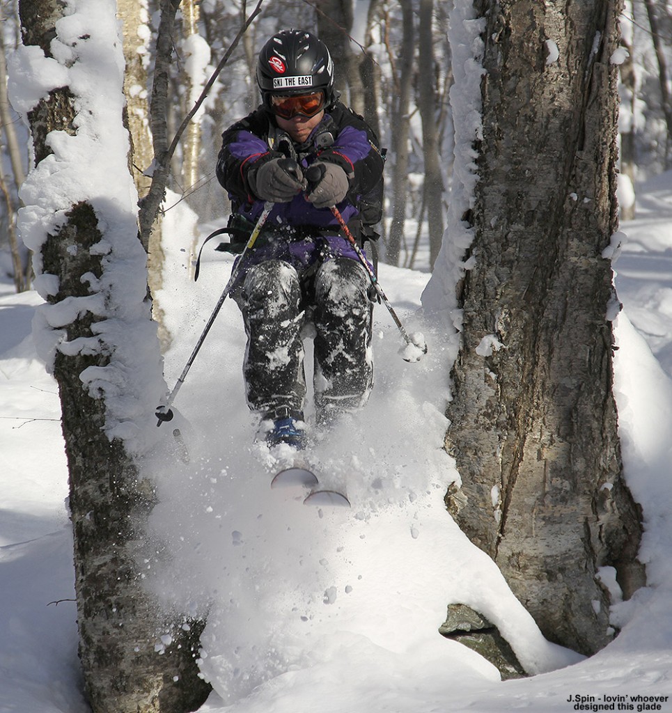
An image of Jay jumping off the side of the trail on skis at Stowe Mountain Ski Resort in Vermont
Catching some air today at Stowe while Rolandos runs the camera

Today I spent the day skiing with Rolandos and Chris at Stowe – we had soft spring snow and hit some of the old favorites like Lord, and of course Hayride with those great bumps.  Rolandos took some photographs with his camera, and it was great having the chance to be out with a skilled photographer possessing a real SLR camera.  Rolandos scanned his negatives (or something along those lines) and created some digital images that I’ve added to this report.