Bolton Valley Nordic & Backcountry, VT 26JAN2025

An image of a backcountry ski pack with a blue access band attached on the Nordic & Backcountry Network at Bolton Valley Ski Resort in Vermont
An image showing evergreen trees plastered with snow from recent winter storms at Bolton Valley Ski Resort in Vermont
The snow continues to pile up and the evergreens continue to become buried in the Bolton Valley Backcountry.

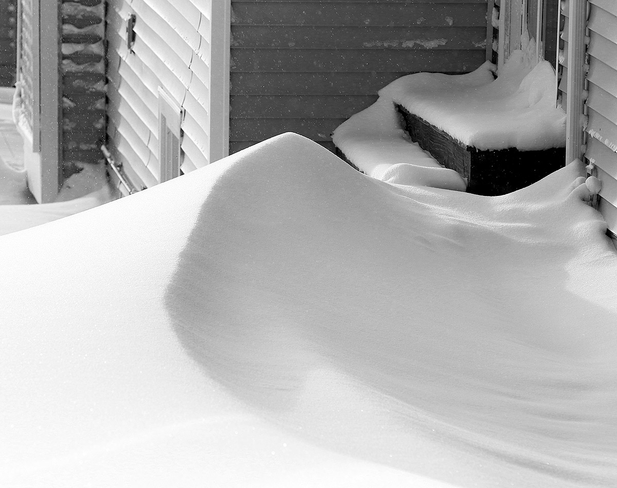
A cold front moved through the area in the late morning period today, and whiteout conditions were encountered in numerous spots. With snow returning over the past couple of days, Bolton Valley was reporting an additional 2 to 3 inches in their 24-hour total, and my liquid analyses from down at the house indicated that it was indeed very dry snow – down around 2% H2O. This isn’t the kind of snow that is going to quickly build the snowpack, but it is the kind of snow that compliments the powder that is already in place. And the mountain snowpack is doing fine for this time of year anyway – as of today’s report, the snow depth at the Mt. Mansfield Stake is almost 60 inches.

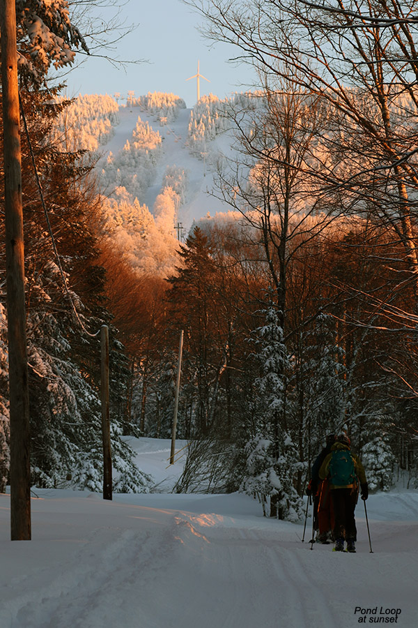
My ski tour from yesterday revealed that the powder out there is in absolutely fantastic shape, so I decided to head out for another tour today. Temperatures were up today – well up into the 20s F in the mountains, but the wind had picked up as well. Skies were cloudy as the snow pulled out but quickly shifted to partly cloudy conditions with bright sun at times.

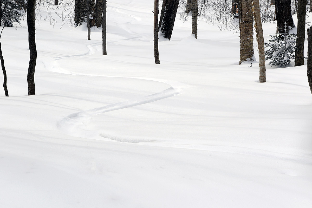
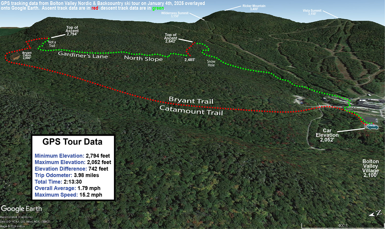
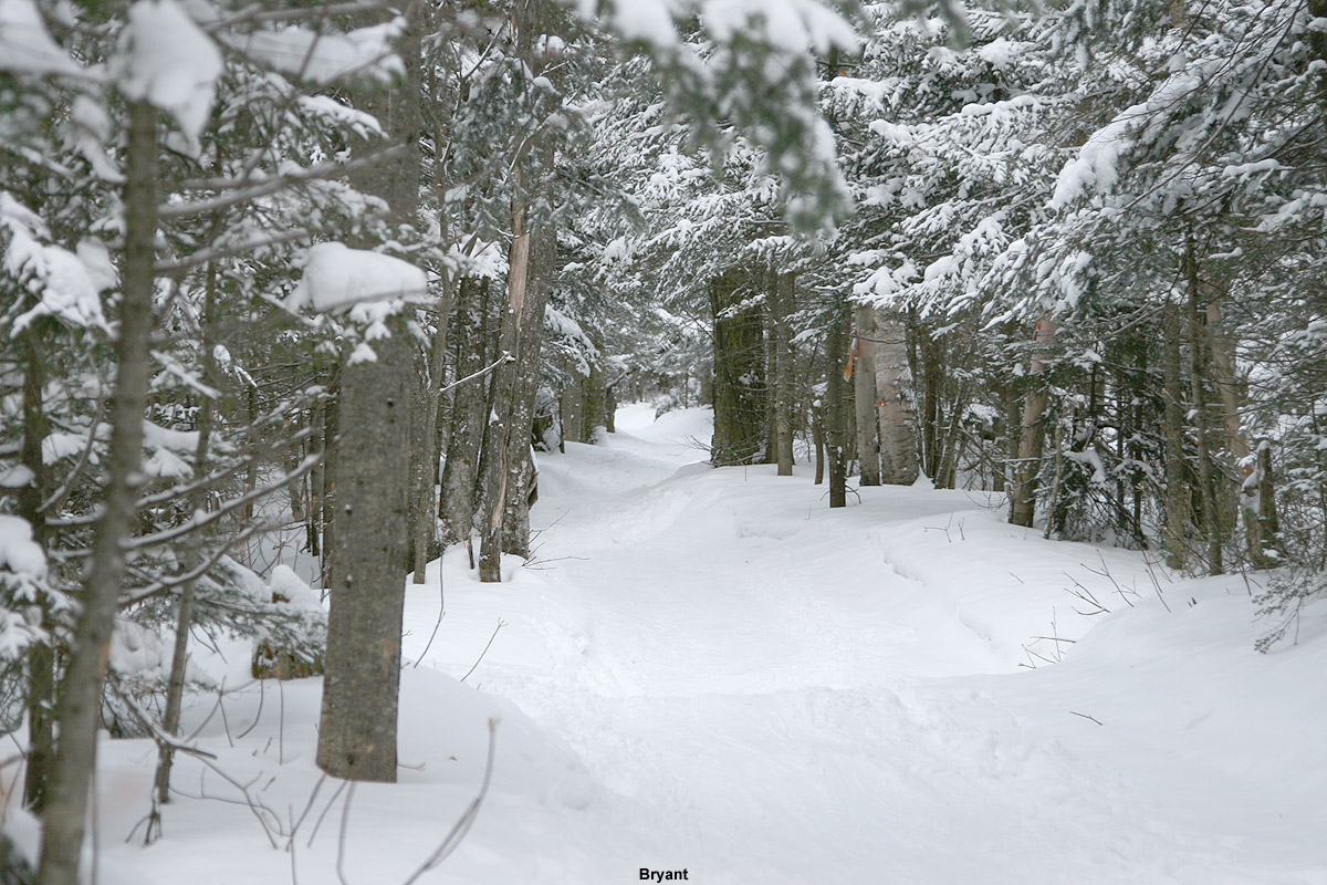
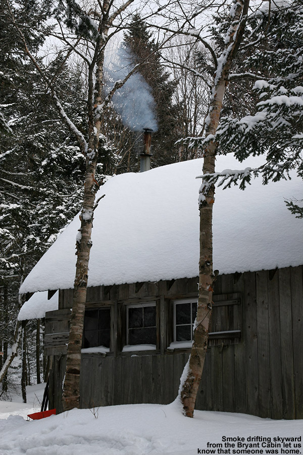
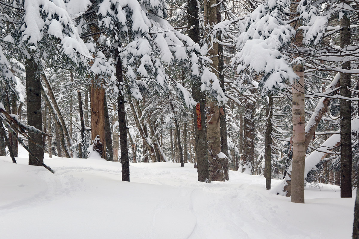
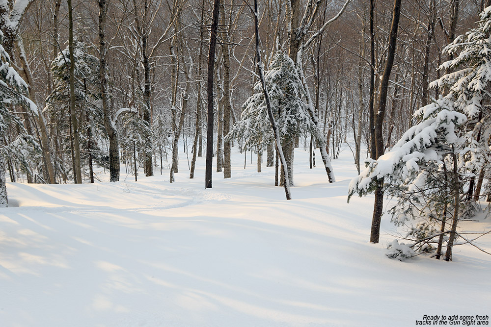
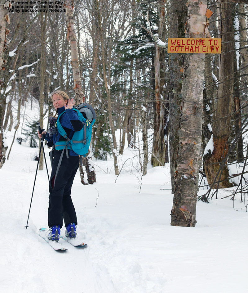
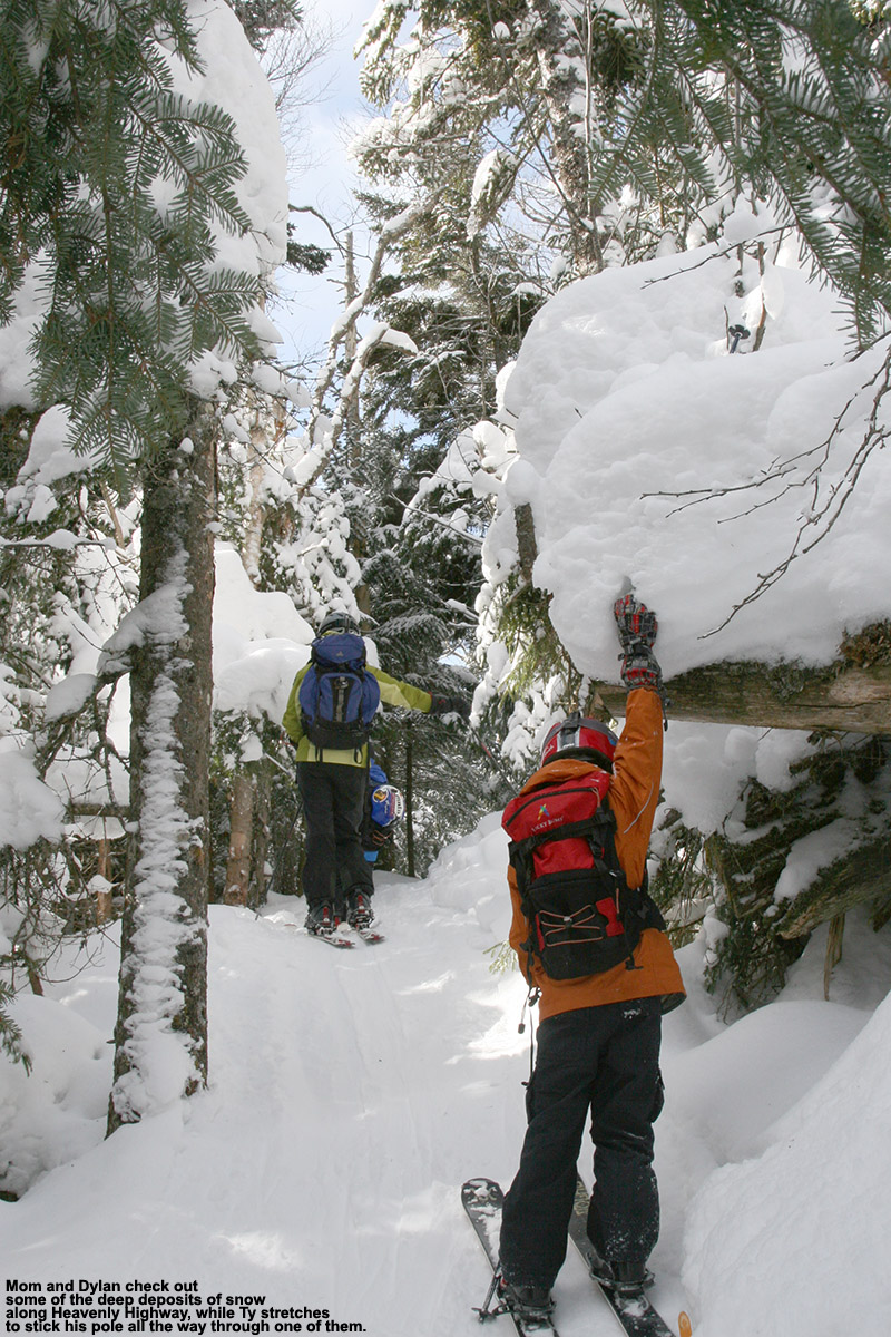
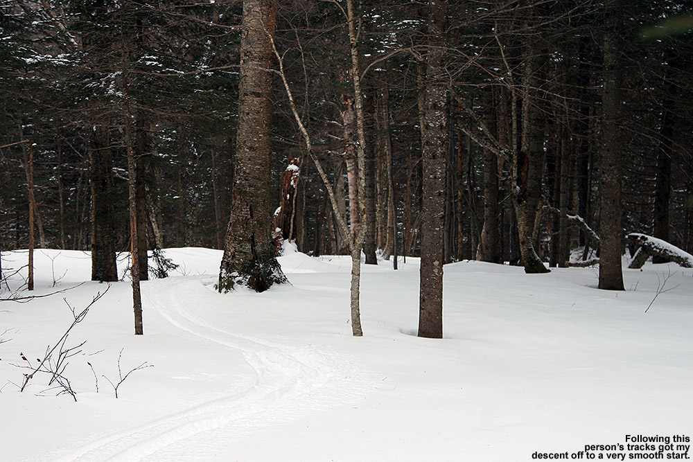
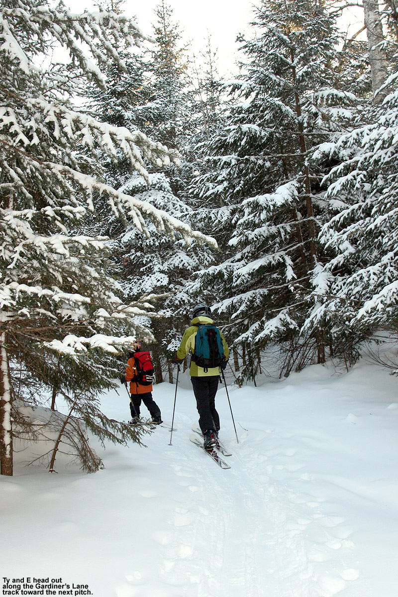
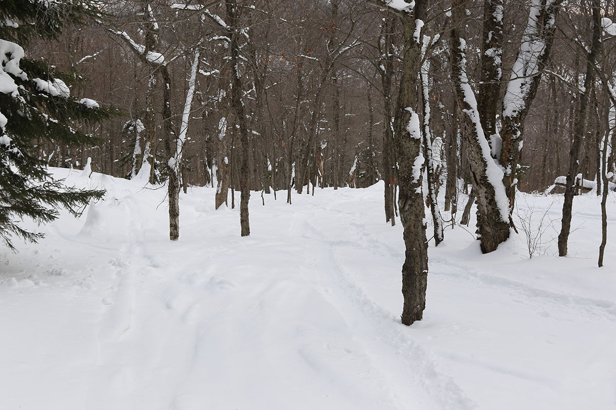
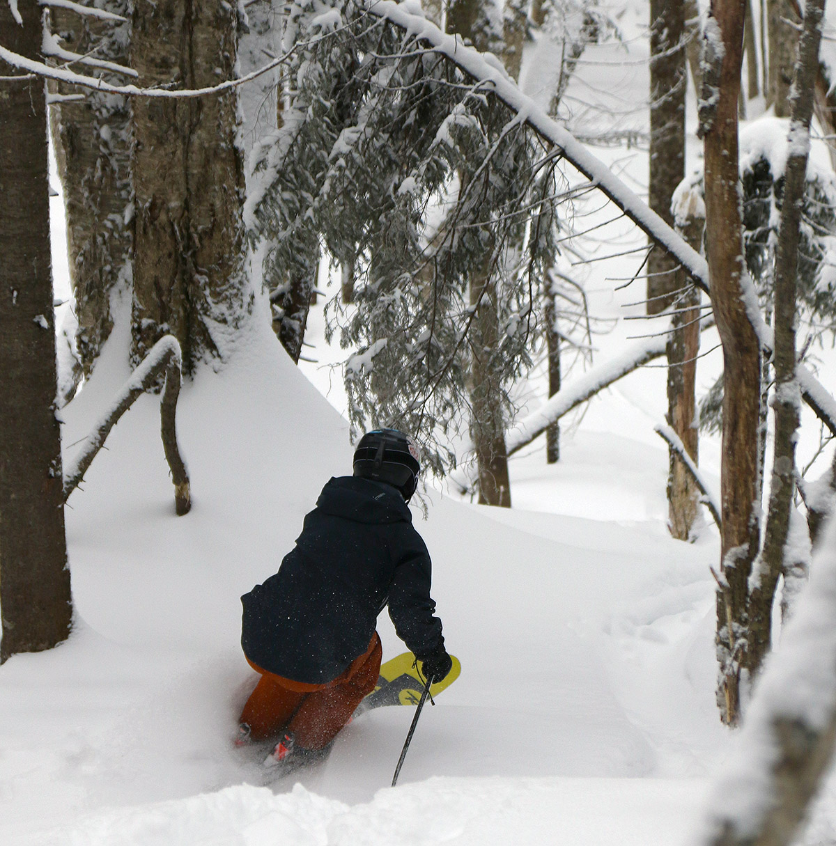
I toured on the west side of the Bolton Valley Nordic & Backcountry Network yesterday through elevations in roughly the 2,000’-2,400’ range, but today I toured on some of the more traditional Bryant Trail terrain and topped out around 2,800’. I toured up and around Bryant Cabin, then continued on up to the Not a Trail traverse and descended from there. I hit the Gun Sight area, which I’d yet to visit this season, and then continued my descent through a collection of lower-elevation glades. Similar to yesterday, the main lines of most glades have seen plenty of skier traffic, but all you have to do is head off into the surrounding trees and the snow is untracked and bottomless. Even in the dense evergreen areas the snowpack is deep – it was at least 30 to 40 inches when I checked at the 2,800’ level, but I can’t tell if I was actually probing all the way down to ground level.

A Google Earth map with GPS tracking data for a ski tour on the Bolton Valley Nordic & Backcountry Network
A map of today’s ski tour on the Bolton Valley Nordic & Backcountry Network using GPS tracking data displayed via Google Earth

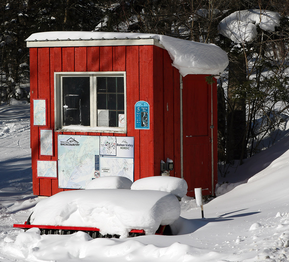
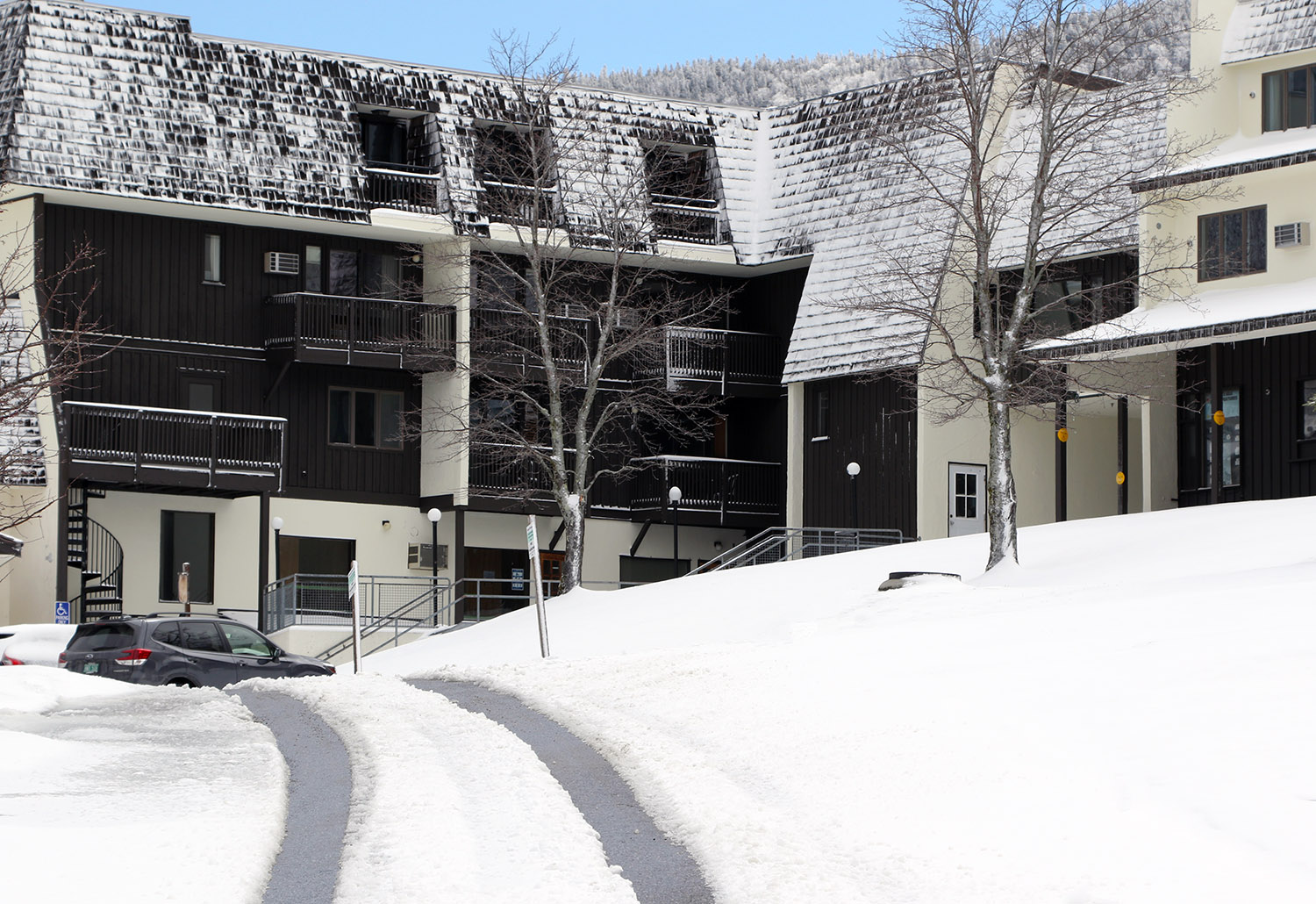
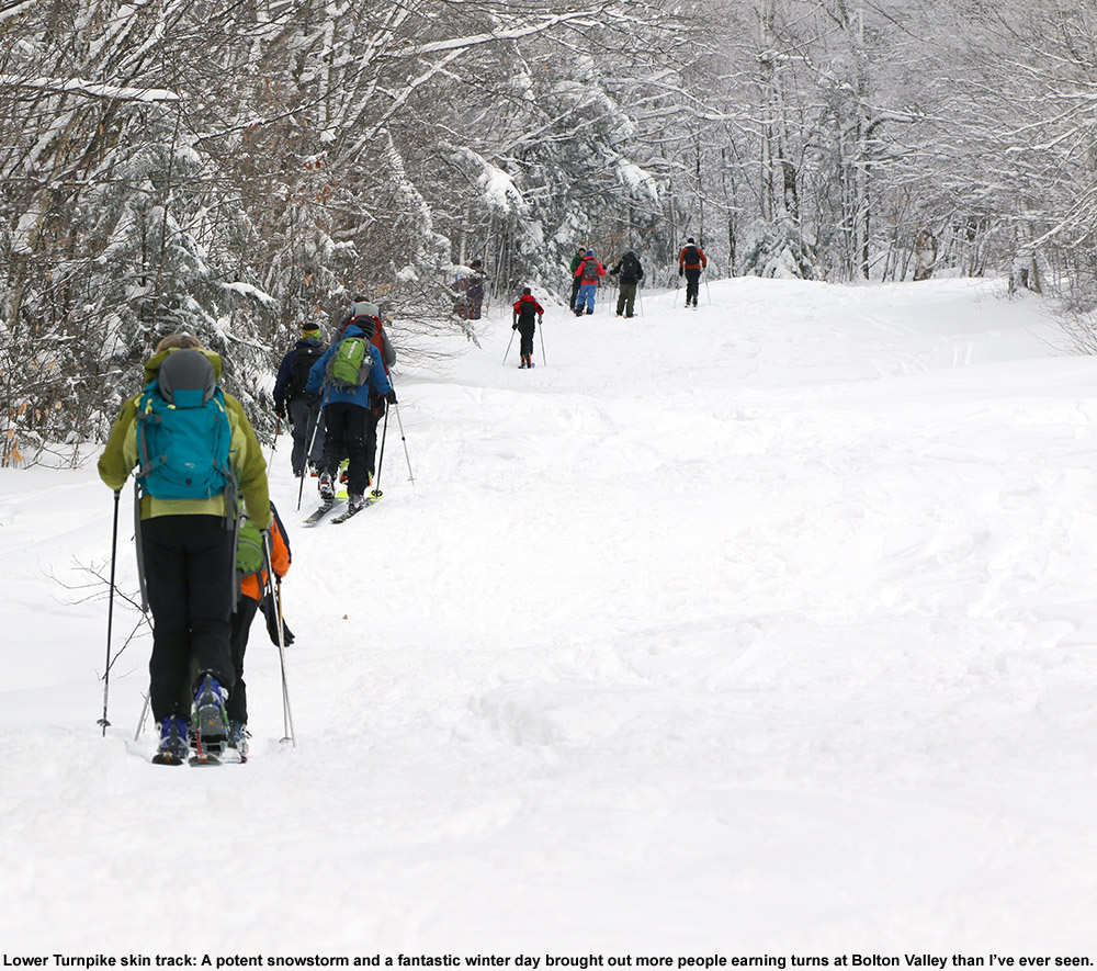
Today must not have been as busy at the resort as yesterday, because when I headed up the afternoon there was no sign at Timberline about the upper parking areas being full. Bolton has definitely been checking people’s passes for Nordic & Backcountry Network access this weekend. Yesterday on my way up the Bryant Trail I had to show a patroller my pass, and today they had an employee stationed at the Nordic Hut at the base of the Bryant Trail. I showed her my pass, but she wanted me to get one of the new blue arm bands that the resort is requiring for trail network use this season. I’d read about the arm bands on the resort’s website but hadn’t seen them in practice. It looks like they’re fully implementing them now, but now that I’ve picked mine up, it’s good for the whole season. In the Nordic & Backcountry Center they said that you can just keep it on your backcountry pack, since people are finding them a bit small to go on the arm. I was planning to visit the Nordic & Backcountry Center anyway, because I wanted to check out its new location. It’s moved from down at Ralph’s Rec Center to one of the buildings on the west side of the Village Circle. This is a better location with respect to backcountry access, especially for those using the Wilderness Uphill Route since it’s so close, but it seems to be a little less convenient for Nordic skiers that might be starting out on the Broadway Trail.

Bolton Valley Nordic & Backcountry, VT 20JAN2025

An image of trees near the Alchemist glade plastered with dry fluffy powder snow from recent winter storms at Bolton Valley Ski Resort in Vermont
An image of the Nordic Ticket Booth area covered in sunshine and powder snow from recent winter storms at Bolton Valley Ski Resort in Vermont
The views of snow and sun at the Bolton Valley Nordic ticket booth suggested that Mother Nature was setting up another great day for ski touring.

We were back to highs in the single digits F today, and I’d certainly call those touring temperatures. With the cold weather, I wasn’t sure if I was going to head out for turns today or not, but with snow quality this good and snowpack this deep, it’s easy to tip the scales toward skiing vs. doing something else for exercise. Bolton Valley was also reporting another 2 to 3 inches of fresh snow from Winter Storm Demi, so the January snowfall just keeps piling up, inch by inch.

There are a number of main sectors of the Bolton Valley Nordic & Backcountry Network that I haven’t visited yet this season, and with the current snowpack, essentially everything is in play, so it was difficult to choose where to go. I ultimately decided on a loop up to Bryant Cabin and a descent in the Gotham City area, since I hadn’t been out there yet this season. Indeed, the afternoon temperatures were in the single digits F in the mountains today like we had back at the beginning of the month, but it was sunny, and there was little wind, so that made it feel noticeably different from the snowy, windy single-digit temperatures we had before. It was really quite comfortable out on the ascent, and I was cruising up the Bryant Trail, it was feeling so nice that I decided to extend my tour a bit higher.

An image of the snowy roof of the Bryant Cabin out on the Nordic and Backcountry Network at Bolton Valley Ski Resort in Vermont
A view of snowy Brant Cabin today as I stopped by briefly during my ski tour for a drink and some photos.

I stopped briefly at Bryant Cabin for a drink and some photos, then continued on up Heavenly Highway to the Not a Trail area at around the 2,800’ elevation. I did some checks on the snowpack depth and was typically getting numbers in the range of 35 to 45 inches. I think I was getting to the bottom of the snowpack when probing with my ski pole, but it’s hard to know for sure without digging a pit. When I was out in the Jay Peak backcountry touring the west face of the Gilpin Mountain/Domey’s Dome range on Saturday, snowpack probing at similar elevations was typically giving me depths of 45 to 50 inches. So, as one might expect with the snowfall the Jay Peak area has seen thus far this season (a bit over 200 inches), the snowpack seems to be a bit deeper there at equivalent elevations.

An image of a snowy evergreen tree near the Alchemist glade at Bolton Valley Ski Resort in Vermont
It’s only mid-January, but the forest is getting check with snow and evergreens are beginning their process of disappearing into the snowpack

For my descent, I skied a bit of Not a Trail, took the Not a Trail high traverse, then dropped into a nice line that brought me across North Slope and down to Gardiner’s Lane. From there I headed to Gotham City, and since the weather has been so cold and snow preservation so solid, I decided to check out the south-facing Alchemist glade. That area typically suffers from coverage in sunny and warm conditions, but we haven’t had much of that lately, and coverage was excellent. Since our most recent snow, there were only a couple of new tracks in the main Alchemist lines, but there were a number of older tracks that had packed the snow down a bit more, so I ended up heading off to some ancillary lines on the skier’s left. I found acres of terrain over there that was virtually untracked, and it was so good that I put my skins back on and made a quick second ascent via one of the descent tracks on Alchemist to get in another run.

An image of ski tracks in the fresh powder of the Alchemist glade at Bolton Valley Ski Resort in Vermont
Looking back at some lines after floating down through the powder in Bolton Valley’s Alchemist Glade

If one wants to split hairs, I’d say that the new snow that fell from Winter Storm Demi may have knocked the quality of the powder skiing down just a touch. Up here in the Northern Greens we weren’t in any of the heavier snowfall banding from the storm, so snowfall rates were modest, and flake sizes were as well. My liquid analyses from down in the valley indicated that the powder came in at 8.6% H2O, so that’s getting up there toward the density of standard 10% H2O synoptic snow. That was probably a bit denser than the powder that was sitting on the surface before it fell, so it altered the developing right-side-up density gradient in the surface snow just a touch. Also, the snow skis a bit slower in single-digit temperatures, so the combination of the powder density and temperatures meant that turns were a bit sluggish on lower-angle terrain. Moderate-angle and steep terrain skied great though, and remember, we’re talking about the finer details of powder quality here, so it comes down to the difference between maybe a point on a 10-piont scale. As mentioned, as soon as I reached the bottom of my run, I turned around and skinned up for another go, so that tells you how good the skiing was. With the low temperatures and dry air that we’re expected to have over the next couple of days, and indeed all the way into next weekend, I wouldn’t be surprised to find the top layers of the powder drying out and the density gradient gradually resetting itself for even better powder quality as time goes on. That process has actually happened a decent amount over the past few weeks, which is one of the benefits of consistently cold temperatures and very low humidity.

A Google Earth map with GPS tracking data for a ski tour on the Bolton Valley Nordic & Backcountry Network
The GPS tracking data for today’s ski tour on the Bolton Valley Nordic & Backcountry Network overlayed onto a Google Earth map

There aren’t any major systems expected to hit the area in the next couple of days, so the only potential snow during the midweek period would be if any of the moisture from Lake Ontario makes it over here to the Northern Greens. There’s not much expected, but there were a few radar echoes approaching the area in the evening, so the mountains may have pulled a few flakes out of that. Anything we get from lake moisture would be very dry snow, so it would top off the powder nicely in terms of the density gradient. Once we get out toward Friday and the weekend, there may be a couple chances for Clipper systems to affect the area.

Bolton Valley Nordic & Backcountry, VT 04JAN2025

An image of a snowdrift outside the condominiums near the base of the Wilderness Double Chairlift during a January snowstorm at Bolton Valley Ski Resort in Vermont
An image of ski tracks in powder snow in the Cup Runneth Over area of the Nordic and Backcountry Network of trails at Bolton Valley Ski Resort in Vermont
The powder is great and the backcountry ski traffic has generally been light – as I passed by, I saw just one old set of tracks in the Cup Runneth Over area.

Our current storm cycle started up back on Wednesday, with low pressure deepening as it passed over southeast New England and up into Maine. It then headed on up into eastern Quebec, stalled there for a bit, and finally moved to northwest to James Bay, where it’s expected to sit until about Monday. While this isn’t a stacked low-pressure system sitting in the Canadian Maritimes feeding continuous 1+”/hr. snows into the Northern Greens, the broad cyclonic flow supported by the various positions of the low pressure has kept the area in a nice moist westerly/northwesterly flow that’s been feeding snow into the mountains. So, this isn’t a typical 24-, 48-, or 72-hour type of storm cycle; it’s a much more drawn-out sort of “cycle”. I wasn’t sure how the positions of this low would actually play out with respect to snowfall, but since well before the start of the storm the National Weather Service Office in Burlington has been on it – they felt that the potential was there for solid amounts of snow over the protracted period. And they certainly weren’t wrong. It’s been a little tough to total up the mountain accumulations for the full event because it’s already been going on for four days, and the resorts typically only report up to 48-hour accumulations, but it looks like anywhere from roughly 1.5 to 3 feet have fallen in the Northern Greens from the system as of today.

Bolton Valley was reporting 4 to 6 inches of new snow overnight on top of their previous accumulations from the system. I’d already been finding snow accumulations of 9 to 10 inches when I was out touring at Bolton on Thursday, so between whatever fell Thursday night into Friday, plus these additional Friday night accumulations, there seemed to be some good powder potential out there. Temperature forecasts for the mountains were in the single digits F today, so touring seemed to be the best option. E was initially going to join me for a ski tour, but after thinking about the temperatures for a bit, she ultimately decided to work out at home instead.

An image of icicles and snow hanging off the roof of the Bryant Cabin on the Nordic and Backcountry Network of trails at Bolton Valley Ski Resort in VermontI headed up to the mountain a bit after noontime, and people certainly didn’t seem to care about the temperatures – the signs were up for visitors to park at Timberline because the upper lots were full. Being after noon, I knew I’d be able to get a spot from someone who was leaving for the day, so I headed up to the main base anyway. I still ended up getting a spot in the lowest tennis court lot though, and that changed up my touring plans a bit. I had initially planned to ascend at the start of the Wilderness Uphill Route and then make my way toward Gardiner’s Lane, but since I was parked right down by the Pond Loop area with easy access to the Bryant Trail, I ascended there instead. I had just planned to loop around Bryant Cabin and then head out to start my descent on North Slope, but the temperatures felt great while touring, so I continued on up to Heavenly Highway, topped out around 2,800’, and started my descent via the “Not a Trail” glade. From there I continued down North Slope and then made a second ascent to ski some of the glades in the Snow Hole area.

An image of a ski pole with measurement of the powder in the snowpack showing a depth of 24 inches during a backcountry ski tour on the Nordic and Backcountry Network of trails at Bolton Valley Ski Resort in Vermont
Up above 2,500′ there were frequently areas with 24 inches of powder atop a substantial base for what must have been a snowpack depth in the range of 40 inches

It was clear that powder depths had increased at the resort since I was last there on Thursday. Winds have died down substantially now, so measuring the snow is much easier, and right at the car at ~2,000’ I was getting 8-12” depths for the surface snow above the base. By 2,500’ the typical depths were in the 12-16” range, and around 2,800’ I’d say they were 12-18”. I’d still think that’s somewhat conservative though, because I was often finding powder depths of 24” up around 2,700’-2,800’. Right now, getting up above 2,500’ makes a real difference in the snow though, because those areas must have done really well during our previous warmup – the interface between the surface snow and the base has mostly disappeared by that point (making it harder to measure just the new snow), and the skiing is really good. Dropping into my initial descent, I could tell that the overall snowpack was really deep.  Below that top 24” of powder there was substantial base, and I’d say the snowpack there has to be 40 inches. The snowpack at the Mt. Mansfield Stake was at 39” as of a couple of days ago, and it hasn’t been updated since then, but based on what I found out there today a few miles to the south, it’s got to be over 40 inches by now.

Anyway, I’d recommend doing most of your touring up in that 2,500’ to 3,500’ elevation range if you can – it’s just a notable improvement in the overall snowpack below 2,500’. It’s still nice skiing down there, but it’s sort of mid-fat powder conditions below 2,500’, and full-fat conditions above 2,500’. I toured on mid-fats today, but I was wishing I had fat skis in that deep snowpack above 2,500’. The powder is of medium weight, so there’s plenty of liquid equivalent in there to really keep you off the base. As of this evening we’re approaching an inch of liquid equivalent from this system at our site in the valley, so you know the mountains have had at least an inch of two of liquid equivalent from this system so far, and it definitely felt like it based on what I experienced above 2,500’ today.

A Google Earth map with GPS tracking data from a ski tour out on the Nordic and Backcountry Network of trails at Bolton Valley Ski Resort in Vermont
A Google Earth/GPS map of today’s tour out on the Bolton Valley Nordic & Backcountry Network

With respect to the ongoing storm, there was generally light but consistent snow falling when I was out on the mountain today. The flakes were small, in the 1 to 2 mm range, so it was hard to gauge snowfall rates, but I had to clean a decent layer off my car when I got back to it after just an hour or two of touring. Toward the end of my tour, the flake size was picking up noticeably to roughly 2 to 8 mm flakes. Down here at the house, we’ve had light snow all day, but it’s picked up more this evening with larger flakes, especially when strong echoes come through as more pronounced shortwaves embedded in the overall cyclonic flow move through the area. Based on what we’ve been seeing here at the house this evening, there should be at least another few inches out there by tomorrow morning for the mountains.