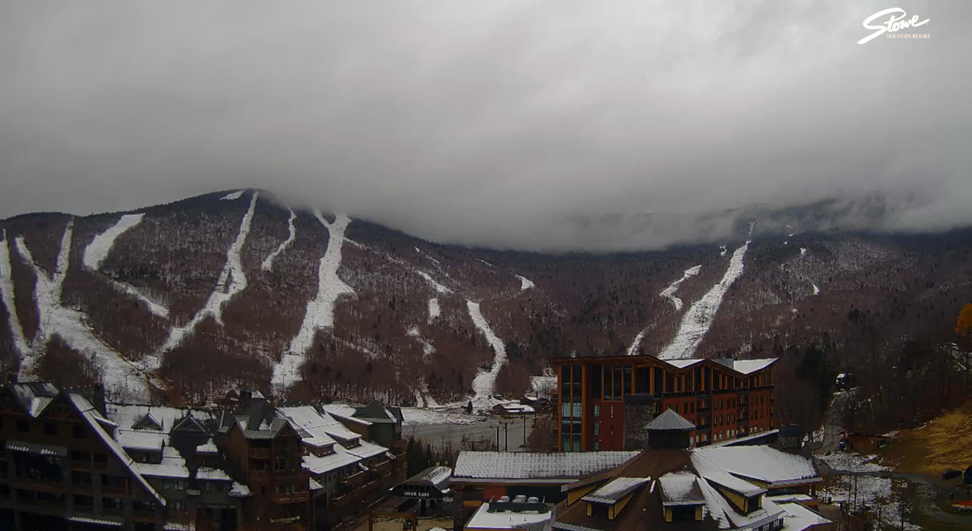
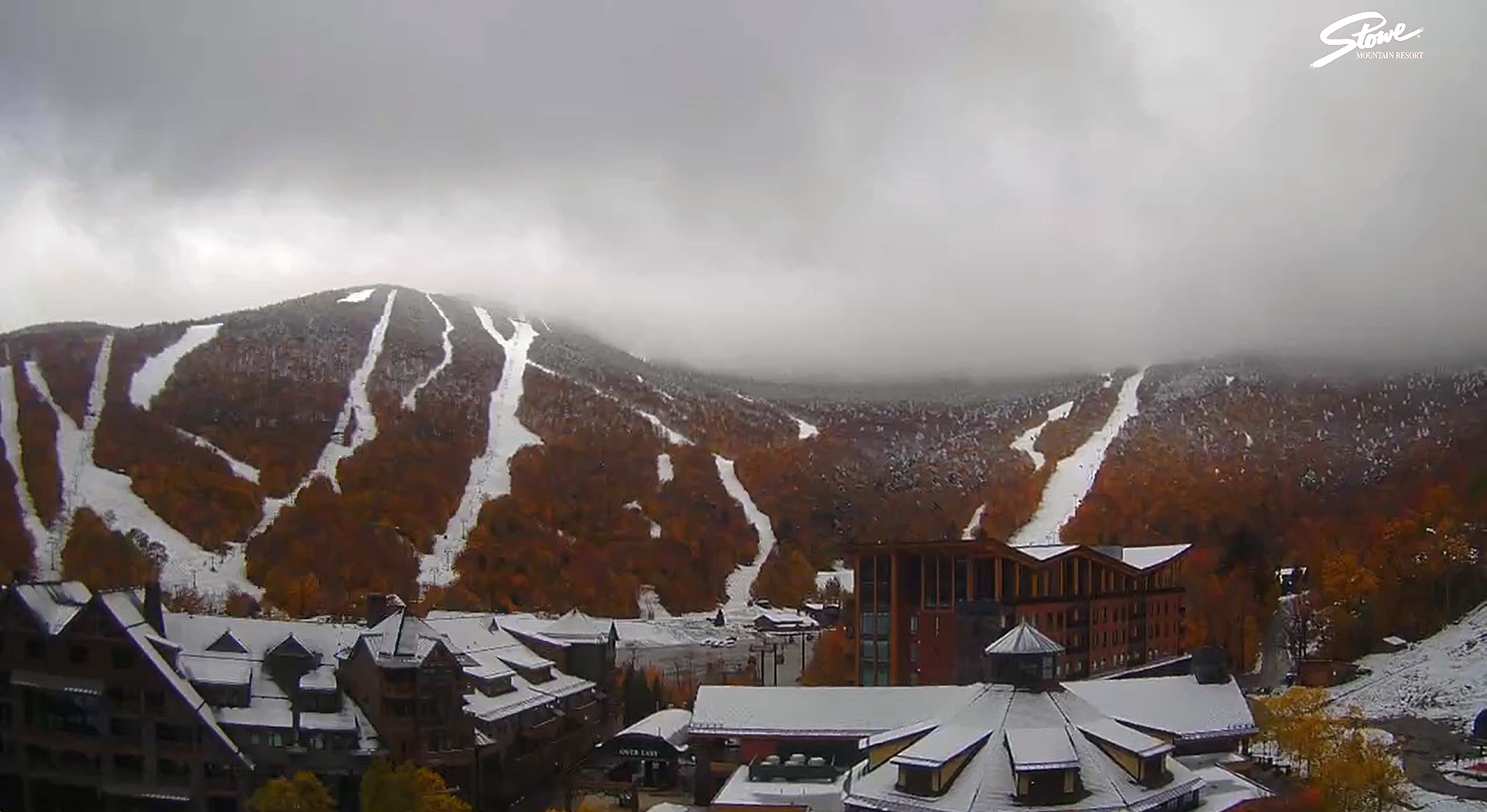
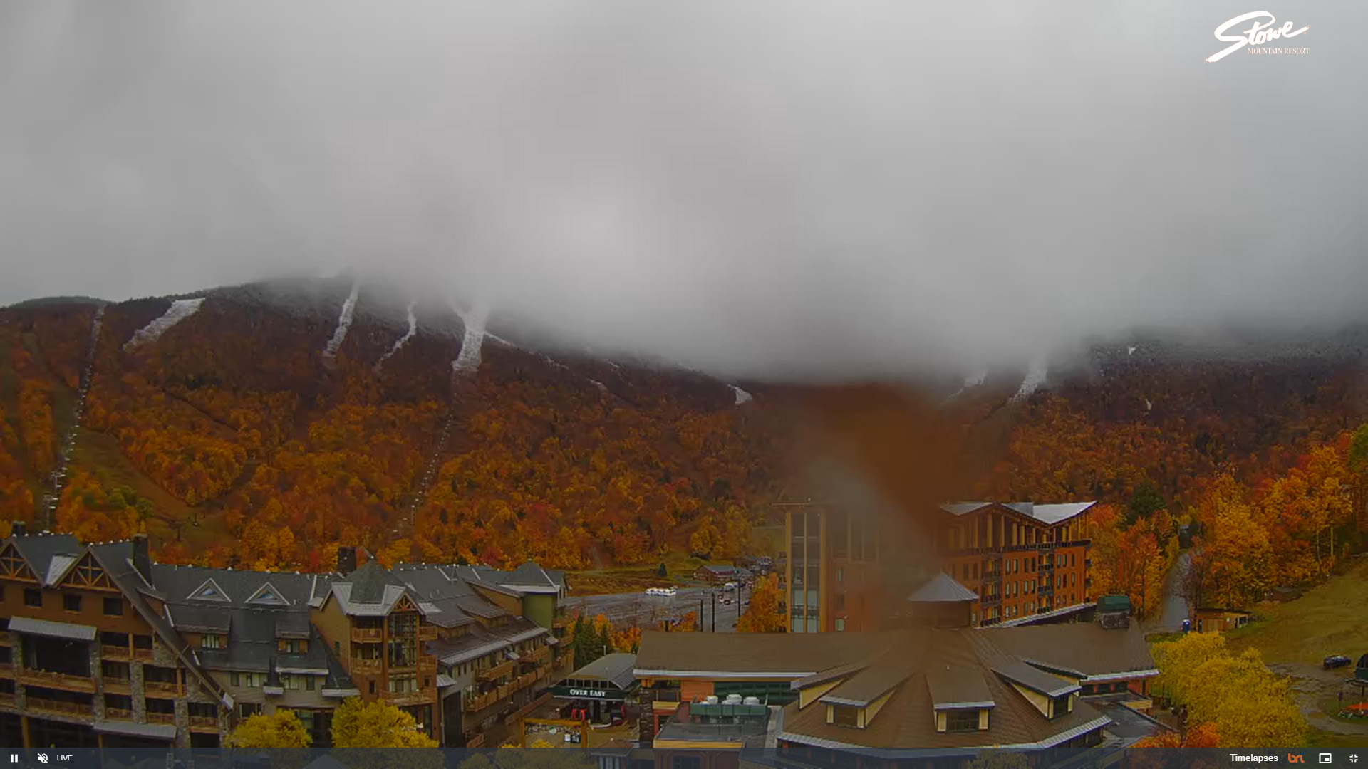
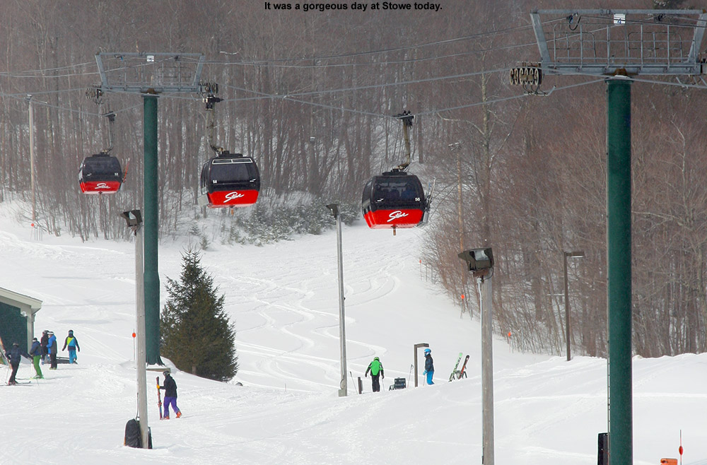
Residual accumulations visible on the Stowe Mountain Resort webcam thanks to our most recent round of early season snows
The first flakes of the season at our site in Waterbury were back on the 16th of the month with that last big snow event, but thanks to the system moving through yesterday into today, we accrued the first accumulations I’ve seen here. Temperatures were certainly above freezing here in the valley, but the intensity of the precipitation is what brought on the accumulation when one of the more active cells on the radar came through our area.
Accumulations finally started to take hold down at our elevation of 500 feet in the Winooski Valley in Waterbury when one of the more potent cells of precipitation crossed the spine of the Green Mountains in our area.
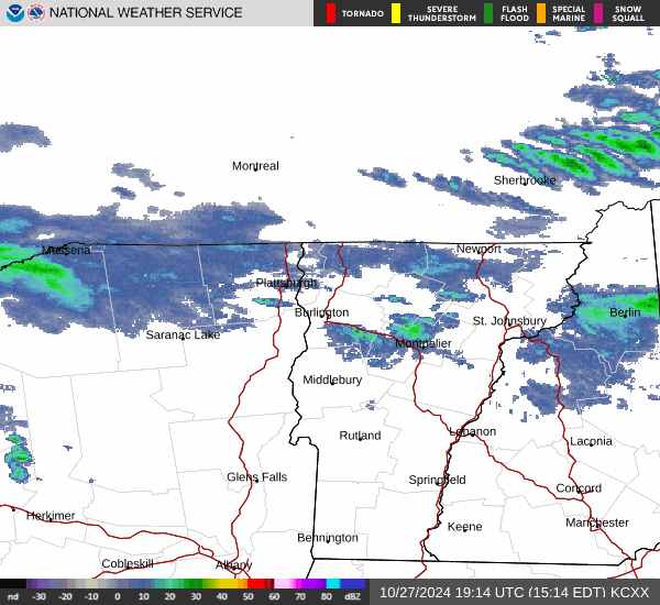
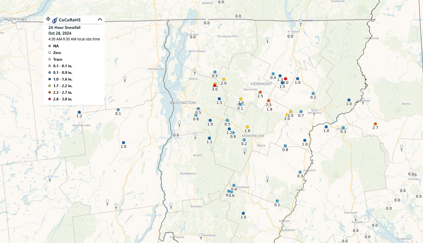
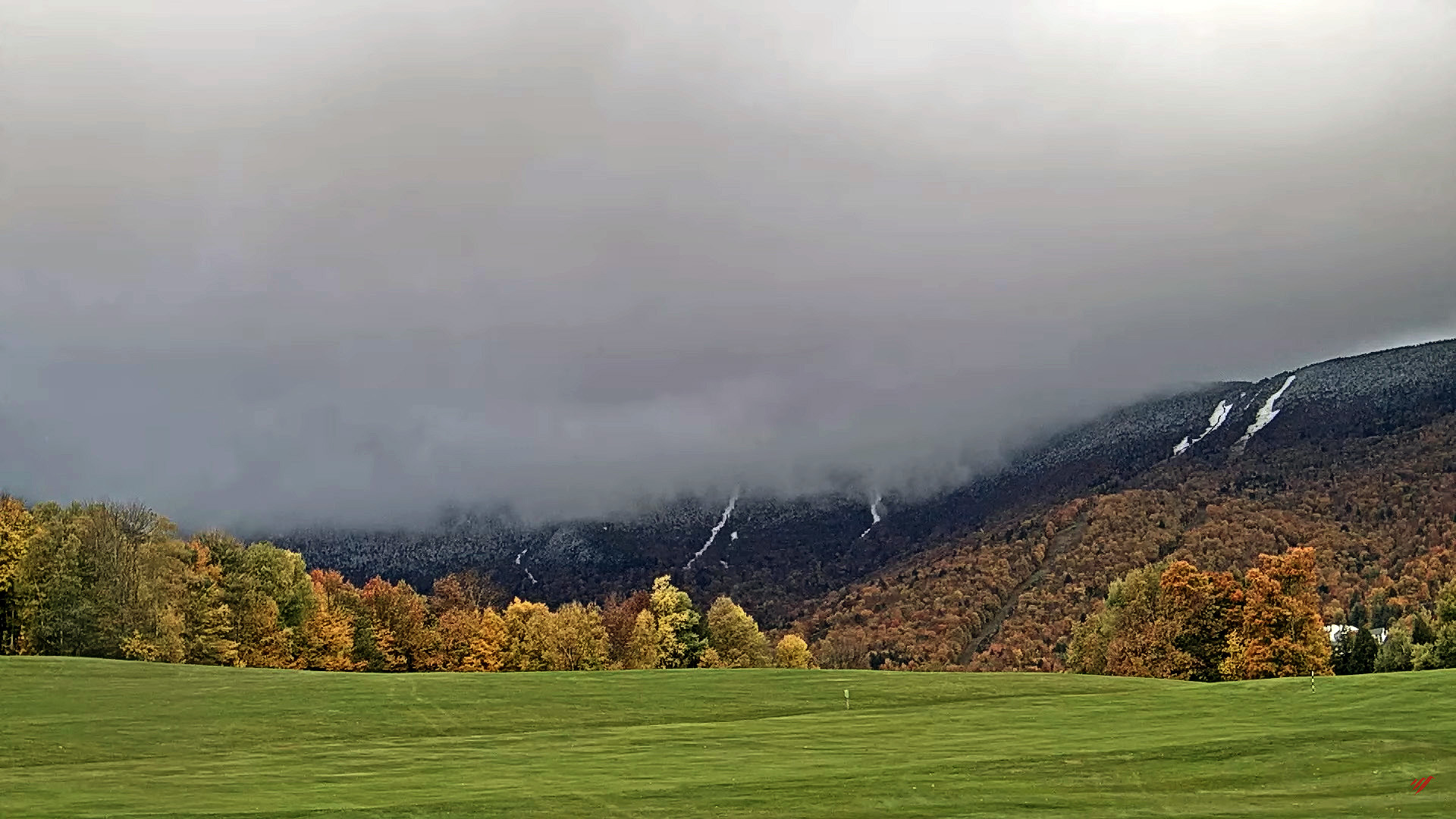
Based on posts that were showing up in the Northern New England thread at the American Weather Forum yesterday, it was clear that many valley locations were starting to see accumulations as the temperatures came down. Temperatures dropped well into the 20s F overnight, so by morning, CoCoRaHS reports revealed valley accumulations of anything from a trace to as much as a few inches in a stripe across Northern Vermont.
As our latest fall snowstorm moved through the area yesterday and into the night, many sites in a stripe across Northern Vermont reported accumulations to CoCoRaHS this morning.
A view of some of the powder turns on Perry Merrill. While yesterday was definitely the best day to get out in terms of fresh snow quality, today still delivered some very nice turns as long as you were high enough and early enough to avoid the warming temperatures.
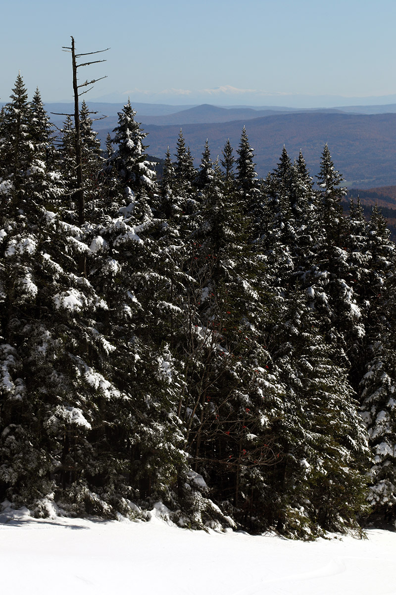
With this latest round of autumn snow culminating in over a foot of accumulation on Mt. Mansfield, the setup was calling for some early season turns. With the way the temperatures were expected to rise today, I think yesterday was the way to go for potentially the best overall snow quality for powder turns, but I was too busy to get out to the slopes. I did get out this morning though, and while snow preservation was undoubtedly better yesterday, the clouds totally disappeared today to reveal incredible snowliage in the sunshine.
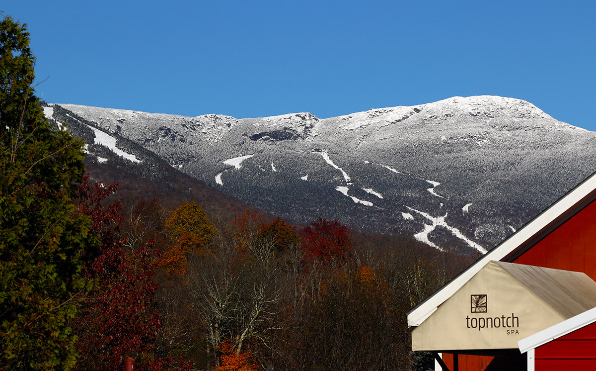
A view of the beautiful snow and foliage from the Top Notch area on my approach to the mountain today.
I started my ascent from the Gondola base at 1,600’ and walked with my skis on my pack for a few minutes to get above the areas with the most melting, then I transitioned for touring and skinned up from there. The snow was already becoming spring-like down low in the sun, and areas in the shade featured refrozen snow. So even yesterday, the freezing level made it above the base elevations. I encountered my first real winter snow that had not seen a thaw-freeze cycle at about 2,800’ in the shade, and then at around 3,200’ I began finding some winter snow even in the sun. I made snow depth checks along the way, and here’s the depth profile I found in the late-morning to midday period:
Depths had consolidated a bit even up at 3,600’ based on Powderfreak’s pictures from yesterday, and the sun was really doing a number on the snow down low. The Gondola terrain gets hit by the sun, and the accumulations down near the Gondola base were just about gone by the time I finished my descent.
An eastward view out toward the snow-capped White Mountains of New Hampshire on today’s descent
In terms of the skiing, I encountered just about every sort of condition that Mother Nature can throw at you, from dense, silky powder, to refrozen areas with unbreakable melt crust, to spring snow, to sticky, freshly melted snow. Once you were down below the driest snow up top, the best approach was to fucus on the snow that was in that happy medium between seeing the most sun on the skier’s left, and that which had seen no sun on the far skiers right in the shade of the trees. The snow on the skier’s left that had seen some hours of sun was getting sticky, and snow that was shaded by the trees was still frozen with either an unbreakable or breakable melt crust, but in between there was an area of quality snow that had seen just enough sun to soften up but not get sticky. Once you were down below roughly 2,000’, everything was melting, so you just sort of kept going until you felt the snow was too thin. You could still make it all the way to the base with the help of shaded areas depending on what level of rock skis you might be on, but I took off my skis for the last few hundred vertical because I didn’t want to beat them up too much.
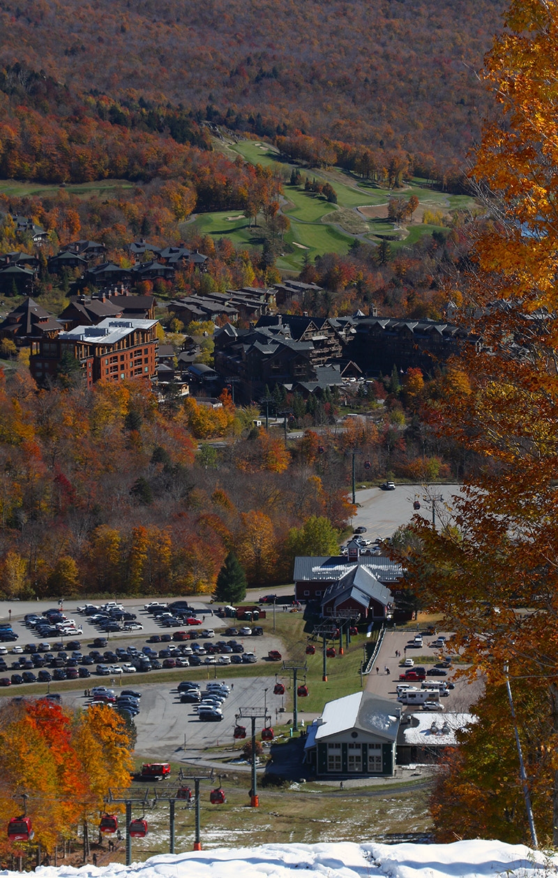
Snow cover was disappearing in sunny areas down at the base elevations of the resort as I approached the end of my descent
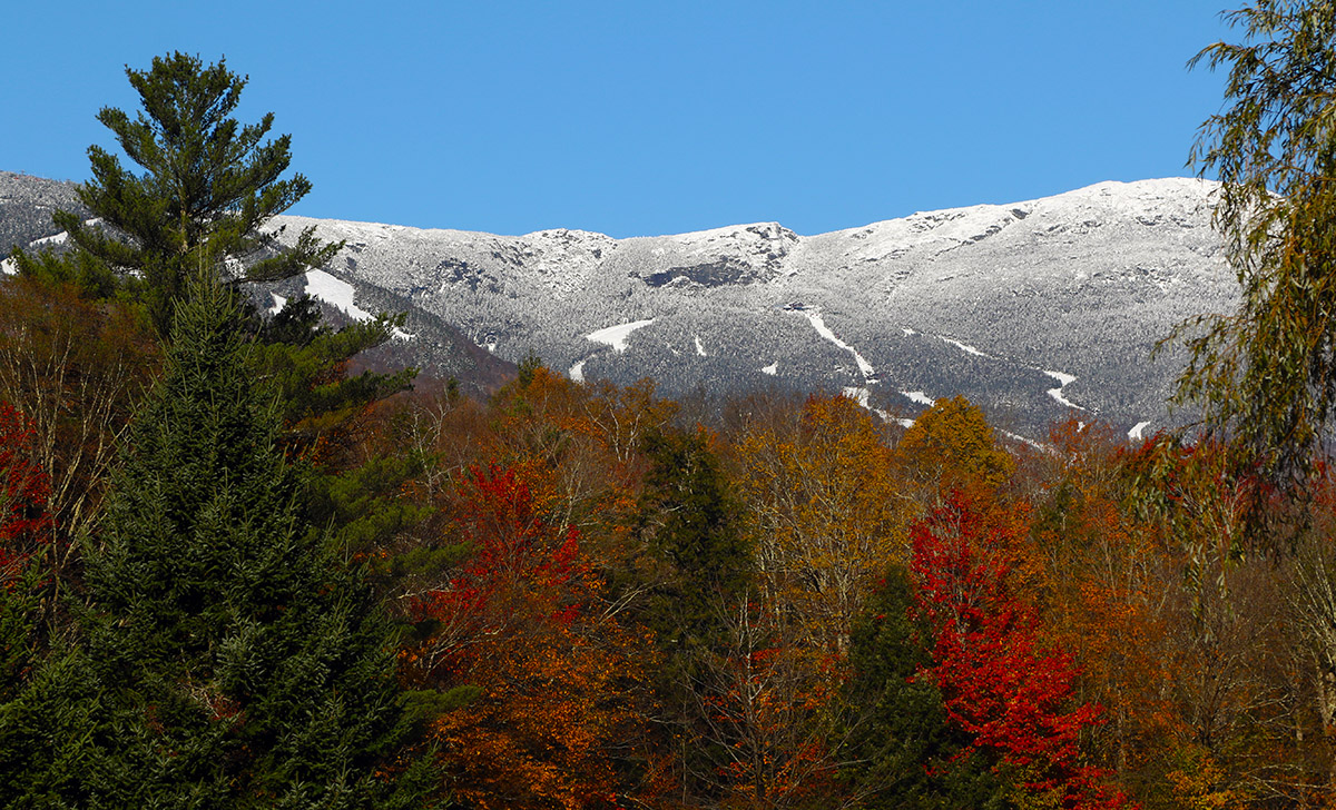
That was a solid dump for the middle of October though, and with the bonus snowliage it was a great way to kick off the season.
By Tuesday, accumulations were starting to appear in the upper elevations of Mt. Mansfield, with snow levels continuing to drop and accumulations jumping as the event continued on into Wednesday.
This was a great early season event for the local mountains, and even at elevation, there were still enough leaves left on some of the trees to create excellent snowliage images.
We had our first reported snow of the season here in Vermont over a month ago when flakes were spotted atop Jay Peak, but this latest round of winter weather has now brought us the first actual accumulations of the season. Our initial images of the accumulations came out yesterday morning when Powderfreak sent out some shots from the higher elevations of Mt. Mansfield during his usual Stowe Mountain Resort duties. Later in the day he sent along a nice image of the cloud ceiling and flakes falling on Spruce Peak while he was out on an afternoon hike. The snow was down to at least the 3,100’ elevation as of the afternoon, and with more moisture pushing into the spine of the Greens according to the radar, the potential for some additional overnight accumulations was looking good. The moisture seemed to be drifting a bit south though, and I saw a comment from Powderfreak that he felt the Central and Southern Greens would have the better chances for accumulations during the overnight period.
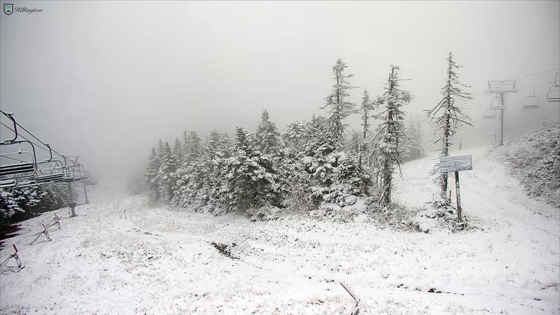
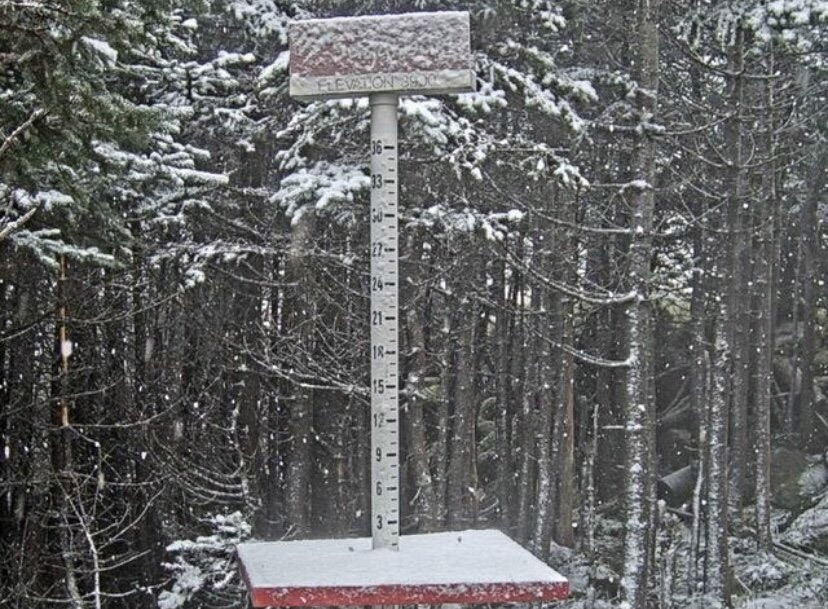
A shot from Killington’s North Ridge Webcam of today’s new snow during our period of first snow accumulations for the 2024-2025 winter season. Accumulations began in the area yesterday and the Central Green Mountain s picked up some of the best snows overnight.
Since our first snows of the season back in September, we’ve moved on into a new month and another window for early season snowfall. This time the snow chances are associated with a series of small disturbances that started moving into the area last night and are expected to continue through the weekend.
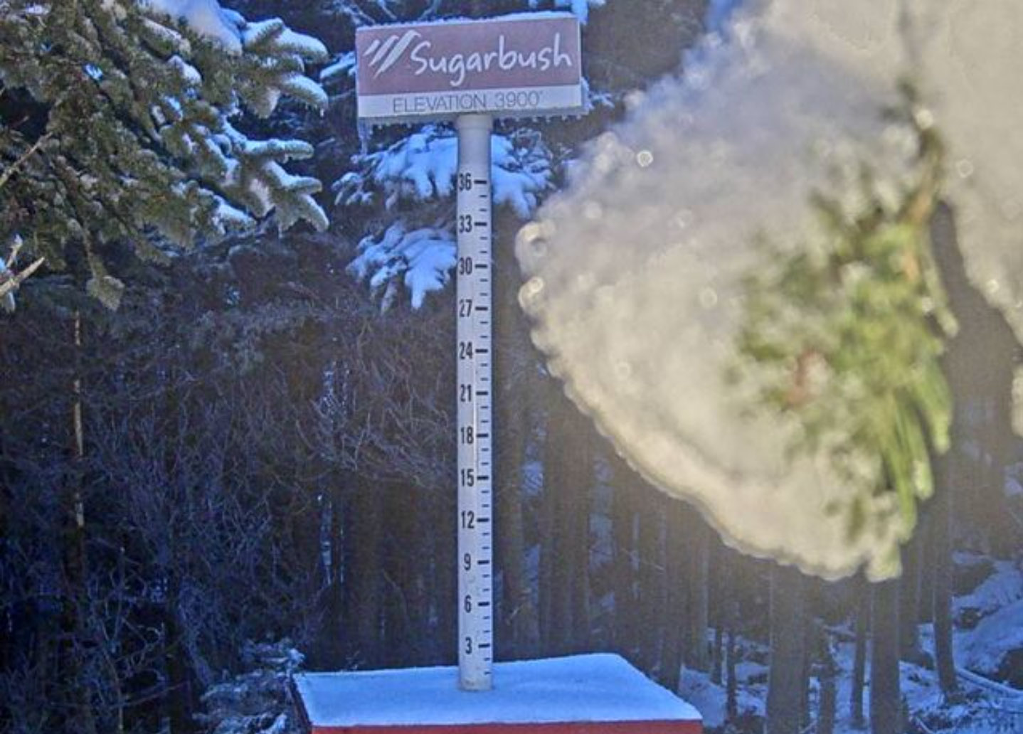
A view of the Sugarbush upper-mountain webcam from this afternoon showing a touch of new snow with what looks like some additional frozen precipitation weighing down the evergreen boughs
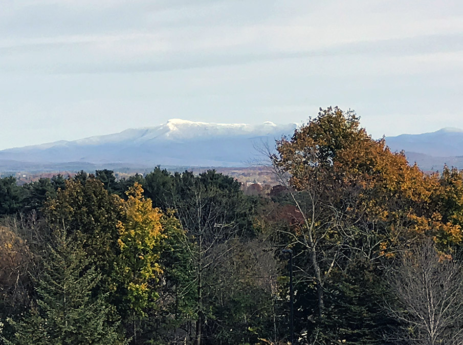
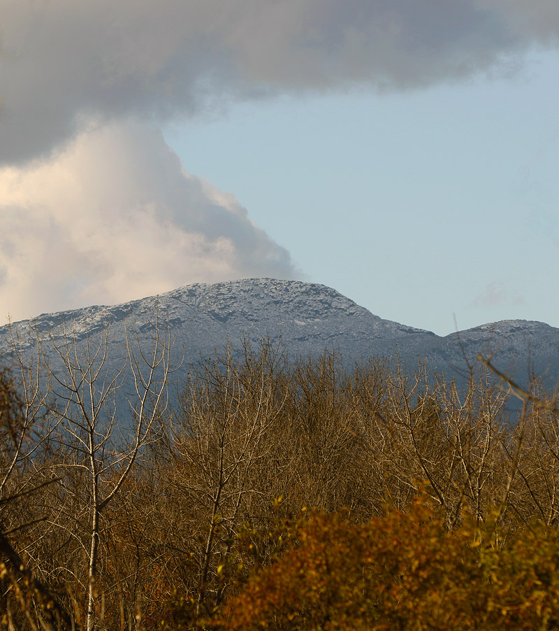
An image of Mt. Mansfield today taken from my office at UVM showing signs from the recent storm and fall foliage still hanging on in the valley.
The local mountains picked up some more snow in what looks to be our final snowfall event for the month of October. Down here in the valley at our house, I found a few flakes on my snow measurement board yesterday evening, but no measurable accumulation. This storm was more notable down in Southern New England where there were totals up around 7 inches in the Worcester, Mass area.
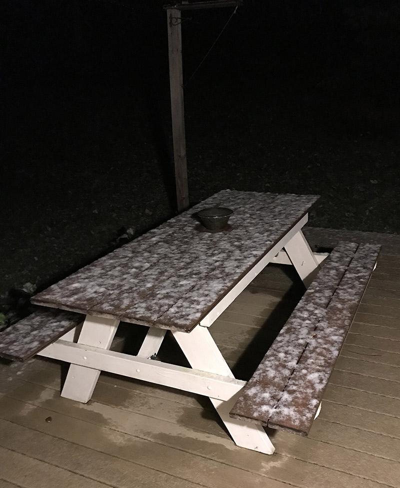
I woke up this morning to find snow accumulating on grassy and elevated surfaces like this picnic table on our deck. It’s the first accumulation we’ve seen in the valley this season!
I woke up this morning to find snow on the grass and elevated surfaces at our house, most notably our picnic table out back on the deck. This was the first snow I’ve seen at our house this season, and although our weather forecast did suggest there was some potential for accumulation, you never quite know how it’s going to play out in marginal situations like this one.
In any event, the snow stuck even down here at 500’, so it should have easily accumulated in the higher elevations. I measured 0.6” on the boards at observations time, and it did look like it could have melted some since the point at which most of it fell.
This is about a week on the late side for average occurrence of first frozen precipitation here at our house, but just a day off for the average date of first accumulating snow, so it’s very typical in that regard.
Details from the 6:00 A.M. Waterbury observations:
The Mt. Mansfield Chin today with some early season October snow
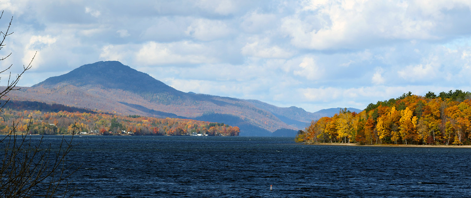
While in many areas around the state, the leaves have mostly fallen and it’s looking like stick season, there are still a lot of beautiful scenes with fall foliage. We were up in Newport today for a soccer game, and the views of foliage along Lake Memphremagog were beautiful.


