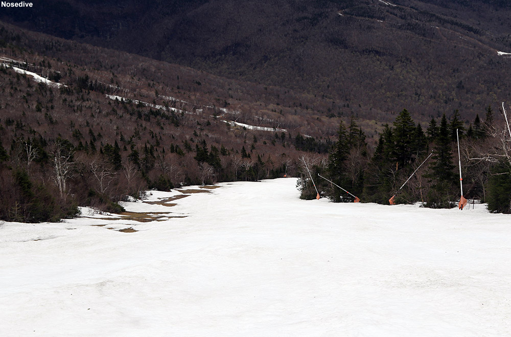
There’s still plenty of snow on Nosedive as of today.
I was hoping to head out for a ski tour when the weather cleared up yesterday afternoon, but it happened just a bit too late to fit any skiing in among the rest of the things I had to do in the evening. Today however, we got a more substantial break in the weather around late morning, so I decided to take advantage of that window and head off to Stowe.
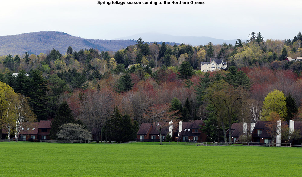
Spring is slowly making its way into the mountain valleys throughout Northern Vermont
The forecast called for scattered rain showers today, but we know how Mother Nature works when it comes to Mt. Mansfield, and it wouldn’t be too surprising to find her scattering a lot more of the showers in that direction. Indeed as I drove the final 10 minutes to the mountain, the rain steadily picked up from sprinkles to a steady light to moderate rain by the time I was at the Mansfield Base preparing my gear.
I ascended via the North Slope route, figuring there’s less time left to explore that area vs. the long-lasting Nosedive option. I found the snow sun cupped in a lot of spots, but coverage was almost completely continuous until I got up into the areas where Toll Road crossed my route. Unfortunately, they’re plowed the road for vehicles, so that put some substantial gaps in the coverage. I had hoped to descend via something similar to my descent route, but eventually resolved to head to Nosedive because the plowing had just cut things up too much.
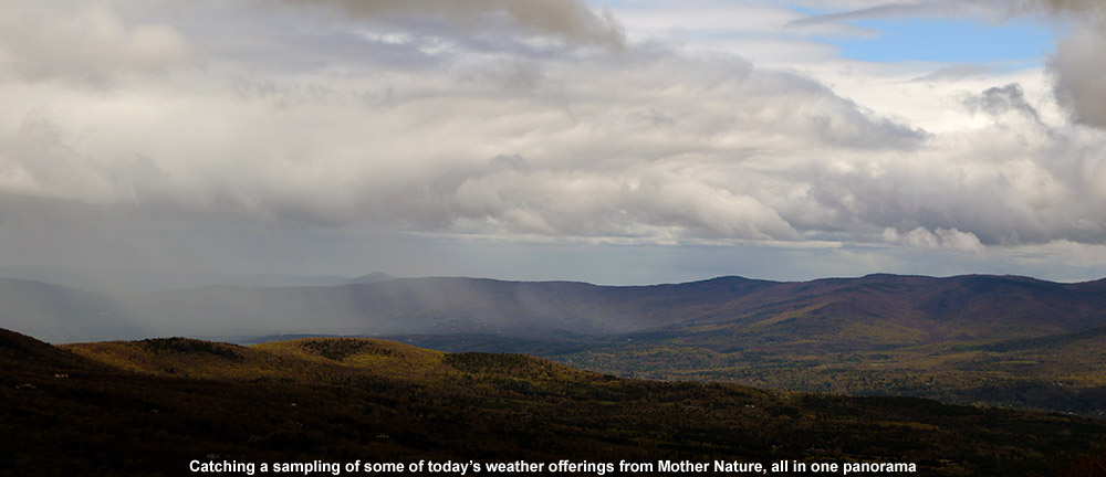
“The overall ascent was quite enjoyable with the variety of weather dancing around Mansfield and the surrounding peaks; there was blue sky, an occasional sprinkle or rain shower, breezes, low clouds skimming the summits, and everything in between.”
The overall ascent was quite enjoyable with the variety of weather dancing around Mansfield and the surrounding peaks; there was blue sky, an occasional sprinkle or rain shower, breezes, low clouds skimming the summits, and everything in between. It was one of those days where you really wanted to have your gear for the various conditions, and I made use of just about everything I’d brought. One minute the hood of my shell was up, the next I needed a light hat, then suddenly it was time for my sunglasses.
Some of today’s weather views
The snow was decent, although I actually would have like it a bit softer. It only gets so soft without consistent the warmth of the sun though. I did notice it softened up a bit more on the lower half of the mountain, simply due to the slightly warmer temperatures. Nosedive does provide some of the best snow on the mountain in terms of skiing though – there have been enough people skiing it that it has a level of “human grooming” to keep the sun cups at bay.
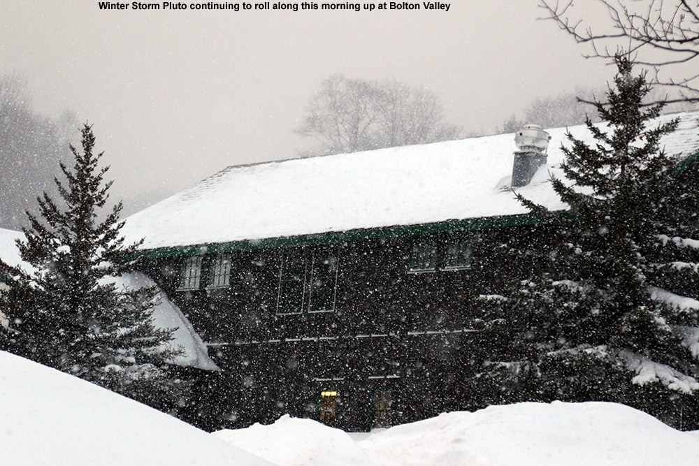
Today we headed to Lincoln Gap to check out some of the recent powder from Winter Storm Pluto.
For the first time in a while, none of the family had anything else on their agenda, so we were all free to ski together today. Winter Storm Pluto wound down on Thursday night, which meant that unfortunately the resorts would have been pretty tracked up after all of Friday’s visitors. Based on my Friday morning tour at Bolton Valley though, I knew the powder from upslope portion of Pluto was really good, so that had me thinking a backcountry session was the call (not to mention it’s a holiday weekend for the resorts). But where to go? We’ve basically hit the point where lines are viable essentially all the way down into the mountain valleys, at least on the east side of the Greens, so basically everything there is on the table. The west side in general did well with Winter Storm Pluto, bit even with that boost, the base there is still lagging well behind the east side. With temperatures expected to head above freezing by midday, I was looking for a protected area with some north-facing lines, and ultimately decided on Lincoln Gap. Ty and I had visited Lincoln Gap back in February of 2015, and I was simply in awe of the massive acreage filled with steep open lines through the hardwoods. This was our chance to show the area to E and Dylan.
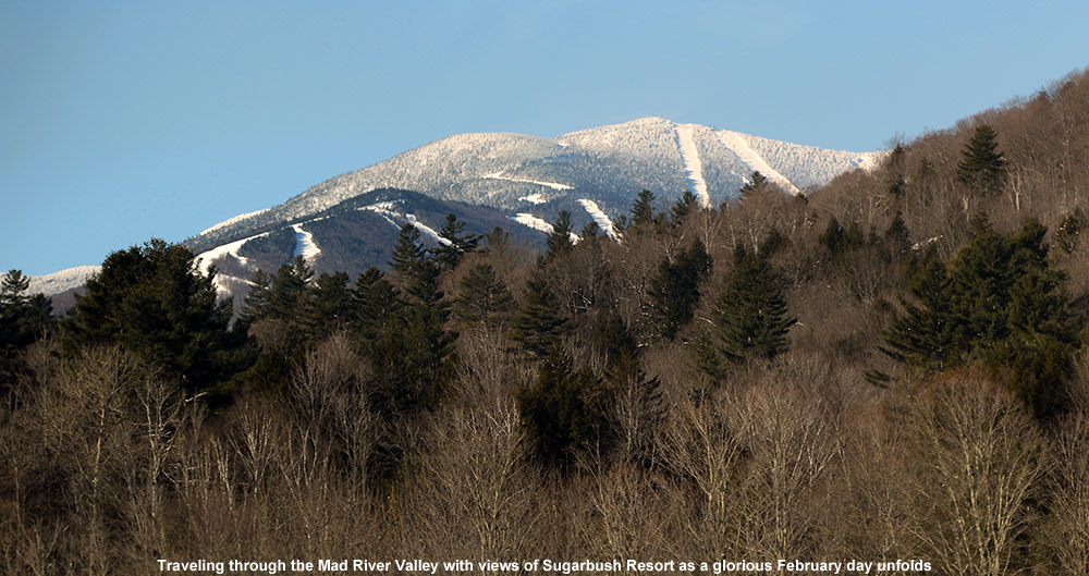
Morning views of Sugarbush as we drive through the Mad River Valley
Knowing that we had only until around midday before temperatures might be a concern with respect to the quality of the powder, we got a relatively early morning start. We were heading out into a gorgeous day with temperatures in the mid-20s F as we passed through the Mad River Valley. One thing that stuck me during our drive was that in the bottom of the Mad River Valley there only seemed to be about half the amount of snow on the ground relative to what we’ve got at our house, so I’m guessing the valley itself didn’t make out quite as well in the recent storms as we did farther north. As usual, snowpack certainly wasn’t an issue as we headed up to closure area on Lincoln Gap Road.
On today’s ascent.
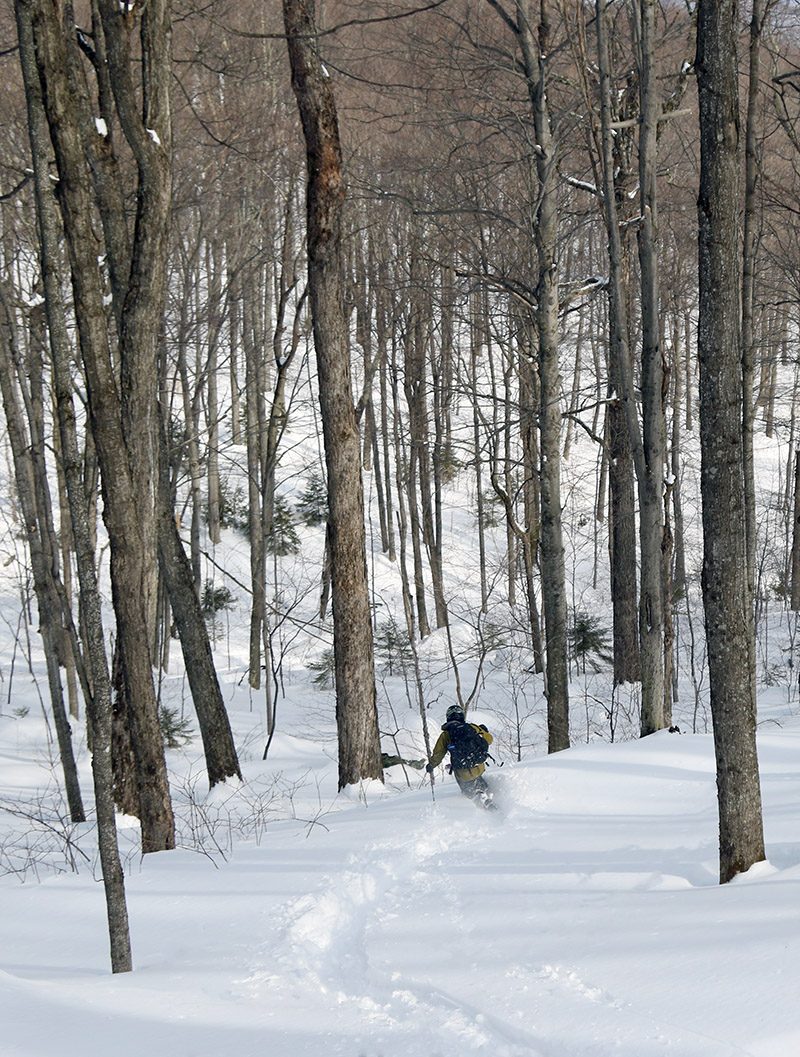
When Ty and I were last at Lincoln Gap to ski, we headed to the south side of the gap road, where there are a lot of popular north-facing lines. I was hoping to try something on the north side of the road this time – the terrain looks a little bit mellower for those getting their Tele legs. With the sun out and temperatures rising though, I didn’t dare risk sticking around on those southerly-facing areas, so we ultimately decided to once again use the route to the popular north-facing terrain that Ty and I had used last time. Once we got to the base of the main terrain area, I decided to alter our ascent from what Ty and I had done. There’s a nice skin track that follows the forest road and wraps beneath some of the terrain, and while it’s got a nice gentle grade, it’s quite circuitous. With concern for the warming temperatures, my plan was to instead just break a skin track right up the main north face. It was extra work, but we were able to direct ourselves right toward areas that looked good. And boy was there a lot of terrain that looked good, really good. I’d actually forgotten what a gold mine of ski terrain the whole Lincoln Gap area is, but I was quickly reminded and spent a lot of time gawking at amazing lines as I broke trail for the skin track.
There are so many great areas to ski around Lincoln Gap!
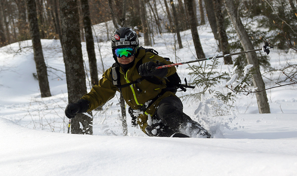
We’d covered about half the potential vertical on that north face before I decided that we’d get a good run, and we’d hopefully outrun the warming temperatures. As for the snow, my probes during the ascent generally revealed about 18 inches of powder over the subsurface. I can’t say exactly which storms the powder should be attributed to, but it was looking great. There wasn’t a single track in the various gullies and spines that we’d surveyed on our ascent, so we had the pick of whatever lines we wanted. Everyone struggled at least a bit with their Telemark turns in the deep powder, but very, or at least moderately-fat skis were certainly helping. Temperatures were pushing past the freezing mark as we finished our descent, so it was really comfortable out there. The snow wasn’t quite as outrageously deep and light as the time that Ty and I went to the area by ourselves last, but I think E and Dylan were impressed with the area, so I suspect we’ll head back at some point.
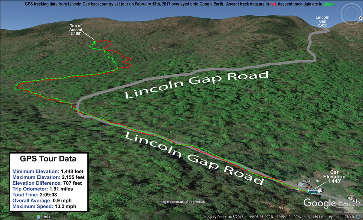
The GPS tracking data from today’s backcountry ski tour in the Lincoln Gap area
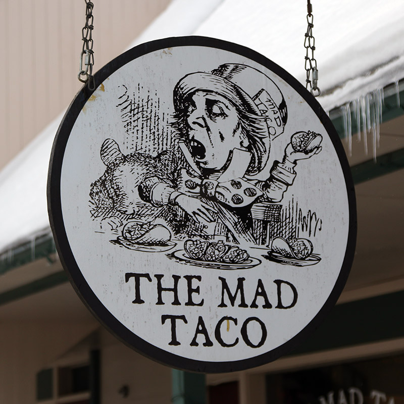
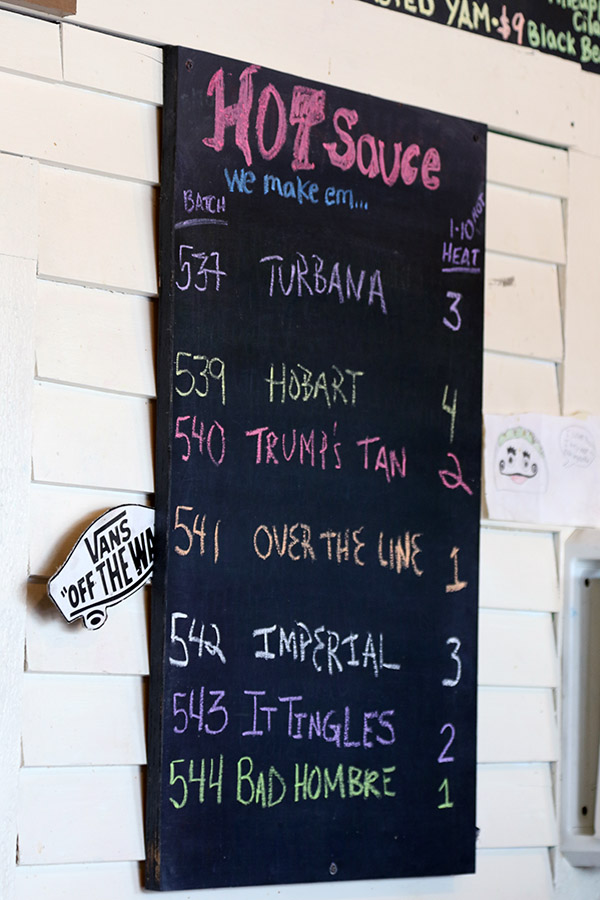
As we drove back down the Lincoln Gap Road, it suddenly felt like the calendar had flipped to March. The gravel/dirt portion of the road was already starting to have some mud on it! For lunch we went to The Mad Taco, and low and behold, Chris was right at the bar and spotted us. We caught up on lots of stuff (including his ski trip to Idaho to see friends) and being quite the regular at The Mad Taco, he gave us the lowdown on everything. They make tons of different hot sauces all the time, and list them on various blackboards in the establishment. They’re even numbered on a 1 to 10 scale based on how hot they are, but Chris said watch out because the numbers aren’t always right. For sauces I tried “It Tingles” (2) and “Bad Hombre” (1) and both had a decent amount of spice. The food was fantastic, and so was the atmosphere. I suspected I was going to like the scene when I jump in line to place my order and Joy Division is coming through the speakers. We’ll definitely be back, and Chris said he’d be happy to grab take-out for us anytime he’s heading toward our place.
Pick your poison… by number.
On a final note, today was my third time using my iPhone to plot my GPS data from a ski tour in place of my old handheld GPS unit. I’ve been using the MotionX-GPS app, and I’m totally sold. It only costs a few bucks, it does basically everything my old GPS unit did, and it makes it all 10 times easier. It’s so much more sensitive to picking up GPS signals as well – I can basically store it anywhere on my person or in my pack and the signal is fine. I really enjoy the feature of announcing your speed, distance and tour time at various intervals. Since it’s on my phone, which I’m carrying anyway, that means one less item I have to carry. Anyway, I’m sold, so if you’re looking for a GPS app for your phone that acts like a real GPS, check out MotionX-GPS.
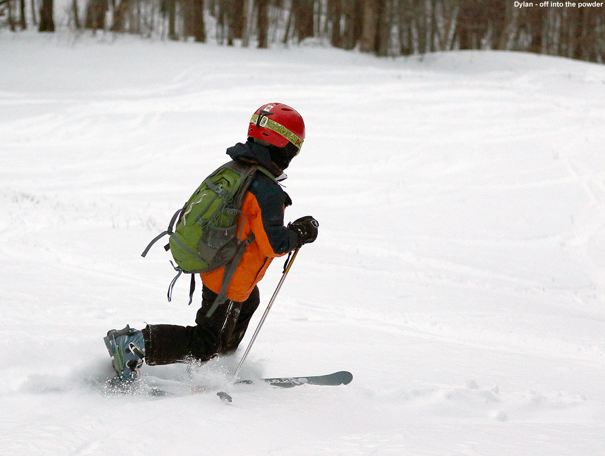
Diving into some deep snow at Bolton Valley this morning
Between Winter Storm Orson and Winter Storm Pluto, the past two cycles to hit our area, we’ve picked up almost three feet of snow at our house in the Winooski Valley. I actually haven’t even been able to consistently check on how much snow has fallen in the local resorts, but it’s been a lot. The Mt. Mansfield Stake has passed the 100-inch mark though, which says a lot about how much snow we’ve been getting recently, and is fantastic for mid-February.
I managed to get out for some turns on Monday morning for Winter Storm Orson, but I’ve been busy this week and haven’t even tried to work more turns into my weekday schedule despite the awesome conditions. Last night though, some of the backside snow of Winter Storm Pluto was falling, and it got me intrigued to hit the hill again. Between 6:00 P.M. and midnight we picked up 5 inches of sub-2% H2O at the house. That’s really rarified fluff that’s way too good to pass up, and I knew that I’d just have to check out how it skied in the morning.
“I dove in and encountered the kind of snow that makes you feel like the bottom of the world is falling out, and you’re dropping down an elevator shaft into infinitely deep feathers.”
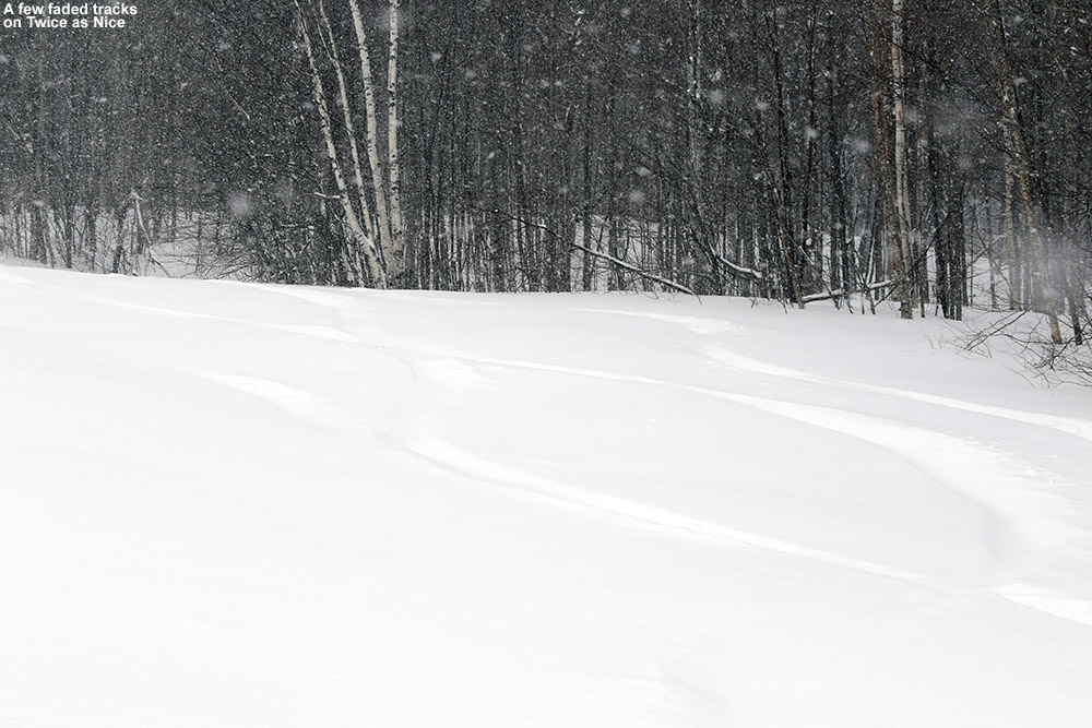
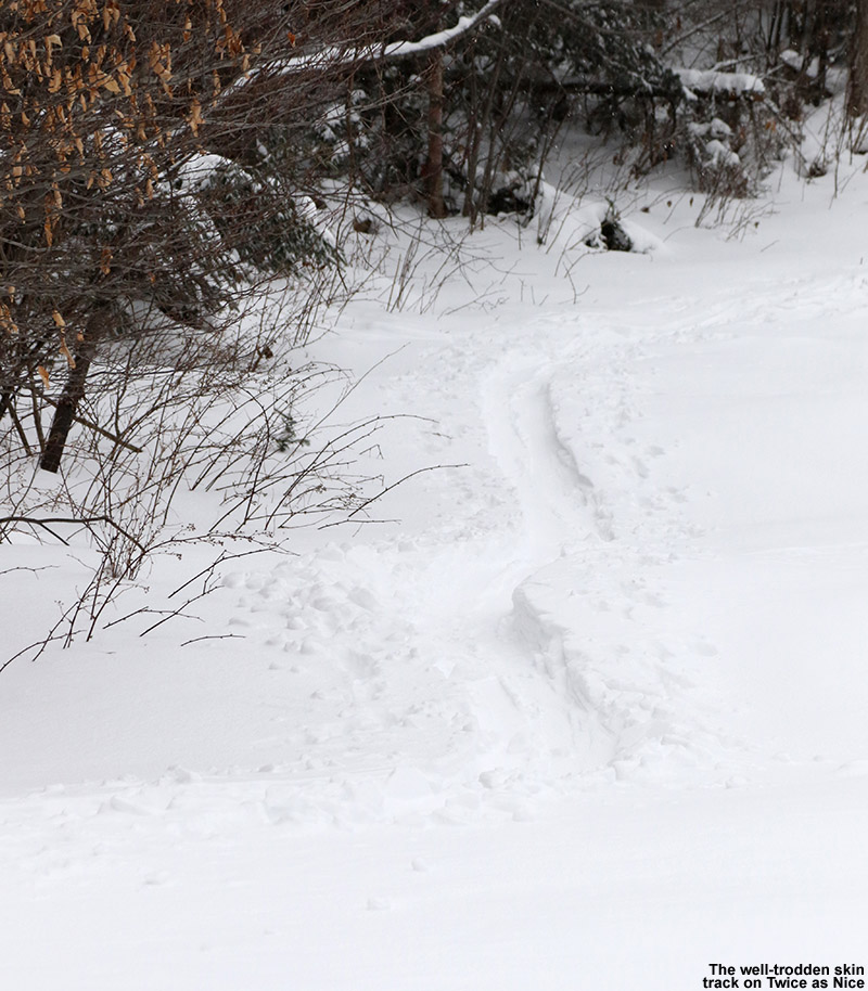
Snow from Winter Storm Pluto was still pounding away when I arrived up at Bolton Valley’s Timberline area this morning. It was quiet, with just a couple other cars in the lot. The skin track up Twice as Nice wasn’t even in place yet, and I feared that I’d have to break trail, but fortunately Showtime had recently been groomed. It held about an inch of new snow over the packed base, and I was really thankful for the efforts of the groomers on that one.
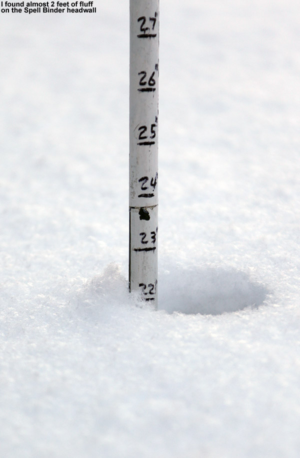
I had time for a quick run down Spell Binder, and a probe on the skier’s right of the headwall revealed close to two feet of ridiculously fluffy Champlain Powder™. I dove in and encountered the kind of snow that makes you feel like the bottom of the world is falling out, and you’re dropping down an elevator shaft into infinitely deep feathers. So, yeah, last night’s snow analysis told the story, and the snow out there today was indeed incredibly dry.
Snows of Winter Storm Orson at Bolton Valley today
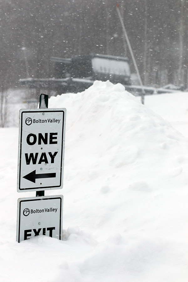
Today’s ski session was great, but it really wasn’t the one I was expecting. Since E and the boys were off from school for a snow day, and I had some time in the morning, it seemed like a great chance to all get in some skiing together. My first inclination was to visit Bolton Valley, which is right on my way into Burlington and very convenient, but lifts weren’t opening until 10:00 A.M., which on the late side based on the time I had. So, we decided on Stowe, which opened at 8:00 A.M. However, what we found on the Mountain Road was traffic backed up all the way to Harvest Market. That’s miles away from the resort. I figured it had to be because of an accident, but people in touch with E indicated that it was just bumper to bumper all the way down from the resort. I’m not sure how long it would have taken to travel all those miles, but we didn’t really have the time to find out. We switched our plans to Bolton Valley, figuring we’d take at least a few runs, but winds were keeping the Vista Quad on hold, so the available terrain would be quite minimal. It was just one of those crazy days where getting us all together to ski was going to be a challenge.
So in the end, I wound up stopping at Bolton for some earned turns on my way into Burlington, just like I often do. It simply took me a lot longer than usual to get to that point. Fortunately, just as one would expect thanks to the recent visit from Winter Storm Orson, the snow is simply spectacular. I skinned up the usual Timberline route, and while there were some tracks on Twice as Nice from skiers who had visited earlier, it was still snowing big, fat, fluffy flakes, and their tracks were rapidly disappearing. Today seemed like a great day to make a run on Twice as Nice, and it delivered bottomless turns all the way. The depth of the powder I found there today was generally 8 to 10 inches at the Timberline Base elevation, with nearly a foot in may spots higher up. The density gradient of the powder was fantastic, since we’ve been getting some really light fluff on the back side of the storm. It was funny to come full circle back to what I probably would have done if E and the boys hadn’t had the day off, and while it was a crazy path getting me there, the quality of the turns was definitely worth it.
Out on the Burt Trail today for some backcountry skiing
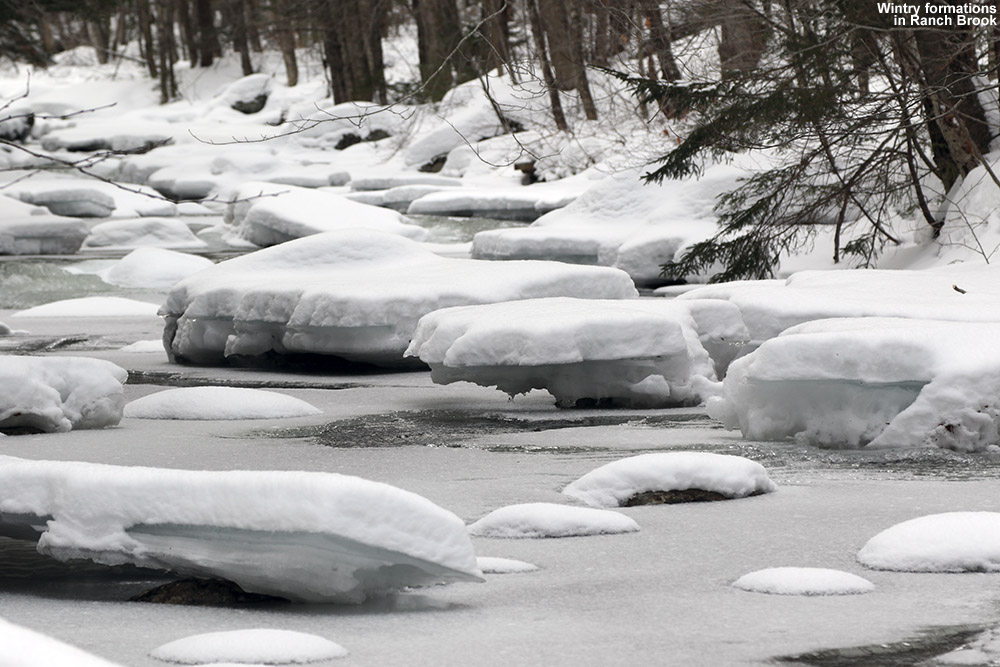
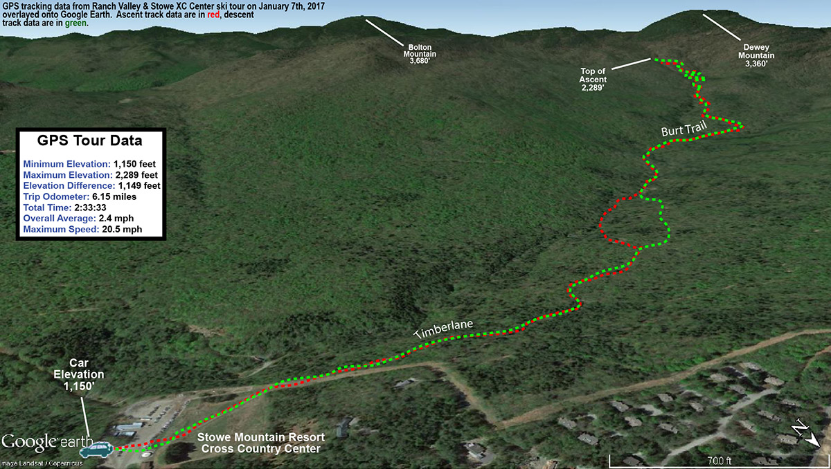
It’s been a relatively slow week for snowfall in the Northern Greens, but Stowe did manage to pick up roughly a foot of snow between Wednesday and Thursday. Since the Mt. Mansfield area seemed to be a sweet spot with respect to snowfall, I decided to head out for a backcountry tour in the Ranch Valley, which sits just to the south of the resort’s alpine trail network and is the location for Stowe’s Cross Country Center. I’ve been through the area numerous times when coming down the Bruce Trail, and I’ve sampled some of the natural glades that populate the middle elevations in that area. I could see that there was much more skiable terrain to explore though, so I decided to check out what the areas around the Burt Trail had to offer.
Temperatures were in the low to mid 20s F in the local mountain valleys as I headed up to the Stowe Cross Country Center to start my tour. It turns out that Mrs. Blanck was behind the counter when I was buying my trail pass, so we were able to catch up a bit and she gave me an overview of some nice glades that she’d heard of as we reviewed the backcountry portion of the trail map.
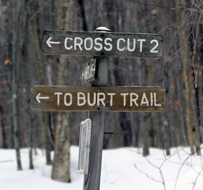
My ascent route consisted of starting on the Timberlane Trail and using Cross Cut 2 to get to the Burt Trail. The recent snows were certainly elevation dependent, so there was only about an inch of fresh snow atop the snowpack down near the base of the Cross Country Center at ~1,000’. It did increase as I ascended, reaching a couple of inches by the time I hit the Burt Trail, and nearly 4 inches at the top of my ascent at the junction with the Underhill Trail. Here’s the general depths of surface powder I found on my tour with respect to elevation:
1,000’: 1”
1,500’: 2-3”
2,000’: 3”
2,500’: ~4”
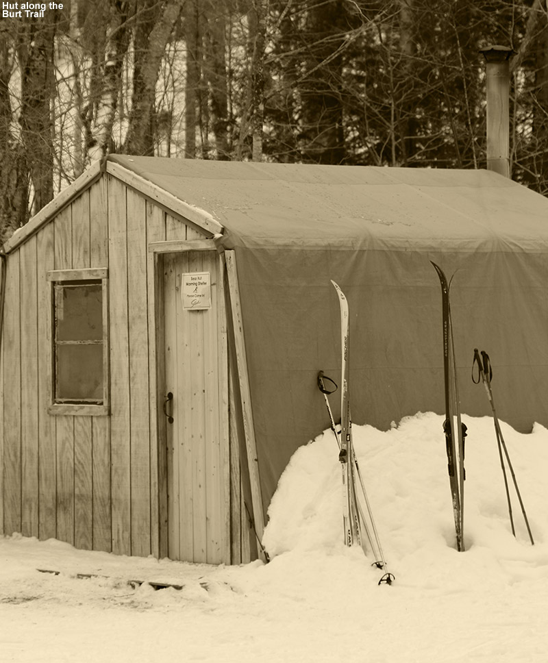
Passing a hut along the Burt Trail
The backcountry portion of the Burt Trail starts right around 1,500’ elevation, and getting to that point represents a pretty hefty approach of over two miles, so that’s about the minimum distance one will have to go on this route to get into terrain for potential descents. The Burt Trail really starts to steepen above 2,000’, which one hits at close to three miles in. At that point it’s comprised of switchbacks to accommodate the steeper terrain. That area is still mostly hardwoods, with scattered evergreens, so tree density isn’t too bad and one can easily cut the switchbacks and ski through the forest. That terrain is pretty steep though, so one would want a decent amount of powder for it to be optimal. Based on darkness and trying to ensure that I made it back to the Cross Country Center by 5:00 P.M. since a sign that the parking lot gate would close at that point, I only ascended to the junction with the Underhill Trail, but I could see that there was plenty of similar terrain right up above me.
As for the skiing and conditions, one would definitely want more powder above the base than what I found today, but I was still able to get in some decent turns. I had my midfat Tele skis, which were certainly not all that light in the overall spectrum of Nordic equipment, but I was thankful to have something that could handle the descent well. I cut the Burt Trail switchbacks and skied the fairly open forest in some spots, but I could actually stay on the trail itself for the most part where it mattered. Only one person had gone up ahead of me above 2,000’ on the trail and they must have descended another way, because there was no descent track. So the Burt Trail itself was relatively untracked and I got some of my best turns of the afternoon simply by staying on it. The terrain in the 1,500’ to 2,000’ range offers some options off the trail depending on the pitch of the terrain, but I just ran my descent out the trail itself based on the snow conditions and my time. The whole runout back to the Cross Country Center is actually pretty fun, and you can really cruise along at times, but you will have to do some skating and deal with a couple of small uphill sections. It’s quite similar to running out the Bruce Trail though, and indeed the route is identical in some spots, so if you’ve done that you’ll have a good sense for what this is like.
Today’s backcountry ski route in the Ranch Valley
It looks like we’ll be in a fairly active weather pattern in the foreseeable future with some clipper-type events and larger synoptic systems with potential mixed precipitation, so we’ll see how these play out in terms of bolstering the snowpack.
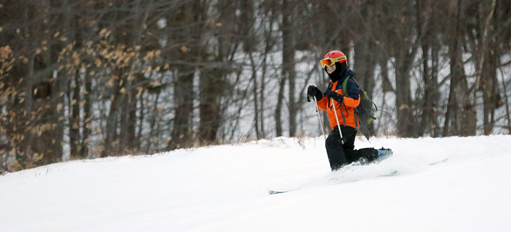
Dylan and Dad were out today at Timberline for a quick afternoon ski tour.
Dylan and I headed up to Bolton Valley this afternoon for a quick New Year’s Eve ski tour. Based on my observations from yesterday’s outing, I knew that despite exposed areas being wind-scoured, many trails at Timberline were holding some great powder. There were still resort visitors parking down at the Timberline lots, and while most had left by the time we arrived, there were still a few folks trickling down either by bus or via the trails.
“In a bit of a reversal of the usual setup, the powder actually improved the farther we descended, simply due to better protection from the winds.”
It was a cloudy afternoon, but temperatures were very comfortable in the upper 20s F as we ascended the Twice as Nice skin track. We contoured across below the elevation of the Timberline Mid Station to avoid the wind scoured areas and descended via most of Spell Binder. In a bit of a reversal of the usual setup, the powder actually improved the farther we descended, simply due to better protection from the winds. We were typically skiing in depths of 5 to 10 inches, with the deeper are being those that were most protected. Dylan had a great time and made some excellent turns – even on his bad side, which is getting better all the time.
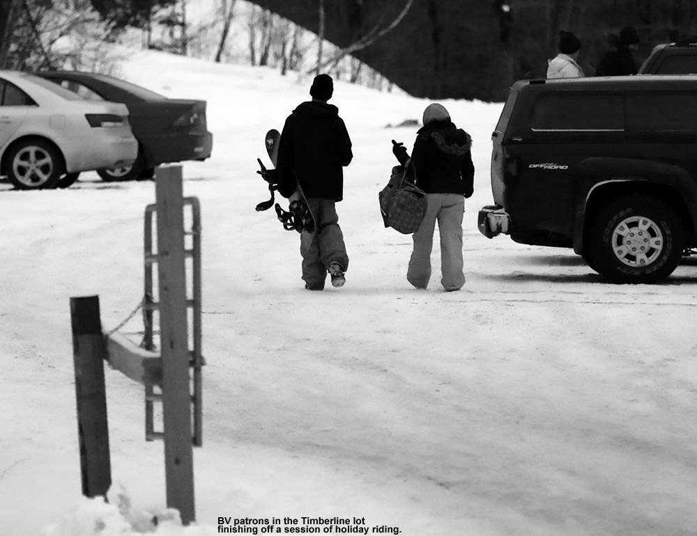
Some folks closing out their day of riding
We’ve actually got an Alberta Clipper coming through the area right now, but the current wind flow seems to be sending most of the snow off to the east of us. We’ll see if that changes to bring any accumulations to the mountains for tomorrow.
An afternoon visit to Bolton Valley today with some first tracks on White Rabbit
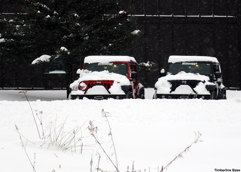
I haven’t been up to the mountain for turns since last week, but today when I arrived at Bolton Valley I was reminded just how popular skiing can be over the holidays. I pulled into the Timberline lot expecting to find a few cars from folks earning turns there, but found it nearly full of vehicles. The main lots had presumably filled up, and I could see that the shuttle was ferrying people to and from the Timberline lots.
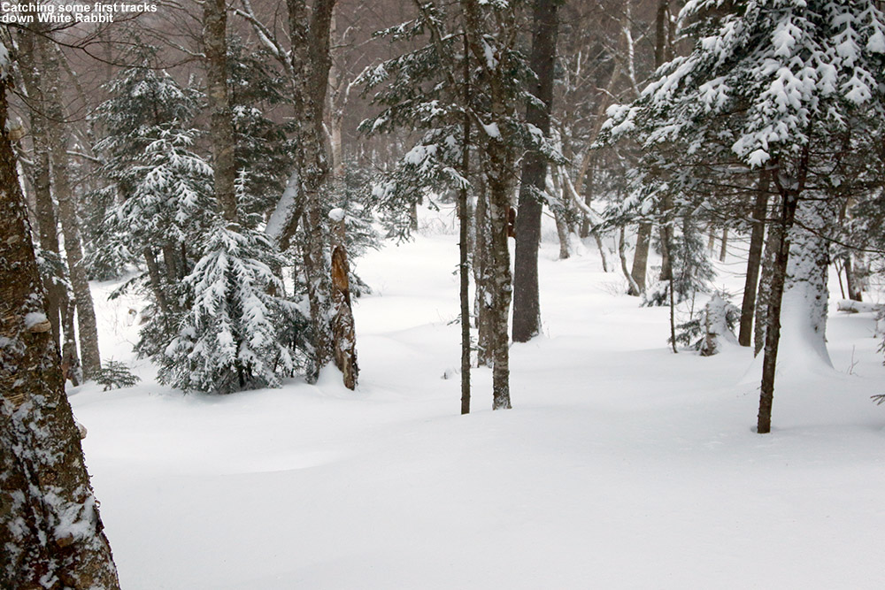
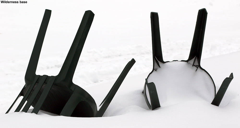
Although the Timberline Quad isn’t running yet, I was starting at Timberline today as part of a combination sidecountry and lift-served tour that I’d planned. The resort had picked up 4-6” of snow yesterday from Winter Storm Fortis, and an additional 4-5” the previous day from a weak cold front, but I didn’t expect that to be enough snow for a thorough resurfacing that would hold up to holiday skier traffic on all terrain. The Wilderness Lift is running though, so my plan today was to skin up from Timberline to the main mountain, catch a lift-served run through White Rabbit and Snow Hole, and then return via some Timberline skiing.
The skin up Timberline was very pleasant, and I saw a few skiers and riders skiing the trails to make their way back to their vehicles at the Timberline Base. I could see why Timberline isn’t open for lift-served skiing yet though – exposed areas were really windswept and wouldn’t be able to support lift-served levels of skier traffic. Sheltered areas like most of Spell Binder, Brandywine, and Tattle Tale looked really nice though with all the new powder, and I suspected I’d find some great turns at the end of my tour. When I reached the main base I found that there were plenty of visitors, but fortunately lift queues were almost nonexistent. There was generally light snow coming down, with some hefty wind at times that was enough to cause a short stoppage of the Wilderness Lift when I was on it. By the time I reached the top of Wilderness it was definitely cold – it had to be in the teens F, and feeling much lower than that with that wind.
“I caught first tracks down White Rabbit, which was in great shape. The base is really deep up there, with another 5 to 10 inches of powder atop the older layers.”
I caught first tracks down White Rabbit, which was in great shape. The base is really deep up there, with another 5 to 10 inches of powder atop the older layers. Snow Hole had seen a good deal of traffic, but there were still plenty of routes available with powder, and the traffic actually helped to compact the snow at the water crossings. Lower Turnpike was its usual smooth self and offered a nice groomed surface on which to carve some Telemark turns.
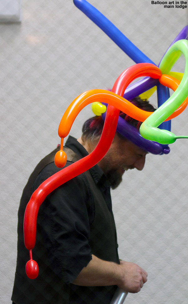
Back at the main base I had a little time to stop in for a slice at Fireside Flatbread, and it was sort of that transition time between day and night skiing with lots of visitors coming and going. One of today’s holiday week activities was balloon art, and you could see people around with their colorful balloon headgear.
“I didn’t linger too long in the lodge, but by the time I came out the snowfall had really picked up – it was falling heavily and dramatically reduced the available light as we approached dusk.”
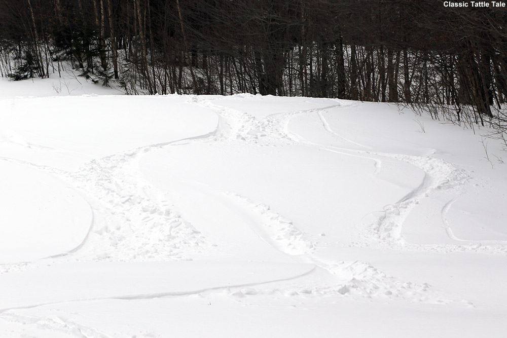
I didn’t linger too long in the lodge, but by the time I came out the snowfall had really picked up – it was falling heavily and dramatically reduced the available light as we approached dusk. I quickly headed over to the Snowflake Chair and made my way toward Timberline. I ran into a family on Timberline Lane trying to make their way back to the Bear Run condominiums where they were staying, and their younger son on a snowboard struggled to move along in the flats, and then struggled more on the ungroomed steep pitch of Timberline Run below. I headed to Lower Tattle Tale to catch some fresh tracks in the powder there (which I’d say were actually the best of the day) but waited at the intersection of Timberline Run to make sure everybody in the family was getting along OK. I actually had already pulled out my headlamp for the last bit of skiing since it had gotten so dark, and that was helpful in making sure the family found their way to their lodging.
It was a great tour today with plenty of powder, and it looks like we’ve got another storm coming into the area tomorrow. Just as I was arriving at the resort today I got an alert that we’ve got a Winter Weather Advisory starting up tomorrow at 10:00 A.M.
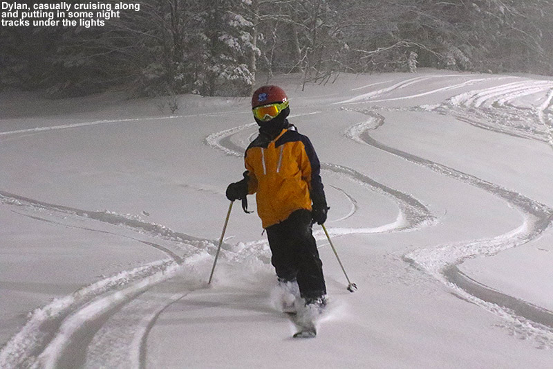
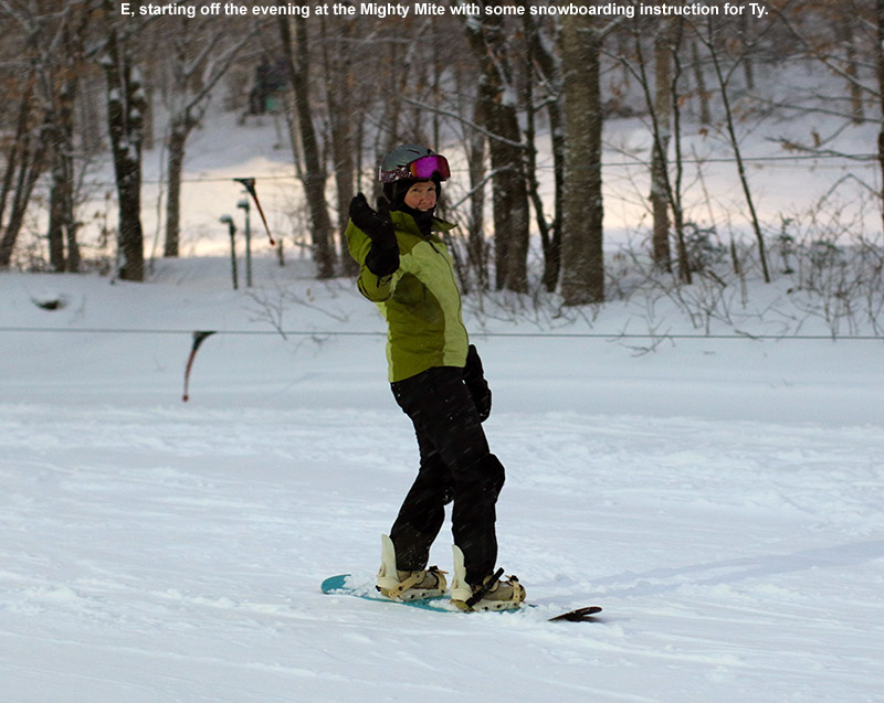
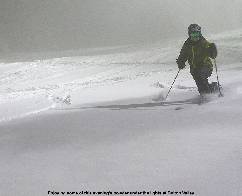
We headed up to the mountain this evening for some turns and found some great conditions brought on by today’s new snow.
I was home this afternoon with enough time to head up to the mountain for a couple of runs before dark, with the incentive being a bit of snow that we picked up today from a small Alberta Clipper-type system. Although the snowfall had generally been quite light in intensity today, it had been snowing continuously, and reports of 3 to 5 inches were coming in from the mountains. I didn’t know if anyone else would be interested, so I figured it would just be a solo outing for me to scope out how the new snow was setting things up for coming days. But, before I knew it, the whole family was interested in getting some turns, and once we confirmed that night skiing was on, up to the hill we went!
“…combined with the weather, the overall ski conditions were so good that we ended up staying a lot longer than I’d thought we would.”
The temperature at Village elevation (~2,100’) was right around freezing, and while we were at the mountain the cloud deck fluctuated between there and Mid Mountain (~2,500’). There was light snow falling the entire evening, and although we never went higher than Mid Mountain, there was no wind to speak of. So overall, it was an incredibly nice time to be out skiing under the lights. I measured 3” of snow in the Village parking lot, and generally found 3-4” on the hill, which jives perfectly with the 3-4” that I see this evening in the Bolton Valley snow report. My liquid analyses down here at the house (500’) revealed a very mid-weight 10% H2O snow, and while we may have had a touch of compaction due to being slightly above the freezing mark at our elevation, I’d say that 10% density is fairly consistent with what the mountain received. So the new snow has got a bit of girth to it and can float you pretty well on low- to moderate-angle terrain as long as there’s a smooth subsurface.
One thing that got Ty excited to head to the mountain this evening was the chance to do some snowboarding. He’s big enough to use my snowboard now, so E said that she’d give him some instruction to get him started. We all started off at the Mighty Mite to ensure that Ty was set on the board, and then spent the rest of our time on the Mid Mountain Chair so that Ty could work on his snowboard turns with E, while I worked with Dylan on his Telemark skiing.
Dad having a blast in the fresh snow!
There was plenty of powder available this evening off to the sides of the main runs and on the easily accessible side trails, and combined with the weather, the overall ski conditions were so good that we ended up staying a lot longer than I’d thought we would. There obviously hasn’t been enough liquid added atop the snowpack to keep folks from touching down to the old surface on steep terrain yet, but lower-angle to moderate terrain is skiing beautifully. I suspect the groomed terrain could have been pretty loud before this new snow, but turns were very silent and peaceful tonight. And, there’s the aesthetic quality of all the new snow. Folks coming up for the holiday weekend should be pretty psyched, especially if Mother Nature tops this current snow off with a bit more from the system potentially affecting the area on Saturday.
We capped off the evening with a trip to Fireside Flatbread for the first time this season. It was a quiet midweek evening, and service was really quick – we sent the boys downstairs to the cafeteria to get a couple of appetizers and the pizza arrived before they even got back! Anyway, tonight’s experience with the soft conditions has got everyone in the family interested in getting more turns this weekend, so hopefully we’ll have another chance to get out and enjoy the new snow.
Getting out to Bolton Valley for a quick morning tour on the snow from Winter Storm Caly delivered some excellent turns.
Yesterday evening at some point after 9:30 P.M., light snow began falling at our house in Waterbury with the approach of Winter Storm Caly. Winter Weather Advisories were put in place for a fairly moderate 3 to 6-inch snowfall, which was expected to fall overnight and into the Monday morning commute.
This morning for my 6:00 A.M. CoCoRaHS observations at the house I found 3.3 inches of snow on my snow measurement boards. Snow was still falling in the form of small (1-2 mm diameter) flakes, and based on the density of the snow in the accumulation stack it appeared as though that smallish flakes had been the general trend throughout the storm up to that point. My liquid analysis revealed that the snow was right around 10% water content, so it’s certainly not Champlain Powder™, it’s very much your typical synoptic snow. This standard, medium-density snow is great in terms of building up the snowpack, which is important this time of year.
“…the turns could really flow, and they did.”
School was cancelled for E and the boys, not so much due to massive amount of snow falling, but presumably the timing right during the morning commute. I wished them a good snow day, and headed off to stop in at Bolton Valley on my way into Burlington. Bolton’s Timberline area had looked just a touch lean on base when I check on my way to the resort on Saturday, but I figured with this latest round of dense snow it was time to check it out. At the Timberline Base I’d say there was a similar amount of accumulation to what we picked up at the house – roughly 3 to 4 inches.
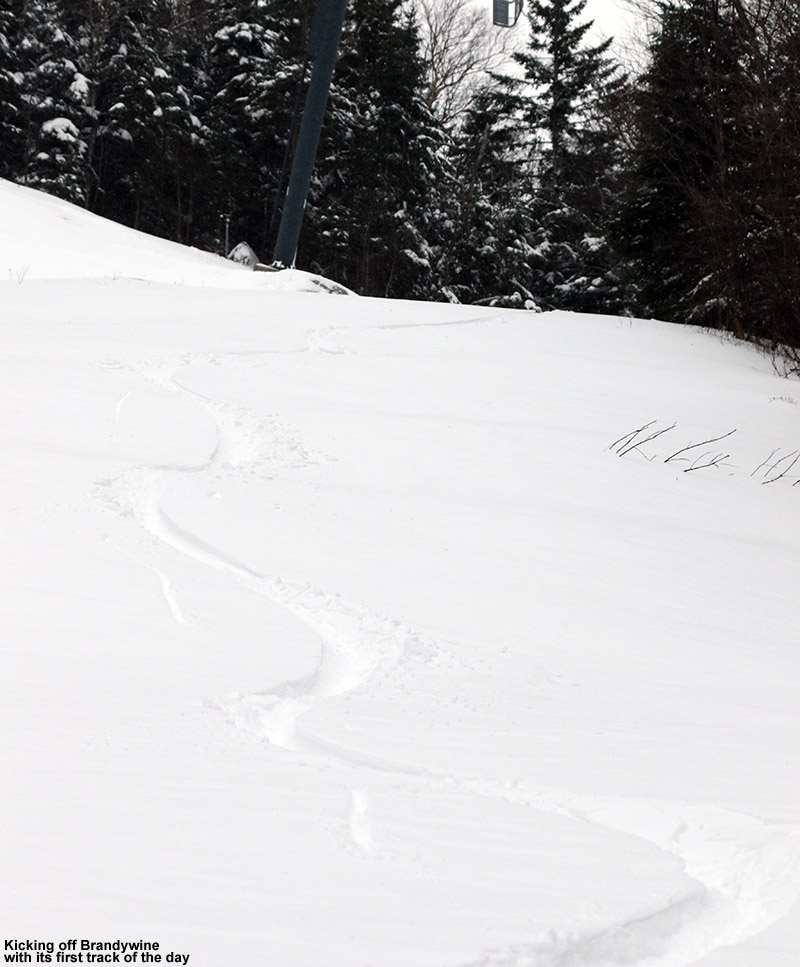
Making use of the great skin track on Twice as Nice today
The skin Track on Twice as Nice was in excellent shape, so I made good time up to the Timberline Mid Station, where I decided to mix things up a bit from recent outings and head a little father to ski Brandywine. This turned out to be a great option, since it hadn’t seen any skier traffic and I got to enjoy first tracks. While this new snow is fairly medium density, it actually skis quite well where no wind has affected it, and Brandywine certainly delivered there. Although this certainly wasn’t out lightest powder of the season, today’s outing featured some of my favorite turns up to this point because the snow was consistent, there was plenty of base, and of course the untracked nature of the trail meant that I could get first tracks on whatever line I wanted. That meant that the turns could really flow, and they did.
It sounds like we’ve got light snows in the forecast this week, with the potential for a larger system toward the weekend.
In the backcountry today, the higher elevations held up to 20 inches of powder atop a roughly 10-inch base, indicating a snowpack of approximately 30 inches.
This is opening weekend for lift-served skiing at Bolton Valley, but with only minimal terrain served by the lifts at the moment and fairly chilly temperatures in the forecast, I decided to make it my first visit of the season to the Bolton Valley Backcountry Network. Although we haven’t had any big storms in the area in the past few days, we’ve had some lake-effect snow from the Great Lakes and additional snow from an arctic frontal passage that has given the mountains additional bouts of snow almost every day. The Mt. Mansfield Stake is indicating a snowpack depth of 34”, and it’s definitely not just fluff. With the high elevation and maintenance that goes on in the Bolton Valley Backcountry Network, I’ll usually feel OK poking around on appropriate terrain once the stake kits 24” (depending on the composition of that 24”), so with 34” I figured it would definitely be ready to go.
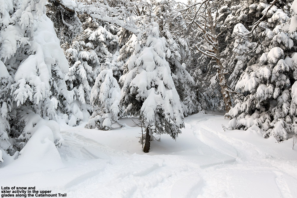
I headed up to the mountain in the afternoon, and temperatures in the Village at ~2,000’ were in the mid-teens F, but fortunately there was minimal wind. There was blue sky at times, but light snow was still falling off and on. My goal was to head to the upper glades along the Catamount Trail out past the resort boundary. Those glades are up around the 3,000’ elevation, so I suspected the snowpack would be more than sufficient.
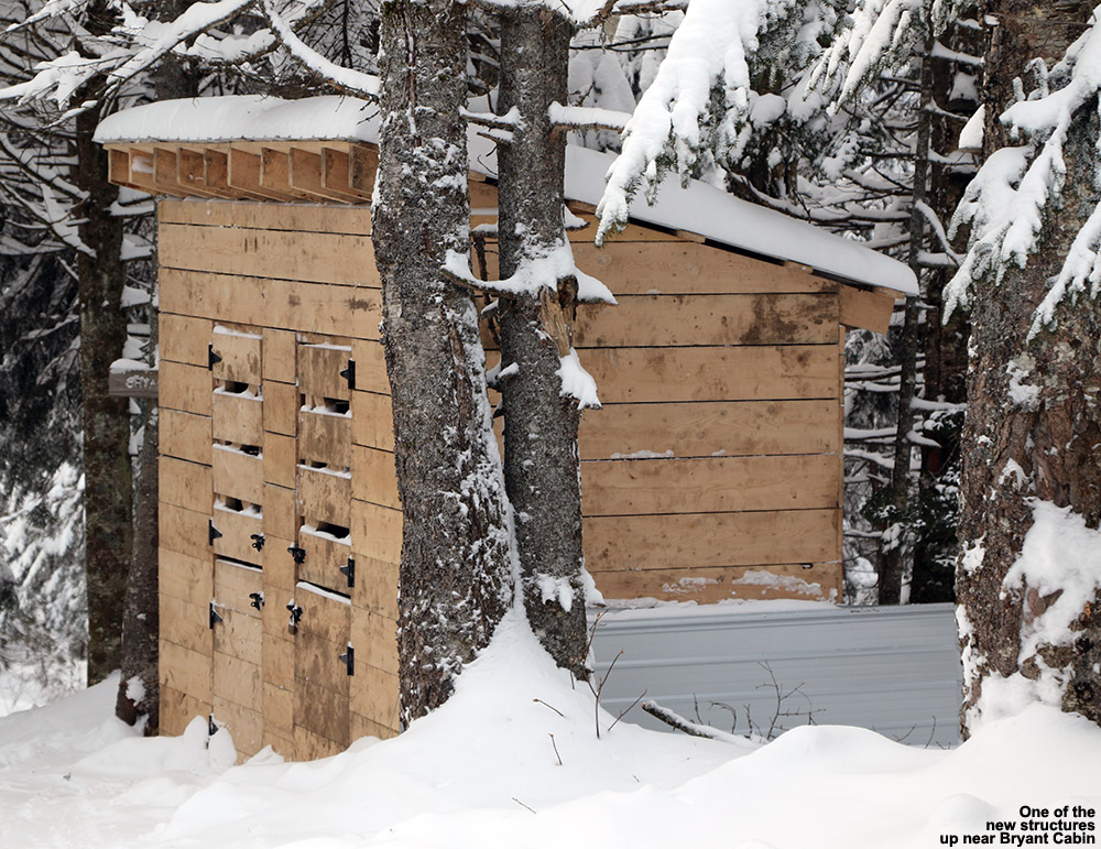
I saw that there had been some recent construction up in the Bryant Cabin area.
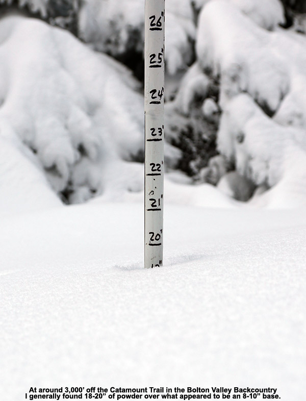
I headed up the usual Bryant Trail, and the most interesting thing I saw was that there are some new structures going up around the Bryant Cabin. One structure looked like a shed of sorts, and there was a larger structure that seemed to be partially built. It also seemed that there had been some work done on the cabin itself. In terms of snowpack depths, down at the Village at 2,000’ the surface snow was generally 14-15” of powder over a fairly thin layer of base snow. Up at the Bryant Cabin at ~2,700’ there was 16-17” of powder over a much more substantial base, and when I finally got up to ~3,000’ in the glades on the back side of Bolton Mountain there was a healthy 18-20” of powder. I was able to punch through the base at one point in my measurements, and the base snow seemed to be in the 8-10” range. So, that would put total snowpack depths up at that elevation approaching the 30” range, which seems pretty reasonable with the Mt. Mansfield Stake at 34”.
“…when I finally got up to ~3,000’ in the glades on the back side of Bolton Mountain there was a healthy 18-20” of powder. I was able to punch through the base at one point in my measurements, and the base snow seemed to be in the 8-10” range. So, that would put total snowpack depths up at that elevation approaching the 30” range…”
The skiing was generally excellent, especially in those upper glades. Since it was afternoon there had certainly been some traffic up there, but I still found areas of fresh snow. I made my way down via Gardiner’s Lane, and eventually decided to check out the Alchemist glade that I hadn’t visited in a while to the south of Gotham City. It’s a south-facing glade, so conditions can be quite variable, but aspect almost doesn’t matter right now because we’ve had November/December sun over the past couple of weeks… and not much of it anyway, so south-facing terrain isn’t all that different from north-facing terrain. One does have to watch out as they get down near 2,000’ though because the base below the surface snow does start to get pretty thin, so you don’t want to ski anything with many obstacles at that point. One could easily just lap terrain up above 2,500’ though with minimal concern about base depths. Skiing is definitely quite good up high right now.
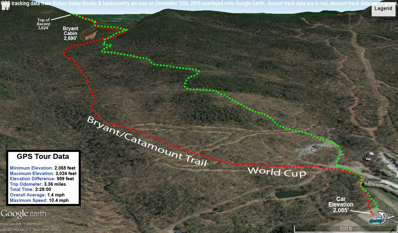
GPS/Google Earth plot of today’s backcountry ski tour at Bolton Valley
There was a bit of accumulation of snow on my car when I got back to it after the tour. It was rather minimal though, about ¼“ of new after 2 to 3 hours away. Currently, Winter Weather Advisories are up ahead of our next storm that is coming into the area tomorrow. I signed up for Washington County weather alert texts through VT-Alert, so I was notified of our Winter Weather Advisory just I was finishing up my ski tour today. It was definitely nice to get that heads up right away without having to actively check, and it really doesn’t matter where you are. Anyway, the advisory calls for a general 4-7”, which seems pretty consistent with what’s been expected of this event for a few days now.


