Bolton Valley, VT 30NOV2024

An image of Jay Telemark skiing in powder on the Cougar trail in the Wilderness area of terrain during a November lake-effect snow event at Bolton Valley Ski Resort in Vermont
An image of Erica standing with her Telemark skis after a ski tour during a November lake-effect snow event at Bolton Valley Ski Resort in Vermont
Erica is done with her first ski tour of the season and is happy to have had great powder conditions for the outing.

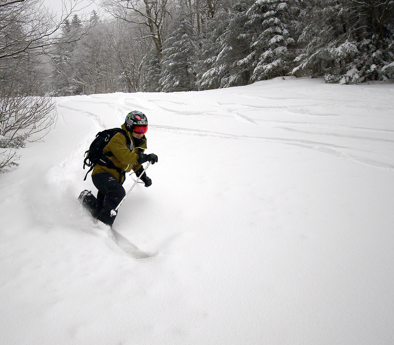
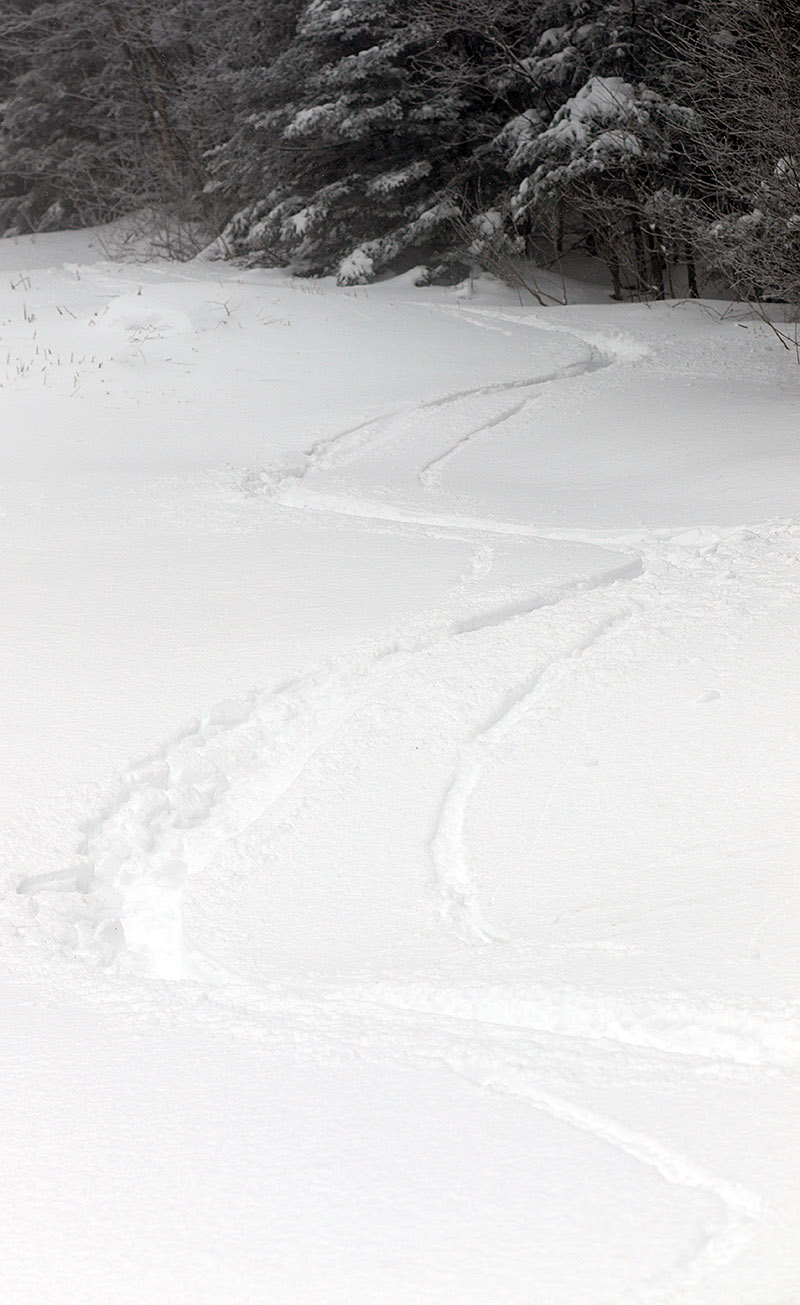
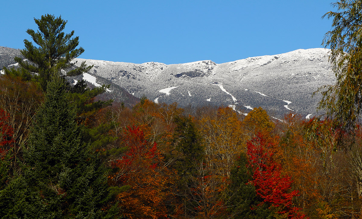
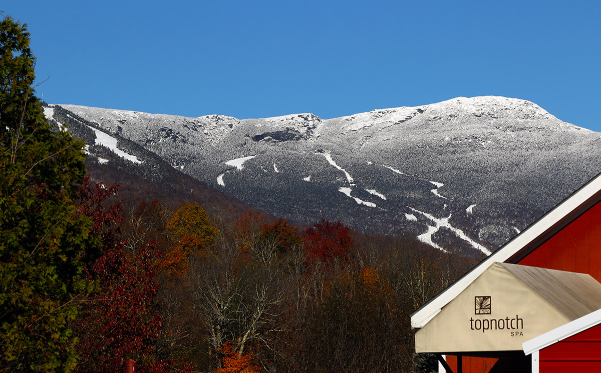
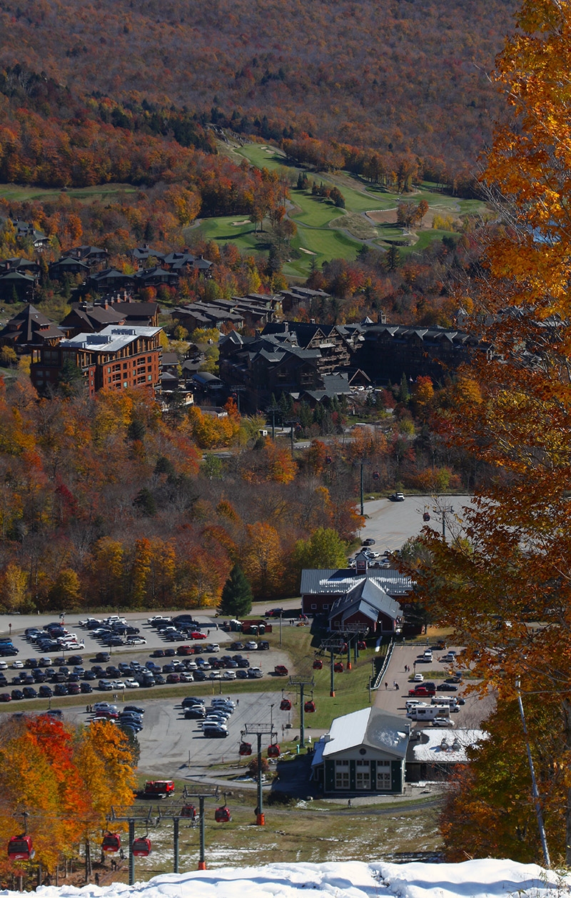
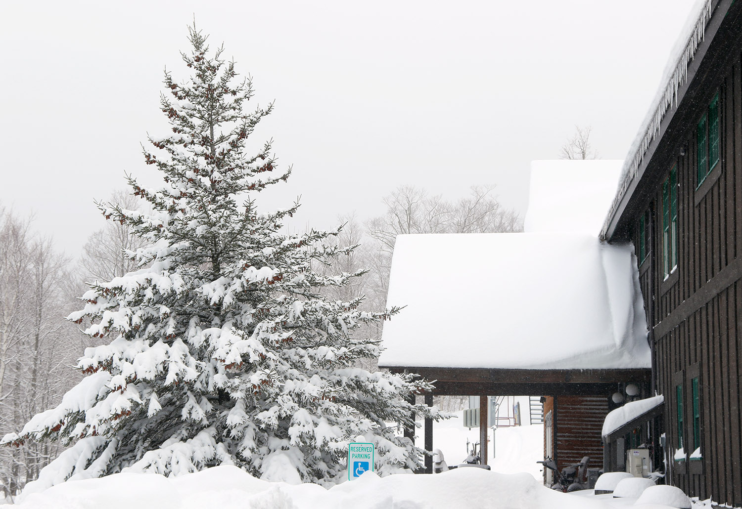
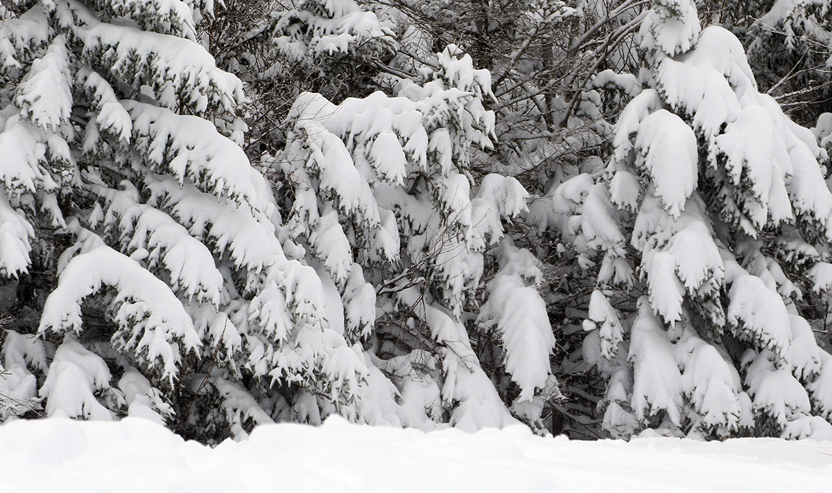
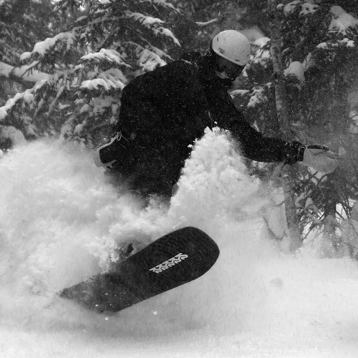
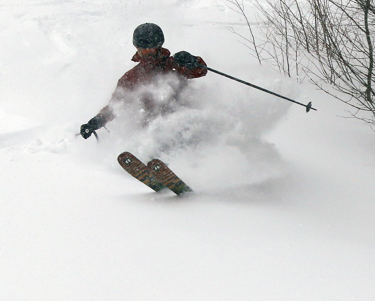
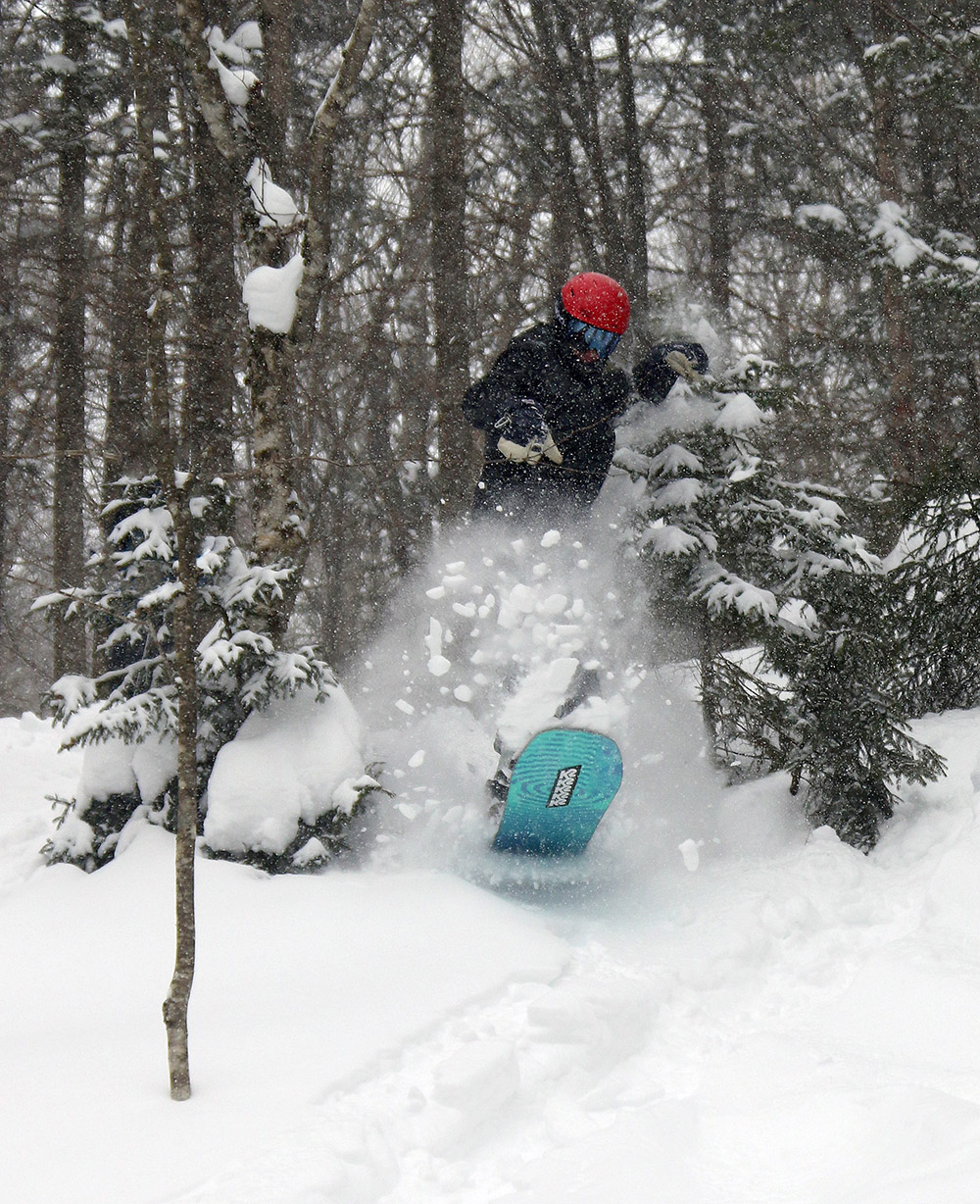
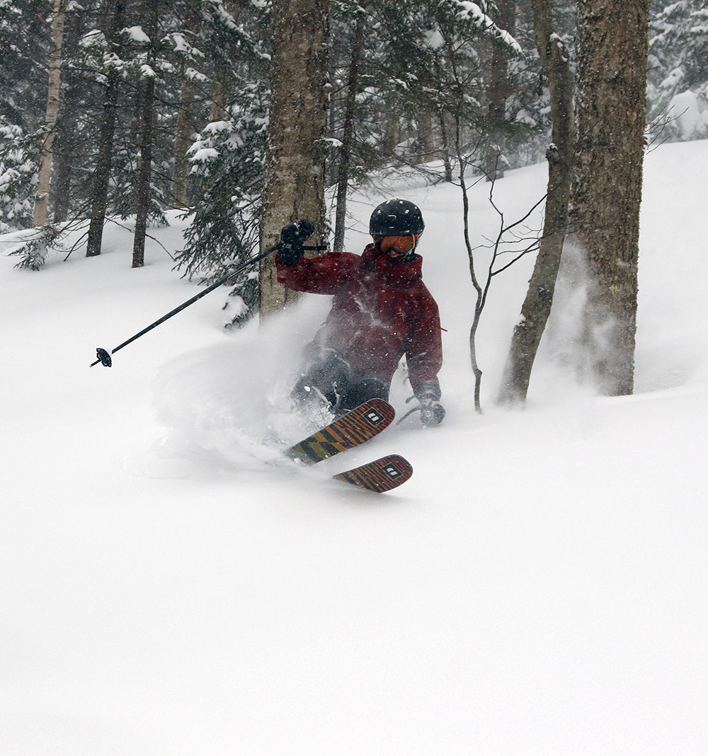
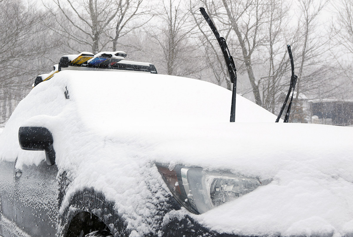
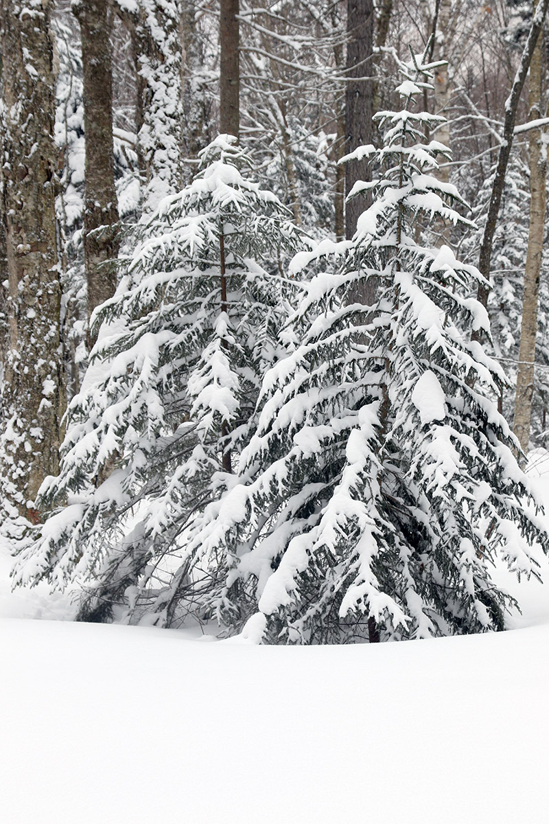
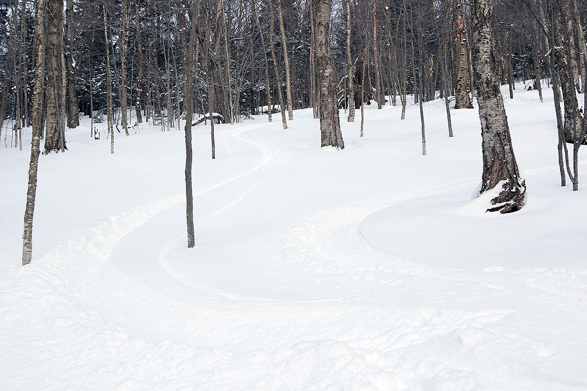
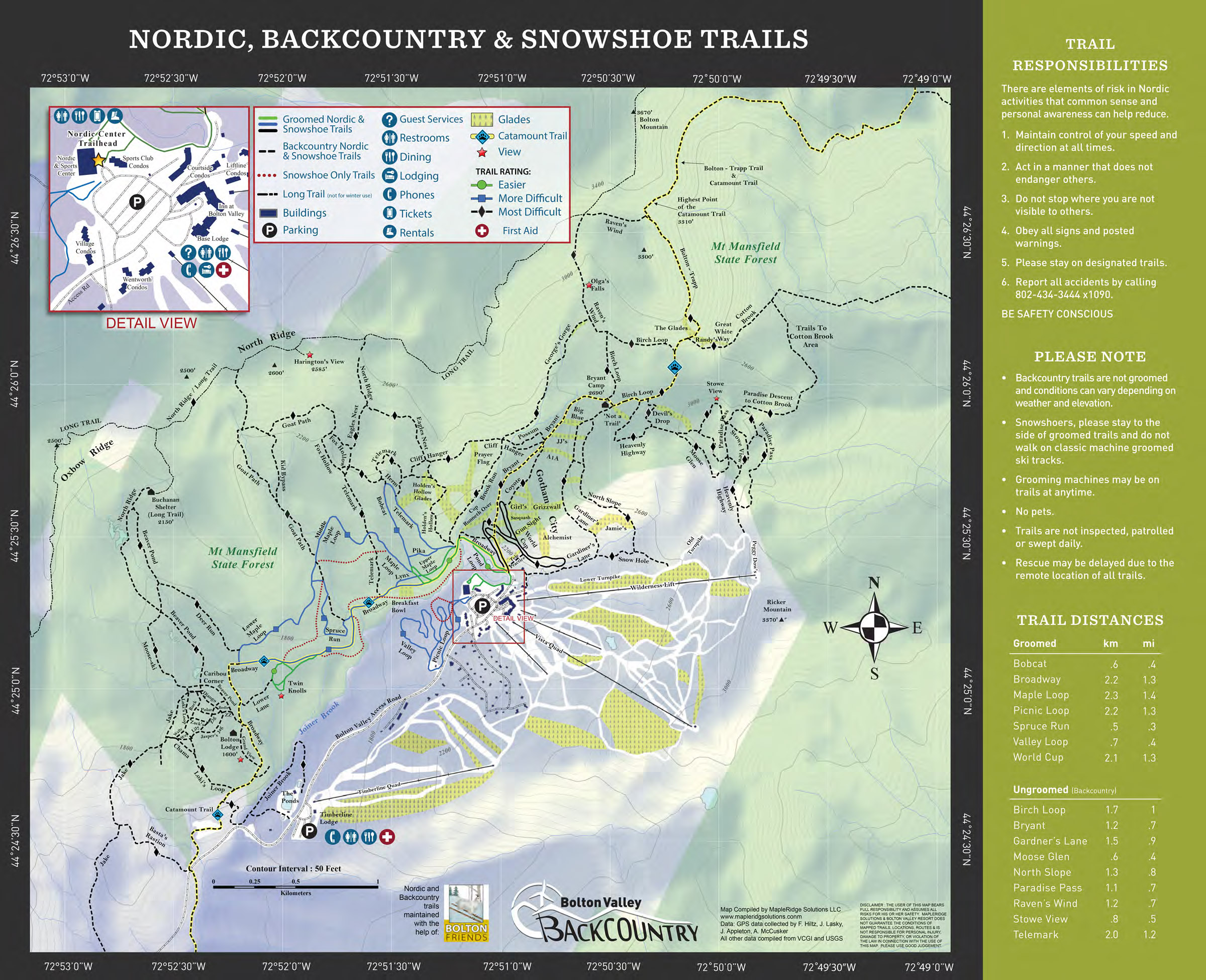
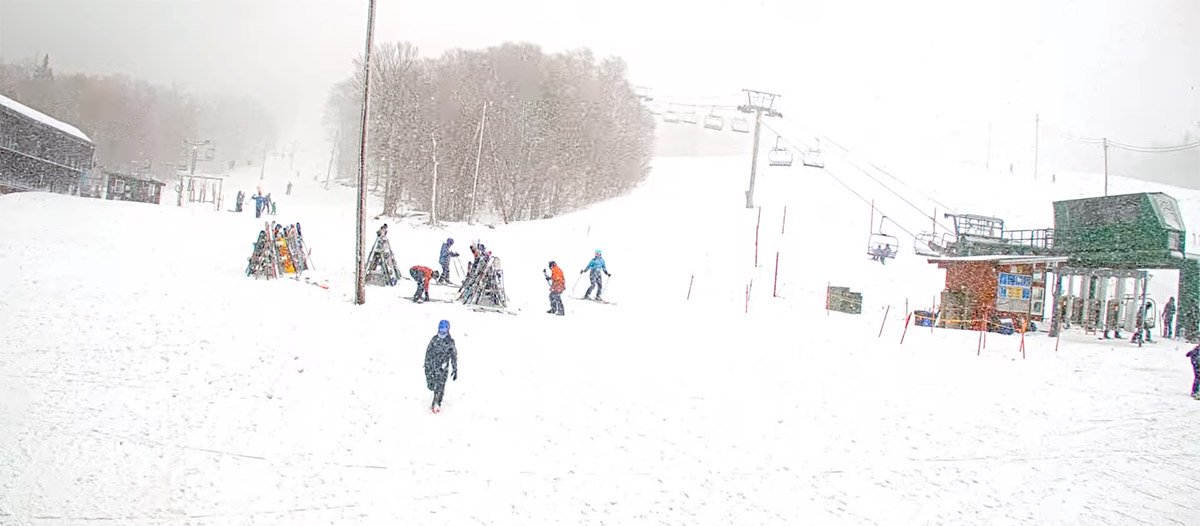
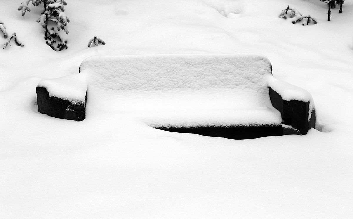
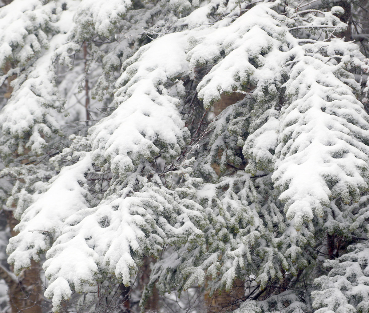
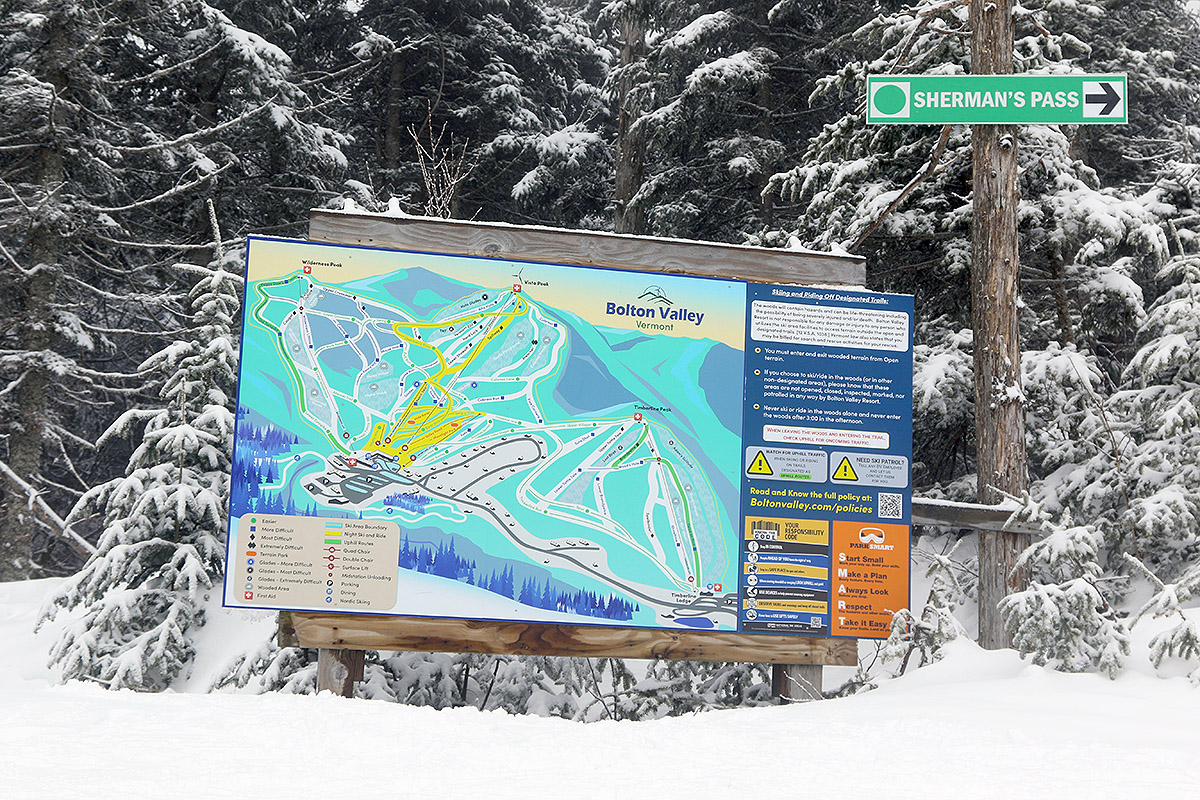
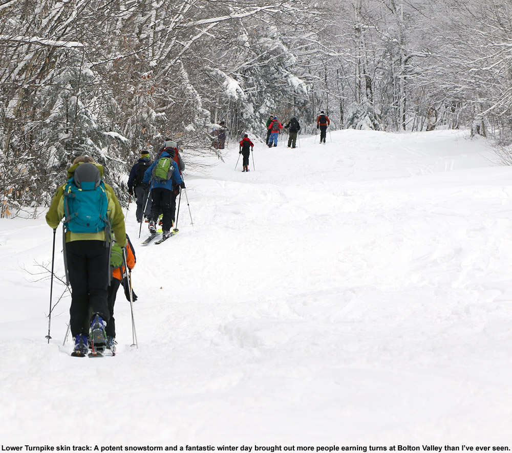
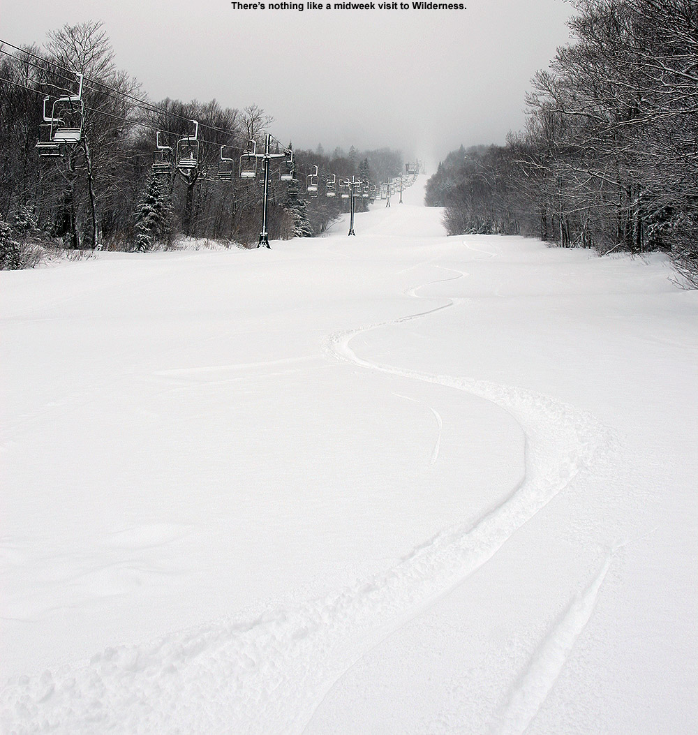
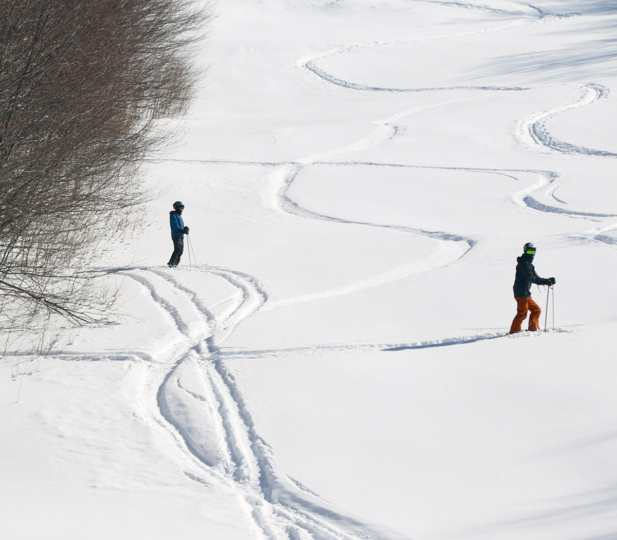
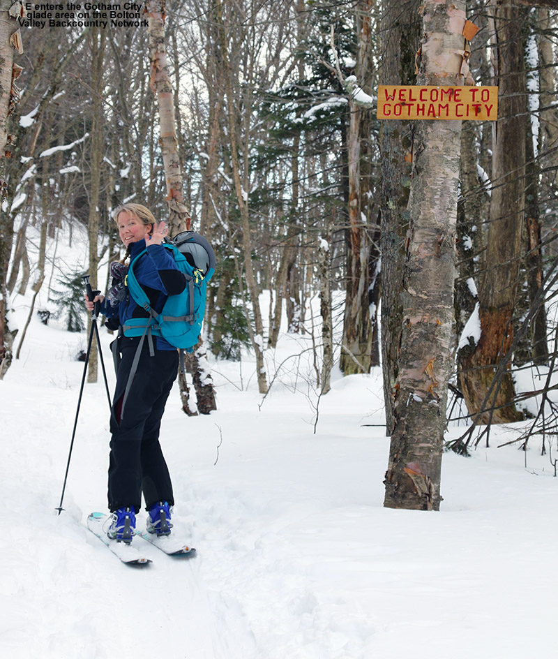
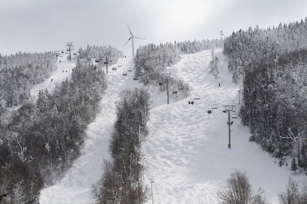
I told E about how good the skiing was yesterday, so she was interested in getting out and the two of us headed up to Bolton Valley today for another tour. Thanks to the ongoing lake-effect snow from Lake Ontario, surfaces have been getting some nice freshening. Since my report detailing the snow conditions during yesterday’s tour, we’ve had another inch or two of additional snow down at the house in the valley, so I’m sure Bolton has had at least that much as well. It was really dumping when I left yesterday afternoon, so that period alone should have contributed some nice accumulations.

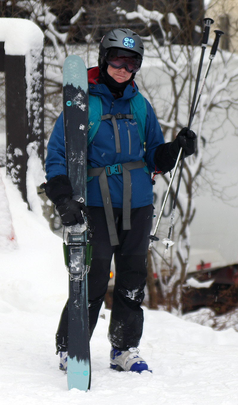
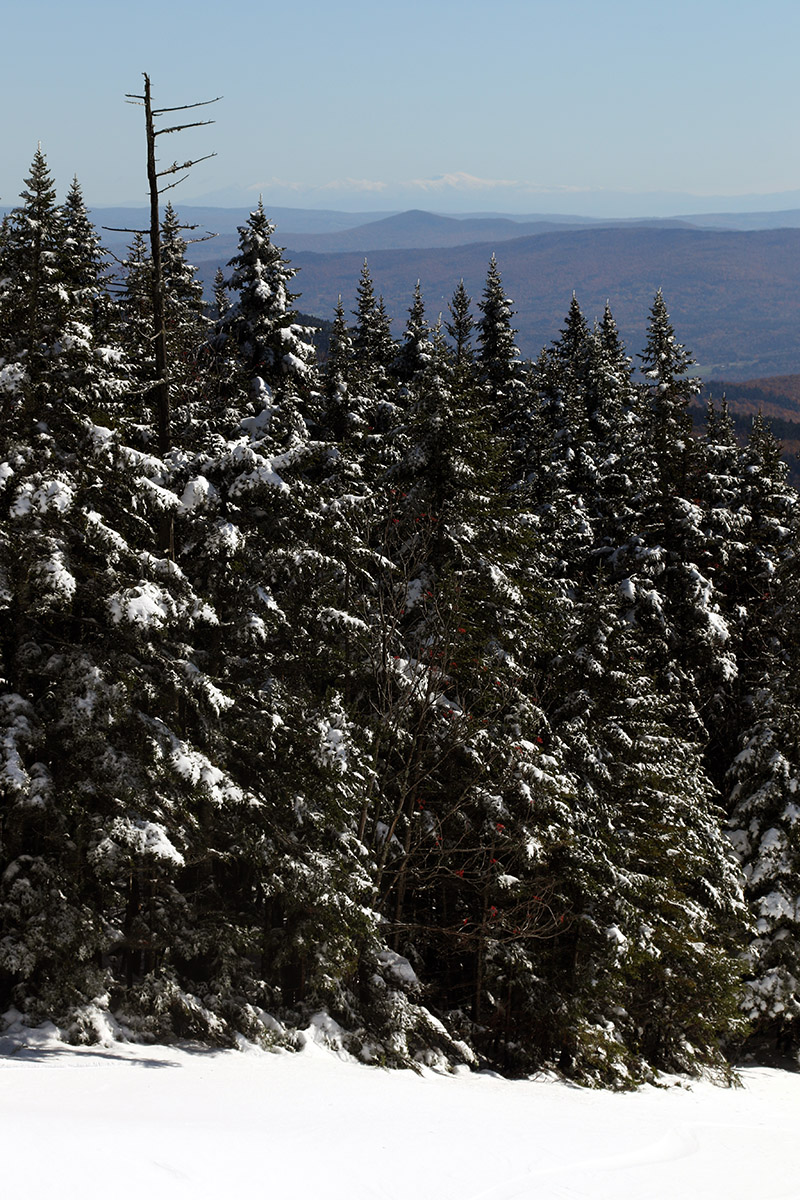
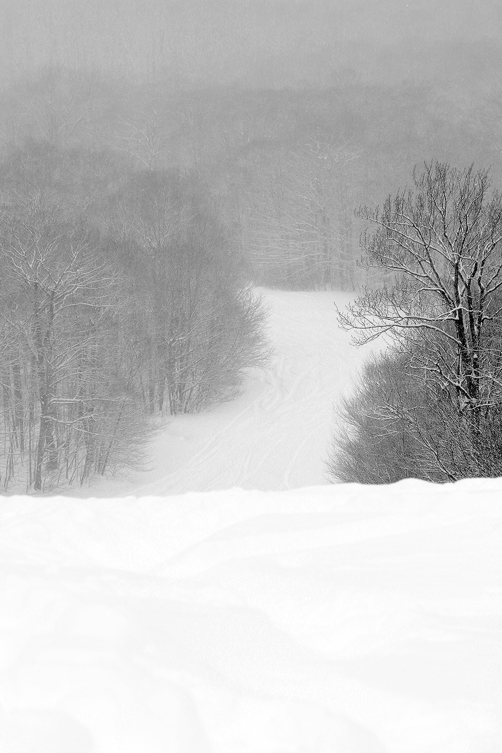
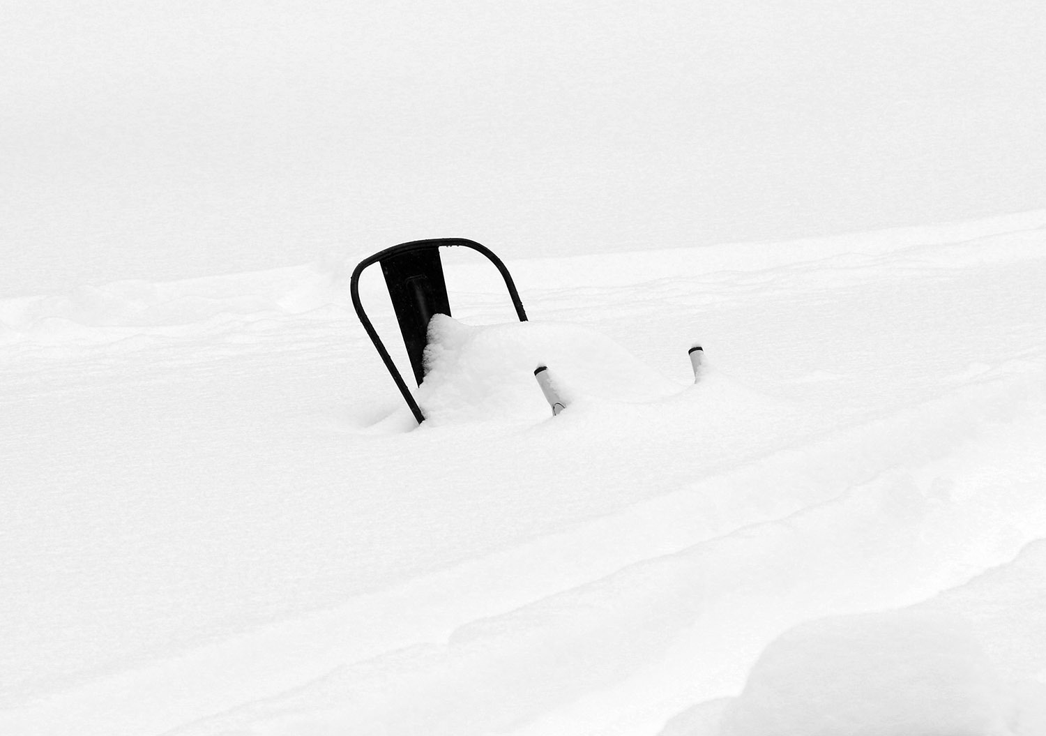
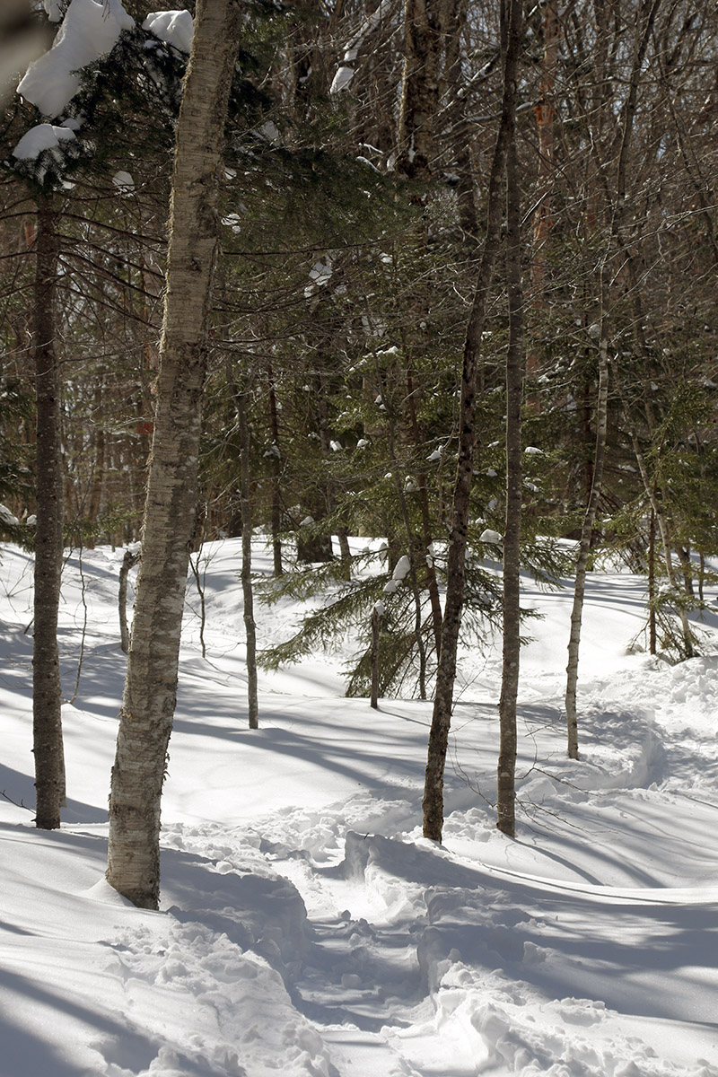
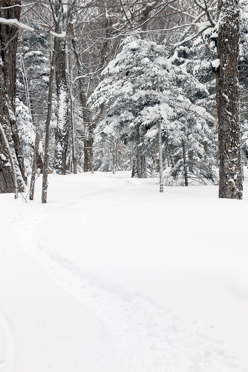
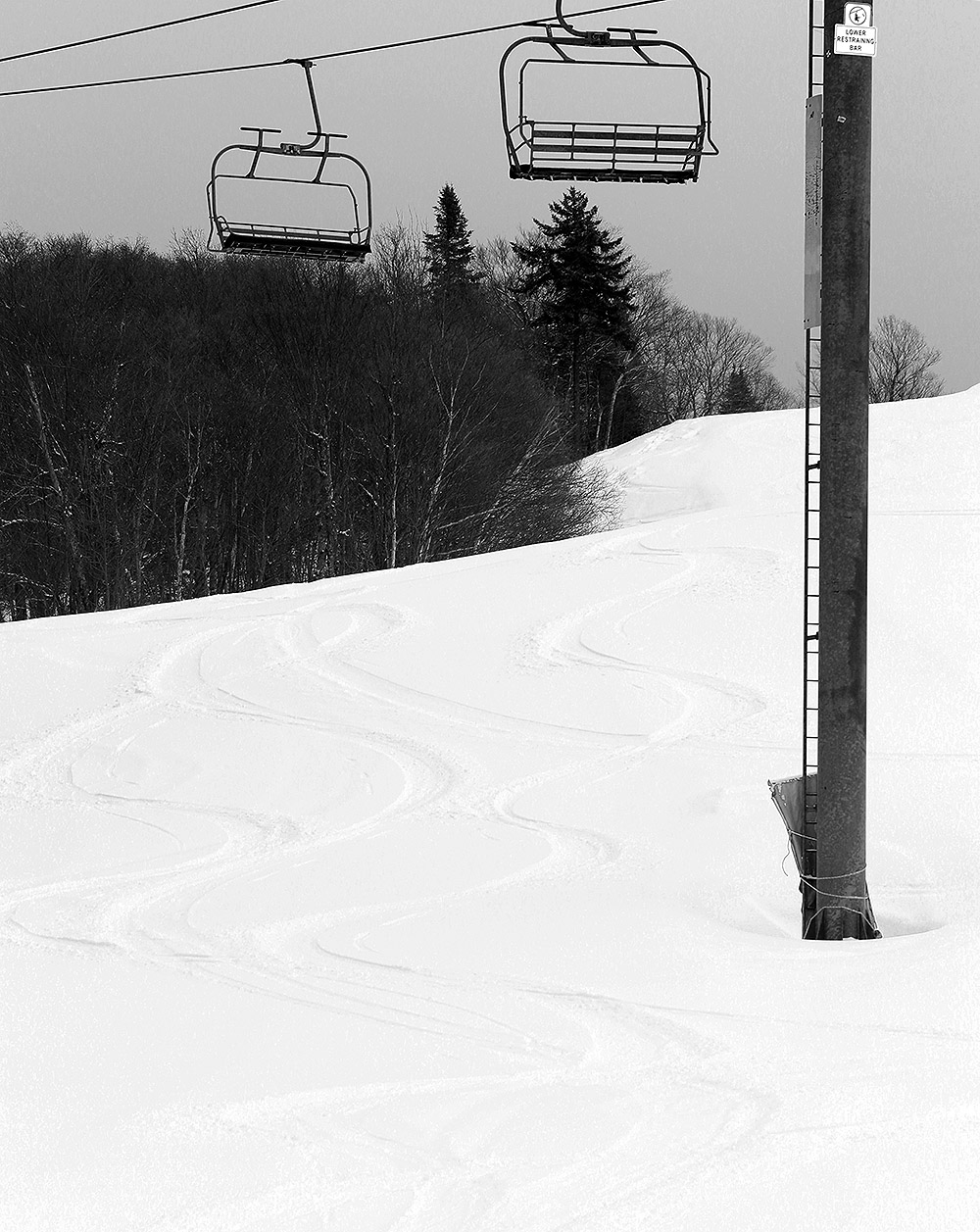
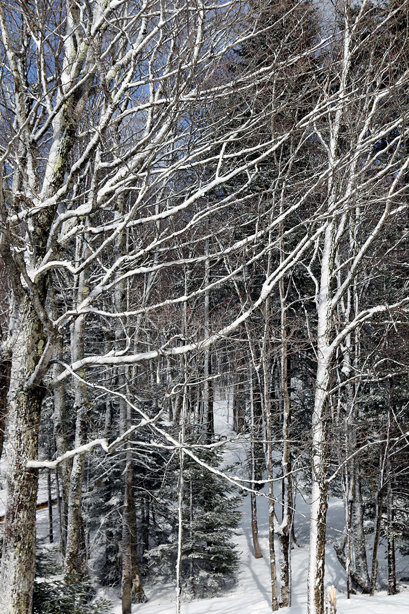
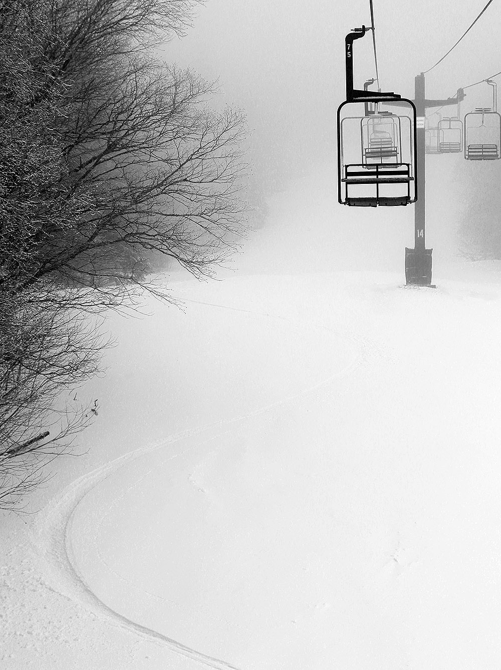
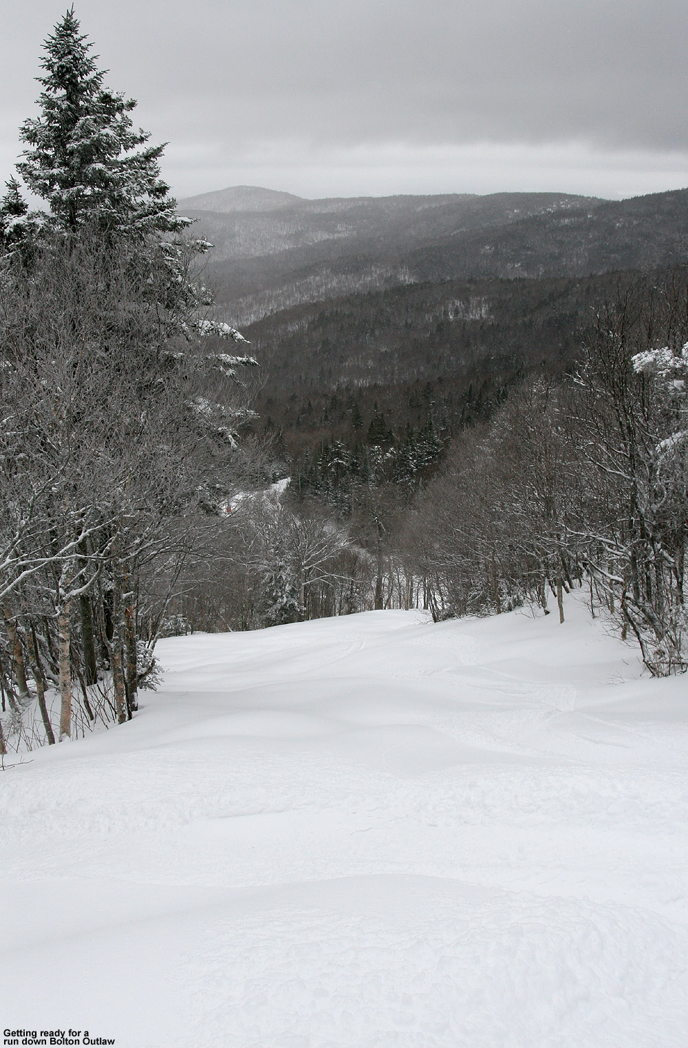
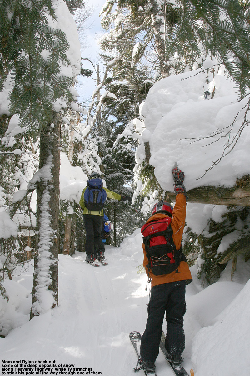
Between settling and the additional snow that’s been falling, snow depths seemed to be just about where they were yesterday, so just refer to the detailed snow depth profile I provided in that post for approximate snow depths that were out there today. Temperatures were in the mid-20s F out on the mountain early this afternoon, so it was just a bit cooler than yesterday, and consistent with that, the snow was a bit drier. Whereas yesterday I estimated the upper layers of powder in the snowpack to be in the 8% H2O range, today I’d say we were hitting powder that was more in the 6 to 8% H2O range. E is notorious for getting out on the snow one day too late when conditions aren’t as good as the day before, but that wasn’t the case this time. While there were a few more tracks out there today than what I found yesterday, the dry air and drier snow falling kicked the quality of the powder up a notch. The existing base snow, the continued settling of the lower layers of surface snow, and new rounds of dry snow coming in have set up some beautiful right-side-up powder. The drier nature of the powder was evident in the way it was even easier to ski lower-angle slopes; I’d brought fat skis to help in that regard, but my wife was on mid-fats, and she had no issues maintaining speed on even the mellowest pitches. So once again, essentially any mowed terrain from roughly single black diamond pitch down to gentle slopes was in play for great powder turns today.

An image of evergreen branches with fresh powder while ski touring snow during a November lake-effect snow event at Bolton Valley Ski Resort in Vermont
A view along our ski tour in Bolton’s Wilderness area today – we had beautiful temperatures, no wind, and fantastic powder for Erica’s inaugural tour of the season.

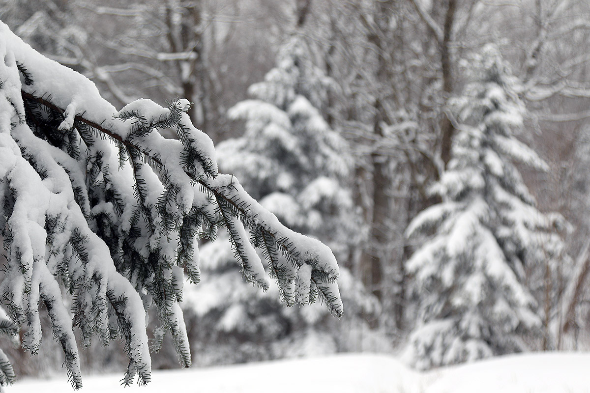
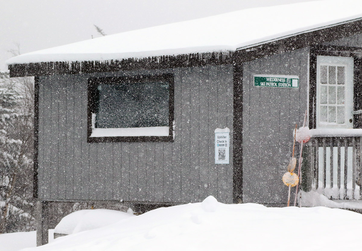
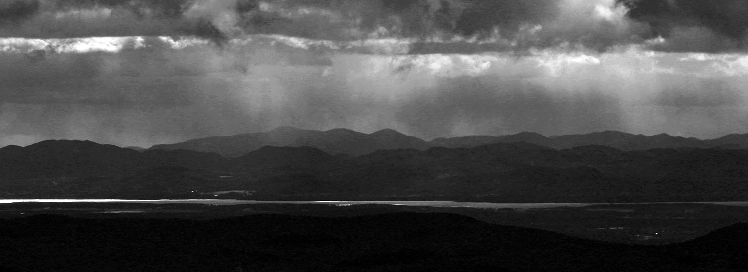
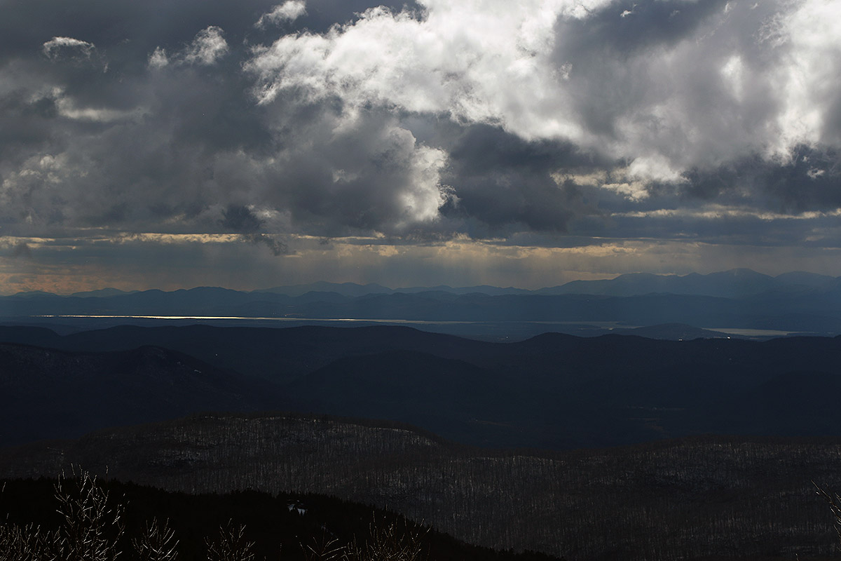
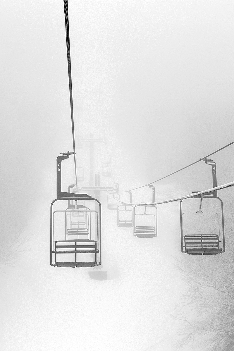
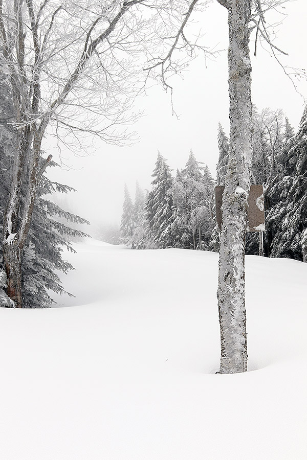
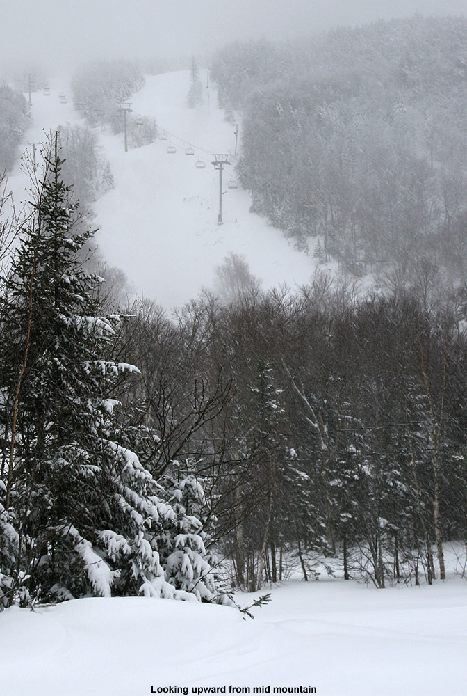
In terms of the ongoing snowfall, today was much like yesterday with continued light snowfall of varying intensity throughout our tour, and it was steadier when we were finishing up our descent, but not nearly as heavy as when I was leaving yesterday. The direction of the more intense incoming moisture from Lake Ontario seemed to be a bit more to our north today, but it sounds like the Jay Peak area has been doing well from that setup.

Bolton Valley, VT 29NOV2024

An image of snow falling at the base of the Wilderness Double Chairlift during the Thanksgiving 2024 snowstorm at Bolton Valley Ski Resort in Vermont
An image of ski tracks in powder snow on the Wilderness Liftline  during the Thanksgiving 2024 snowstorm at Bolton Valley Ski Resort in Vermont
I wasn’t initial sure what to expect from the Thanksgiving snowstorm at Bolton Valley, but with a solid shot of new powder over the existing base snow, there were excellent soft turns out there today.

With the Thanksgiving winter storm wrapping up overnight, today was clearly a day to get out for some skiing, but I wasn’t initially sure where I was going to go. The storm seemed to be more potent further south based on observations that I’d seen, as well as images from mountain cameras like the Okemo snow stake webcam and the Sugarbush snow stake webcam – they both showed about a foot of new snow at elevation. We’d been watching Bolton Valley’s webcams throughout the storm, and the resort was certainly getting some decent accumulations, but Bolton doesn’t have a specific snow stake webcam and it was a bit difficult to get a feel for just how much they’d received from the wider views. This morning, I perused a variety of mountain webcams from around the state, and in the end, there didn’t seem to be all that much difference in practical base area accumulations and coverage between what I was seeing at Bolton and the various resorts father south. I also checked on how much liquid equivalent was in the new snow, since that has such a big impact the quality of the skiing, and while the Vermont CoCoRaHS numbers seemed to be around an inch of liquid to our south, we’d picked up over 0.6 inches of liquid in the snow that fell at our house in the Winooski Valley, so I’d expect Bolton Valley to have picked up at least that much. With some base snow already in place at Bolton, that felt like plenty of snow for some good touring and turns.

An image of pickup truck covered in snow in the Village area during the Thanksgiving 2024 snowstorm at Bolton Valley Ski Resort in Vermont
A view of some of the growing storm accumulations in the Bolton Valley Village today

Overall, the decision ended up being relatively easy, and I headed up to Bolton around midday. Down at the base of the Bolton Valley Access Road at 340’, new snow accumulations were just spotty, with areas of grass visible, but by the time I hit the Village at 2,000’, I found 6 to 8 inches of fresh snow, so the skiing prospects were looking good. I ascended by the Wilderness Uphill Route, and the skin track was nicely set. I probed snow depths throughout the tour, and by the time I hit the Wilderness Summit at roughly 3,150’, depths were in the 12 to 14-inch range. Above 2,000’ there was already existing snowpack in place, so the higher-elevation snow depths I measured on today’s tour weren’t necessarily all from this most recent storm, but here’s the detailed snow depth profile from today:

340’: T-1:
500’: 1”
1,000’: 2”
1,200’: 2-3”
1,500’: 3”
2,000’: 6-8”
2,250’: 8-10”
2,500’: 10-12”
2,750’: 11-13”
3,000’: 12-14”

An image of steps covered in snow at the Wilderness Summit area during the Thanksgiving 2024 snowstorm at Bolton Valley Ski Resort in Vermont
Some accumulations of snow up near the Wilderness Summit during today’s ski tour

Although the precipitation from this storm was 100% snow even at our site at 500’ in the valley, temperatures were around freezing down low, so the accumulations were quite dense. That wasn’t the case up on the mountain though – the snow was considerable drier, and the powder was of good quality. It was clearly sub-10% H2O powder, and if I had to guess it was probably in the 8% H2O range above 2,000’. I’d brough mid-fat skis today since I was initially unsure of how deep the powder was going to be and how good the overall coverage would be, but one could easily go with fatter skis if they wanted. With some existing dense base snow in place, even black diamond terrain was easily in play today. You’ll still want to be on mowed, on-trail terrain though – I suspect that venturing onto anything with too many obstacles would find you hitting things below the base. And the trees are still not ready yet – the base isn’t deep enough to cover the typical obstacles in the woods. Today’s powder turns were great though, and the snow was dry enough that even low-angle terrain was fun. Fat skis could help there for a bit more planing and speed if you’re on the fence about what width to shoot for.

An image of evergreen branches covered in snow while out on a ski tour during the Thanksgiving 2024 snowstorm in the Wilderness are at Bolton Valley Ski Resort in Vermont
One of the views of the early season accumulations from along the slopes during today’s tour

Thanks to our upwind friend Lake Ontario, snow was falling the entire time I was out touring. For most of the tour the snowfall was of varying light intensity depending on whether a larger pulse of lake moisture was hitting the spine or not, but it jumped up to borderline heavy snowfall when I was leaving a bit before 2:00 P.M. There was a good shot of moisture hitting the mountain at that point and the top half of the Bolton Valley Access Road had taken on enough accumulation that people were really taking their time on the descent. With the lake effect snow event taking place right now, we’ve had about another inch of new snow down here in the valley, so I suspect they’ve had at least another couple of inches up at the resort. And there’s more moisture pushing into the area this evening based on the radar, so there should be some additional freshening of the powder surfaces for tomorrow.

Stowe, VT 17OCT2024

A view of some of the snowy trails of Stowe Mountain Resort in Vermont from the Mountain Road under brilliant sunshine with foliage after a mid-October snowstorm
Ski tracks in powder snow on the Perry Merrill trail at Stowe Mountain Resort in Vermont after a mid-October snowstorm brought more than a foot of snow to the higher elevations
A view of some of the powder turns on Perry Merrill. While yesterday was definitely the best day to get out in terms of fresh snow quality, today still delivered some very nice turns as long as you were high enough and early enough to avoid the warming temperatures.

With this latest round of autumn snow culminating in over a foot of accumulation on Mt. Mansfield, the setup was calling for some early season turns. With the way the temperatures were expected to rise today, I think yesterday was the way to go for potentially the best overall snow quality for powder turns, but I was too busy to get out to the slopes. I did get out this morning though, and while snow preservation was undoubtedly better yesterday, the clouds totally disappeared today to reveal incredible snowliage in the sunshine.

An image of Mount Mansfield in Vermont with the snowy ski trails of Stowe Mountain resort visible in bright sunshine after a mid-October snowstorm brought over a foot of snow to the higher elevations
A view of the beautiful snow and foliage from the Top Notch area on my approach to the mountain today.

I started my ascent from the Gondola base at 1,600’ and walked with my skis on my pack for a few minutes to get above the areas with the most melting, then I transitioned for touring and skinned up from there. The snow was already becoming spring-like down low in the sun, and areas in the shade featured refrozen snow. So even yesterday, the freezing level made it above the base elevations. I encountered my first real winter snow that had not seen a thaw-freeze cycle at about 2,800’ in the shade, and then at around 3,200’ I began finding some winter snow even in the sun. I made snow depth checks along the way, and here’s the depth profile I found in the late-morning to midday period:

1,600’: T-2”
2,000’: 4-5”
2,500’: 9-10”
3,000’: 12-13”
3,600’: 13-14”

Depths had consolidated a bit even up at 3,600’ based on Powderfreak’s pictures from yesterday, and the sun was really doing a number on the snow down low. The Gondola terrain gets hit by the sun, and the accumulations down near the Gondola base were just about gone by the time I finished my descent.

An image looking eastward from Mt. Mansfield in Vermont out toward the snow-capped White Mountains of New Hampshire while ski touring at Stowe Mountain resort after a mid-October snowstorm brought over a foot of snow to the local peaks
An eastward view out toward the snow-capped White Mountains of New Hampshire on today’s descent

In terms of the skiing, I encountered just about every sort of condition that Mother Nature can throw at you, from dense, silky powder, to refrozen areas with unbreakable melt crust, to spring snow, to sticky, freshly melted snow. Once you were down below the driest snow up top, the best approach was to fucus on the snow that was in that happy medium between seeing the most sun on the skier’s left, and that which had seen no sun on the far skiers right in the shade of the trees. The snow on the skier’s left that had seen some hours of sun was getting sticky, and snow that was shaded by the trees was still frozen with either an unbreakable or breakable melt crust, but in between there was an area of quality snow that had seen just enough sun to soften up but not get sticky. Once you were down below roughly 2,000’, everything was melting, so you just sort of kept going until you felt the snow was too thin. You could still make it all the way to the base with the help of shaded areas depending on what level of rock skis you might be on, but I took off my skis for the last few hundred vertical because I didn’t want to beat them up too much.

An image of the Gondola base are of Stowe Mountain Resort in Vermont with melting snow after a mid-October snowstorm brought over a foot of accumulation to the higher elevations of Mount Mansfield
Snow cover was disappearing in sunny areas down at the base elevations of the resort as I approached the end of my descent

That was a solid dump for the middle of October though, and with the bonus snowliage it was a great way to kick off the season.

Bolton Valley, VT 05APR2024 (A.M.)

An image of the Timberline Base Lodge area covered in plentiful fresh powder from ongoing Winter Storm Tormund in April of 2024 at Bolton Valley Ski Resort in Vermont
An image of the steep headwall area of the Spell Binder trail in the Timberline area during Winter Storm Tormund in April 2024 at Bolton Valley Ski Resort in Vermont
The powder has definitely dried out a bit as Winter Storm Tormund rolls on, but I still took advantage of the nice steeps of the Spell Binder Headwall on today’s tour, and it definitely delivered.

With Winter Storm Tormund still churning out the snow today, I decided to head up to the mountain for some turns in the morning. For Bolton’s schedule at this time of year, the lifts don’t start running until noon on weekdays, so ski touring was the natural choice for morning turns. I was initially undecided about whether I was going to tour at Wilderness or on the Backcountry Network, but I ultimately didn’t end up touring in either place. On my way up the Bolton Valley Access Road, I was passing by Timberline and suddenly realized… duh, that was the place to tour! I’ve been touring almost exclusively out of Bolton’s main base area this season because of the access to the superior snowpack depth and snow quality provided by being able to start above the 2,000’ elevation. The snow depth and quality down at the base of Timberline at 1,500’ just hasn’t been there until very recently, and it had been so long since I toured down there, I’d almost forgotten it existed. But when the snow is good, you can’t beat the convenience of ski touring at Timberline with its shorter drive and immediate access to nicely-pitched terrain, so once I was reminded, I jumped at the chance to start my tour there.

An image of chairs outside the Timberline Base Lodge adorned with a bit of snow from ongoing Winter Storm Tormund in April 2024 at Bolton Valley Ski Resort in Vermont
Partially-sheltered chairs lined up behind the Timberline Base Lodge have take on a bit of snow from ongoing Winter Storm Tormund

Skier traffic was light when I arrived at the base of Timberline, with about a half dozen cars or so in the parking areas. There was some snow falling when I started my tour, but at that point we were in a rather light phase of the ongoing storm cycle. I took depth measurements of the accumulations right at the Timberline Lodge as I was just beginning my ascent, and settled snow depths were right around 18 inches. From there, it seemed to increase by a couple of inches for each 500 feet of vertical gained. The resort was reporting 26 inches for a storm total at that point, and that would make sense for accumulations up around 3,000’ based on my measurements from those slightly lower elevations. Temperatures had cooled off overnight, so the most recent accumulations were drier and knocked the skiing up a notch relative to what I’d found yesterday afternoon. Overall, it was still a moderately dense accumulation of new snow, but it had a little better gradient of density for powder turns.

An image of a chair buried in fresh snow outside the Timberline Base Lodge during Winter Storm Tormund in April 2024 at Bolton Valley Ski Resort in Vermont
This chair outside the Timberline Base Lodge was a sign of the recent snows from Winter Storm Tormund that had hit Bolton Valley even down at the 1,500′ elevation.

As I ascending the Timberline skin track on Twice as Nice, I was gauging my options for the descent. Even with the slightly drier snow topping off the ongoing accumulations, I knew from yesterday that having enough pitch was still going to be important for optimal powder turns. I was leaning toward descending on Twice as Nice itself, since it has one of the most consistent pitches among the trail selections – it doesn’t have any heavy steeps, but it also doesn’t have the required compensatory flatter sections. My leaning changed when I watched a snowboard descending the trail with his dog, and I saw that he was bogged down and coming to a near standstill in one of the lower pitched areas. That was enough to convince me to head toward Spell Binder, where I knew I would at least get to sample the steep headwall section for some solid turns.

An image of evergreens adorned with heavy amounts of fresh snow from Winter Storm Tormund at the mid-mountain elevations of the Timberline area at Bolton Valley Ski Resort in Vermont
Evergreens near the Timberline Mid Station elevations adorned with hefty amounts of snow from Winter Storm Tormund

As expected, the headwall of Spell Binder absolutely delivered. The turns were surfy and buoyant in the roughly two feet of fresh powder, and I could absolutely feel the improvement that had come with that most recent drier snow topping off the rest of the accumulation. Just like yesterday afternoon, it was another session of plowing into the powder as deeply and aggressively as you wanted, and you were still nowhere near the subsurface. As a bonus, even the powder in the lower pitched areas skied fine, and I didn’t have any issues with speed. Either my 115 mm boards had surface area to spare for my weight relative to the snowboarder I’d seen, or he had some other issue (wax, etc.) keeping him from planing on those lower pitches. It was a great powder session to kick off the day, and with the storm continuing to roll along, it looks like there will be more fresh snow sessions on the way as we moved toward the weekend.

Bolton Valley Nordic & Backcountry, VT 25MAR2024

An image of large snowbanks and snow on houses from recent Winter Storm Ronnie in the Village area at Bolton Valley Ski Resort in Vermont
An image of the spring snowpack and a skin track in the Gotham City area during a March backcountry ski tour on the Nordic and Backcountry Network of trails at Bolton Valley Ski Resort in Vermont
A view of the snowpack and the skin track as I make my way up into the Gotham City area during today’s ski tour

Today was another chance to take advantage of the new snow from Winter Storm Ronnie, and I had time in the morning to head up to the mountain for some turns. Based on the incredible numbers of visitors yesterday, I figured that untracked lines would be few and far between on the lift served terrain, so I decided to hit the Bolton Valley Nordic & Backcountry Network for a ski tour and get some exercise.

The morning weather was very similar to what we’d been gifted yesterday – sunny, with little wind and temperatures a bit below freezing. I didn’t have time to head all the way up to Bryant Cabin, but I was able to go for a nice loop up the Bryant Trail, onto Coyote, and then up to Gotham City on my tour. With the number of visitors yesterday, I thought that even the backcountry terrain might be heavily tracked up, but that wasn’t the case – there had been a moderate amount of activity, and plenty of untracked lines remained.

There was excellent powder to be found, and I’d say it was just as good as yesterday – if it was protected from the sun. Even with temperatures generally below freezing yesterday, the clear and sunny skies with that late March sun angle were too much for the snow. I suspect the situation was somewhat better if you went high enough in elevation, but least in the 2,000’ to 2,500’ elevation band where I was skiing, areas that had seen direct sun had a substantial sun crust. The effect of the sun was potent enough that it absolutely wrecked the powder skiing in those exposed areas, and it was such a thick and semi-breakable crust in places that the skiing was extremely challenging there. Thankfully, if you skied shaded snow, the powder was in beautiful shape, so I certainly stuck to those lines as much as possible. We’ll likely be warming up at all elevations this week with some spring-like weather, but we may have another substantial storm cycle coming in next week to bring back more spring powder skiing.

An image of a Google Earth map with GPS tracking data from a ski tour on the Nordic and Backcountry Network of trails at Bolton Valley Ski Resort in Vermont
A Google Earth map with GPS tracking data from today’s ski tour on the Bolton Valley Nordic & Backcountry Network

Bolton Valley, VT 23MAR2024

An image of Will shredding fresh powder from Winter Storm Ronnie during a March riding session at Bolton Valley Ski Resort in Vermont
An image of Dylan blasting through fresh powder snow during Winter Storm Ronnie at Bolton Valley Ski Resort in Vermont
Dylan charges through some of the fresh powder as Winter Storm Ronnie rages on during our session at Bolton Valley today

Starting in the wee hours of the morning today, Winter Storm Ronnie began delivering snow, and once things got going, heavy snowfall pounded the mountains all day. In our area, the snowflakes coming in from the system were relatively small, and my early morning liquid analyses from the snow revealed that it was a fairly synoptic-like 12.0 to 1 snow to liquid ratio. That ratio actually dropped as the storm continued through the day, with a 10.6 to 1 ratio for my afternoon analysis, and an 8.4 to 1 ratio for my evening analysis. Despite the relatively small flakes, the snowfall was still in the inch per hour range or more, so there was a lot of liquid coming out of the sky. The very heavy snowfall and small flakes made for some very tough photography out on the mountain today, but we still fired away to get what we could.

An image of Erica coming over a rise into more powder snow while Telemark skiing during Winter Storm Ronnie at Bolton Valley Ski Resort in Vermont
Erica comes over a rise and eyes her next section of powder during our morning session at Timberline today.
An image of Will blasting through powder snow between some trees during Winter Storm Ronnie at Bolton Valley Ski Resort in Vermont
Will blasts between a couple of trees during today’s session – a snowboard was a great tool for riding in today’s dense snow on the front end of Winter Storm Ronnie

Although the storm was still in progress and we’d only received a portion of the anticipated accumulation by the time the lifts started running this morning at Bolton, we still kicked things off with an early start. We were worried about making the ascent of the Bolton Valley Access Road today with the heavy snowfall, but an uphill plow run had been done fairly recently, so it was actually quick and painless getting up to the Timberline Base. We quickly met up with Stephen and Johannes, and Dylan and his friend Will from college as well, so we had a party of six exploring the mountain.

There didn’t appear to be much elevation dependence with the snowfall, so we were happy to hang down at the relatively lower elevations of Timberline and make use of the great terrain there. While there hadn’t been a call for much wind with this storm, it was still blowing quite hard, and that was another incentive to stay down at the Timberline elevations for a while. We eventually did move up to the main mountain, skiing both Wilderness and Vista, and even by the summits up above 3,000’ the wind was similar to what we’d experienced down at Timberline. As the morning moved on, the wind decreased substantially to the point where it wasn’t even a factor.

An image of Dylan surfing through some fresh powder while skiing the trees during Winter Storm Ronnie at Bolton Valley Ski Resort in Vermont
Dylan surfs through the trees and carves at speed – it was fresh tracks all the time and just about anywhere at the resort today with the continued heavy snowfall from Winter Storm Ronnie all morning.

In terms of the ski conditions, the moderately dense snow had already put down an excellent resurfacing even for the first runs in the morning. The new snow was atop recent rounds of snow from previous storms, so that presumably helped, and with snowfall continuing all day at around an inch per hour, the trails were constantly getting refreshed. The resurfacing made the quality of the on piste turns quite impressive aside from scoured or very high traffic areas, but the powder skiing off piste left something to be desired. With the dense snow falling, the powder was somewhat upside-down, and its density allowed you to easily get bogged down on anything but steep terrain. That’s not to say that the powder skiing wasn’t still tons of fun, but you could tell it wasn’t up to the typical standards of a storm cycle in the Northern Greens where the snow gradually lightens into upslope fluff and really sets up some top notch powder.

All in all, though, it was an excellent session of storm day skiing at the resort. We stopped in for lunch with Dylan and Will at Fireside Flatbread and had some excellent pizza – I got to try their barbeque chicken bacon ranch pizza that Dylan has been raving about. There weren’t any substantial lift queues to speak of today, and it was likely that the ongoing storm kept some people from venturing out to the mountains. The drive down the access road was fairly tough when we finally left in the afternoon, so I can understand why that would keep some folks home, perhaps hoping to come out tomorrow if the storm winds down.

An image of our car covered in snow after just a few hours of skiing during Winter Storm Ronnie at Bolton Valley Ski Resort in Vermont
With inch-per hour snowfall hitting the mountain today, our car was well covered after just a few hours of skiing and riding.

Bolton Valley, VT 20MAR2024

An image of a ski track in deep powder after a mid-March snowstorm brought over a foot of new snow to Bolton Valley Ski Resort in Vermont
An image of heavy snowfall at the Wilderness Summit area during a mid-March snowstorm at Bolton Valley Ski Resort in Vermont
Solidly heavy snowfall at the Bolton Valley base area elevations today gave way to very heavy snowfall coming down at over 2 inches per hour in the summit areas

In Bolton Valley’s lift rotation schedule, today was the first time the Wilderness Chair would be running since the weekend, so it was a good place to be to get in on all the snow that’s fallen in the past couple of days. So, after ski touring yesterday, today seemed like a good opportunity for some lift-served turns with Wilderness thrown in.

It was snowing all the way down to the valleys this morning, but not necessarily accumulating too efficiently in the lower elevations. Up above 2,000’ in the Village though, snow was accumulating easily. Snowfall was moderate and steady in roughly the ½” to 1”/hr. range when I first arrived, but by the time I’d made my first run and worked my way over to Wilderness, it had picked up substantially to somewhere in the 2”/hr. range. It was the type of snowfall that covers you in white flakes in mere moments if you aren’t moving around on the lift enough to shake it off.

An image of the Valley Road area with powder ski tracks in additional snow that had fallen after grooming during a mid-March snowstorm at Bolton Valley Ski Resort in Vermont
Even areas that had been groomed were taking on additional snow and had seen a solid resurfacing from all the recent snows.

As might be expected with substantial snow falling day after day, the ski conditions are excellent out there right now. There’s still firm snow that you can find on piste in high traffic areas and steeper slopes, but just head off to untracked or lightly tracked areas, and you won’t really be interacting at all with the old base. I found that even well-groomed areas could be really nice – my first run down Alta Vista was on the groomed surface, but it hadn’t seen much skier traffic at all, and there had been at least another couple of inches of snow since it was groomed, so the turns were all silky smooth with no noise anywhere. Off piste I found about a foot of powder up in the 3,000’ range, and slightly less down around 2,000’, but there’s enough liquid equivalent in all the new snow now that it will support bottomless turns throughout that elevation range.

Wilderness was skiing really well thanks to the especially low skier traffic in recent days, and they had Bolton Outlaw open, which I hadn’t skied in quite a while. It’s steep enough and has probably seen enough traffic from ski touring that I was still contacting the old base, but I was able to cut over to the steep terrain of the Wilderness Liftline Headwall, and that was nearly untracked and yielded excellent turns. The Wilderness Chair stopped three times in fairly short order when I was nearing the Wilderness Summit on one of my runs, and I thought that it might be due to wind issues, but the lift operator at the base let me know that it was just issues with people loading – apparently they were still working out the shape of the loading ramp there. All that new snow can bring about complications that I never would have thought of.

An image of evergreens coated with fresh snow during an ongoing mid-March snowstorm at Bolton Valley Ski Resort in Vermont
Evergreens around the mountain today bore the fruits of continued rounds of recent snowfall.

The snowpack in the Northern Greens is in good shape – the depth at the Mt. Mansfield Stake passed 80 inches today, so these recent storms have helped it cruise right above average for this time of year. There’s still more snow in the forecast right through the weekend, so it wouldn’t be surprising if the snowpack depth increased further in the coming days.

A weather alert map from the National Weather Service office in Burlington Vermont  showing a Snow Squall Warning for the western slopes of the Northern Green Mountains during a mid-March period of repeated snowfall events
The rounds of snow just keep rolling through the area, and the Snow Squall Warning put out by the National Weather Service Office in Burlington is just what you’d expect as the heavy snow hits the western slopes of the Northern Greens

Bolton Valley Nordic & Backcountry, VT 19MAR2024

An image of The Bryant Cabin adorned with picturesque icicles and snow in mid-March during a ski tour on the Nordic and Backcountry Network at Bolton Valley Ski Resort in Vermont
An image of ski tracks in one of the glades on the Nordic and Backcountry Network of trails during a mid-March ski tour at Bolton Valley Ski Resort in Vermont
Carving some tracks in glades on the Nordic & Backcountry Network during this afternoon’s ski tour

The system that’s been affecting our area over the past day or so really started to crank up yesterday evening, delivering some periods of heavy snowfall up in the 1”/hr. range with large flakes. By this morning we’d picked up about a half foot of snow from the system here at our site in the valley, so that obviously called for a check on the Bolton Valley snow report, and I wasn’t surprised to learn that they were reporting 10 inches of accumulation.

I was busy in the morning, but I was able to head up to the resort in the afternoon for some turns. The precipitation was snow all the way down to the valley floors, but afternoon temperatures were in the 30s F, so it wasn’t really accumulating until up in the resort elevations where the temperatures were below freezing. Being a Tuesday, the Wilderness Chair wasn’t running, so I was torn between touring on Wilderness or in the Bryant Trail area. When I arrived up in the Village to find that people were parking even in the lower tiers of the main lot, it was obvious that a lot of folks were interested in getting out for afternoon and evening turns on the lift-served terrain, so I figured the Backcountry Network was the best bet.

A copy of the 2018-2019 Nordic and Backcountry trail map from Bolton Valley Ski Resort in Vermont
A copy of Bolton Valley’s Nordic & Backcountry trail map which lists the trails and many of the official glades

Just as I was heading out toward the Bryant Trail on my tour, I saw a group of 6 to 8 skiers returning from a tour of their own, and one of the guys spoke to me as he passed. He said, “Have fun, it’s amazing out there!” That’s probably a good omen at the start of a tour, and of course, his words were 100% on point.

An image of the "Not a Ski Trail" area during a mid-March ski tour of the Nordic and Backcountry Network at Bolton Valley Ski Resort in Vermont
The scene off Heavenly Highway as I get ready to start my descent on this afternoon’s ski tour

Ascending the Bryant Trail, it was immediately obvious that the powder was in fantastic shape. The only blemishes I could really detect were a couple of areas with a bit of sun crust that must have been in very exposed spots. Other than that, it was hard to find any fault with the quality of the powder or its ability to cover the subsurface. The snow is midwinter dry, but indeed as Powderfreak  mentioned in the Northern New England thread at the American Weather Forums, there’s enough substance to it to provide a nice resurfacing. I toured up to about 2,800’ on Heavenly Highway, and here are the depths of new, settled powder that I measured above the old base:

2,000’: 7-9”
2,400’: 8-10”
2,800’: 10-12”

An image of evergreens covered with fresh snow after a mid-March storm in the backcountry of Bolton Valley Ski Resort in Vermont
Fresh snow adorning the evergreens created fantastic views during this afternoon’s backcountry ski tour. The Bolton Valley area picked up more than a foot of snow from our most recent winter storm.

The powder skiing was fantastic, with a very good right-side-up deposition, and bottomless turns aside from the occasional touch of the subsurface in a few spots. Temperatures were probably in the upper 20s F, so it was very comfortable. I’d describe the powder as “fast”, because it just was. I hadn’t waxed my skis or anything, but either the structure of the crystals, or the temperature close to freezing, just seemed to produce less resistance than usual. This was great for turns, but it was a little frustrating in any rolling terrain where I’d be traversing slightly uphill to another line. I would have loved a bit of stickiness in the snow for those section, but it was super slick, and you had to earn every step you took without skins. Most glades had only a couple of tracks in them, even Big Blue, which is very popular, so I took a run through that area and had 100% untracked powder turns throughout the descent.

A Google Earth map with GPS tracking date from a mid-March ski tour on the Bolton Valley Nordic & Backcountry Network at Bolton Valley Ski Resort in Vermont
A Google Earth map with GPS tracking date from today’s ski tour on the Bolton Valley Nordic & Backcountry Network

I see that with today’s additional snowfall, the resort is now reporting 13 inches in the past 48 hours. The next system in the queue is right on our doorstep this evening though, so we’ll see if this one can bring us anything like what the last one did.

Bolton Valley, VT 17MAR2024

An image of snow squalls crashing out in the Adirondack Mountains of New York during a March ski day with variable weather as viewed from the slopes of Bolton Valley Ski Resort in Vermont
An image of sunshine lighting up snowy trees on a springlike day of variable winter weather in mid-March at Bolton Valley Ski Resort in Vermont
Sun lights up some trees with fresh snow as a perfect representation of today’s variable spring and winter weather.

I’d seen that the potential for more snowfall was in forecast today based on the weather modeling, and it looked like the afternoon period might be the best bet for catching some turns in fresh snow. The BTV NWS forecast discussions have been noting that there’s no large, defined system in our area today though, we’re just moving into a general period of unsettled weather. With nothing really going on at the house other than cloudy conditions around midday today, I was surprised when I checked the Bolton Valley Base Area Webcam and saw that the visibility up there was extremely low due to heavy snowfall. It was notable to see such a disparity between the weather on the mountain and the weather at our house, but then I checked the radar and saw what was going on. The precipitation was very convective/cellular in nature, so the mountain happened to be under one of those rather localized, intense areas of snowfall. In another 10 minutes or so, the snowfall began to wind down, but the radar of to the west was riddled with similar pockets of precipitation all across the North Country that were heading toward the spine of the Northern Greens. I suspected the mountain would see additional episodes of snowfall throughout the afternoon, so I decided I’d head up for turns once I finished up some work I had to get done.

Later in the afternoon when I was getting ready to pop up to the mountain, I checked the webcam again and they were getting hit by another round of snowfall. The early morning snow report from the resort indicated that they’d picked up a fresh inch of snow before opening, and with the way the afternoon had gone, I wouldn’t have been surprised if they’d picked up another inch or two. We were even getting some rain in the valley with that round of snow, and as I headed up the Bolton Valley Access Road, the precipitation switched over to snow a bit below 1,500’. When I’d headed up to the mountain on Friday, the snow level was around 2,000’, so it was notably lower today.

A webcam image of the base area during a mid-March snow squall on a day of variable weather at Bolton Valley Ski Resort in Vermont
A shot taken from the Bolton Valley webcam today as one of the heavy snow squalls moved across the mountain. The resort’s webcam was invaluable today in keeping tabs on the changing March weather.
An image of the Adirondack Mountains of New York State beyond Lake Champlain with areas of snow squalls and afternoon light visible in Mid-March take from Bolton Valley Ski Resort in Vermont
Another shot across to the Adirondacks showing some afternoon like and the various areas of snowfall upstream of Bolton Valley

I can’t say what the snow was like earlier in the day today, but what I found in the later afternoon was a very fun mix of different conditions that all skied quite well. The mountains have been in that temperate March/April mode over the last few days where we’ve got some fresh snow accumulations, temperatures in the upper 20s to 30s F, some sun, some clouds, semi-cycled snow depending on elevation, and probably whatever else you can think of that this time of year has to offer in the higher elevations. Descending from above 3,000’ on Wilderness, I found wintry conditions with some dense powder that was blended into the old snowpack in untouched areas, with wintry wet pack on the groomed/traveled areas that had firmed up somewhat with temperatures below freezing. By the time I descended to 2,000’ I encountered areas of semi-corn, soft packed snow on piste, and denser wet snow off piste. I didn’t ski down below 2,000’ to Timberline, but that area unquestionably had the softest snow. In any event, it all skied remarkably well, with nothing overly sticky or firm. I had waxed my skis in preparation for any potentially sticky conditions, so that probably helped keep things extra smooth for me, but I didn’t see anyone else struggling with apparent stickiness either. Temperatures did seem to be dropping as the afternoon came to a close, so the sub-freezing conditions were falling to 2,000’ and below.

Being later in the day on a Sunday afternoon in March, skier traffic was quite low when I was on the mountain, and I was coming upon trail areas where there were literally just two or three tracks in the fresh snow, and I’d basically have the run of it with respect to laying down my own tracks. I see that the mountain is indicating 3 inches of new snow in the past 48 hours, so that seems about right based on the untouched areas I skied, and it’s generally dense so it does a great job of providing floatation above the base. The weather models are still suggesting that we’ve got more snow chances continuing right through to the end of the month, so we’ll look forward to what are hopefully additional days of these fun winter/spring conditions atop a snowpack that is probably slightly below average, but not bad. Average snowpack this time of year is nearing peak anyway, so even if we’re off from that a bit, it’s still quite plentiful.

Bolton Valley, VT 15MAR2024

An image of an outdoor bench covered in snow form a mid-March storm at Bolton Valley Ski Resort in Vermont
An image of ski turns in powder snow underneath the Wilderness Double Chairlift after a modest mid-March snowfall at Bolton Valley Ski Resort in Vermont
Carving out some sweeping powder turns under the Wilderness Chair in this morning’s fresh snow

This morning I was seeing reports of 2 to 5 inches of new snow for the resorts of the Central and Northern Greens. Snow levels were high; thus, the accumulations were likely to be dense, but that would mean the liquid equivalent could be there for some decent resurfacing of the slopes. I wasn’t sure how much resurfacing would be needed, but the past couple of days have had some spring-like warmth and sun at times, and I haven’t been up to the hill during that period, so there would be plenty for me to discover about the state of the snowpack.

Heading up to Bolton, light rain in the valley didn’t change over to snow until just below 2,000’, so indeed snow levels were relatively high as expected. With the anticipated snow levels, I’d planned to ski out of the main base area, and the elevation of the snow line confirmed that I likely wouldn’t be heading down to the Timberline elevations for my outing.

An image of the upper portion of the Wilderness Double Chairlift disappearing into the clouds on a March ski day at Bolton Valley Ski Resort in Vermont
Gazing up toward the Wilderness Summit obscured in the clouds

The resort only indicated a couple inches of new accumulation in their early morning report, but that was either early and/or from the base elevations, because I found more than that up high. I started off with an Alta Vista run, and I’m not sure when it was groomed, but I’d say 2 to 3 inches of dense powder atop the groomed surface would be a good description of what I found there. Turns there in the untracked snow above the groomed surface were ~75% bottomless on 86 mm mid-fats, so I was occasionally touching down to the firmer surface below, but overall, it was quite a pleasant and surfy experience. Off piste, things were a bit different. At the Wilderness Summit above 3,000’ I measured what seemed to be 5 to 6 inches of new snow, but it was a little challenging to get exact numbers. In many areas off piste, especially up high, the new dense snow has simply bonded into the underlying snowpack, and you can’t find an interface. I can’t say exactly at what elevation that changes, but it’s most pronounced up high where the snowpack has seen fewer, or less intense freeze-thaw processes over the past couple of days. Off piste turns were especially good up in those high elevation areas, but in general I found that everywhere off piste except for the very lowest areas of the main mountain delivered consistent bottomless turns thanks to the dense snow.

An image showing some recent snow accumulations from a modest mid-March snowstorm at the Midmountain elevations at Bolton Valley Ski Resort in VermontThe freezing line seem to sit right around 2,200’ for most of the morning while I was there, and that was because the snow got sticky for the last 100’ of vertical on my runs. As midday approached, the freezing line seemed like it began to rise because on my last run I’d say the stickiness of the snow started to appear about 200’ above the base.

An image showing a trail map sign and some recent snow accumulations from a mid-March storm at the Vista Summit area of Bolton Valley Ski Resort in Vermont
A view of the trail map sign and some recent snow accumulations up at the Vista Summit this morning

It was really quiet at the resort this morning, being a random March Friday without a major publicized snowstorm, but I did ride the Vista Quad with a guy who had come up from Northampton, Massachusetts. He’s an Indy Pass owner, his home mountain is Berkshire East, and with Bolton Valley being on the Indy Pass as well, it was a perfect fit for a trip. He said it’s been a rough season down there at Berkshire East, at least in terms of natural snow. Thankfully, they were able to get by fine on snowmaking terrain, but he was blown away by the natural snowpack at Bolton. From about Mid Mountain on up during our lift ride, when the surroundings really started to get white, he could not stop talking about all the snow. He said he really needed this trip for his overall state of mind because it’s been so long since he’s seen snow around his area, and from looking at the Berkshire East Webcams, I can see what he means. He’s really lamenting that fact that he thinks this is only going to continue to get worse with climate change. With the way the last couple of seasons have gone regarding snowfall down in Southern New England, I can understand why it’s so depressing. He’s a passionate backcountry skier as well, and I definitely wanted to ask if he’d considered the idea of relocating to somewhere like NNE or the Rockies etc. with more reliable snowfall, but I didn’t get a chance to go there before our lift ride ended.

Looking ahead on the weather models, it seems like we’ll have snow chances right on through to the end of the month and beyond. That’s typically par for the course during March and April, but getting snow becomes fickler toward the end of the season, and sometimes the supply of new snow just shuts off due to above average temperatures.