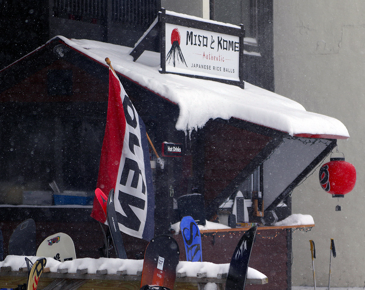
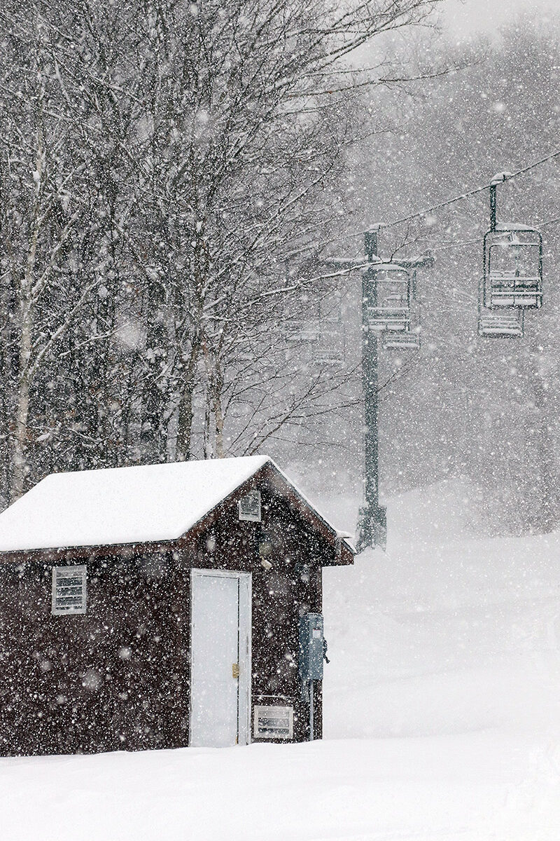
Light snow falls in the Bolton Valley Village in the fading afternoon light as Ty and I finish up our ski tour today.
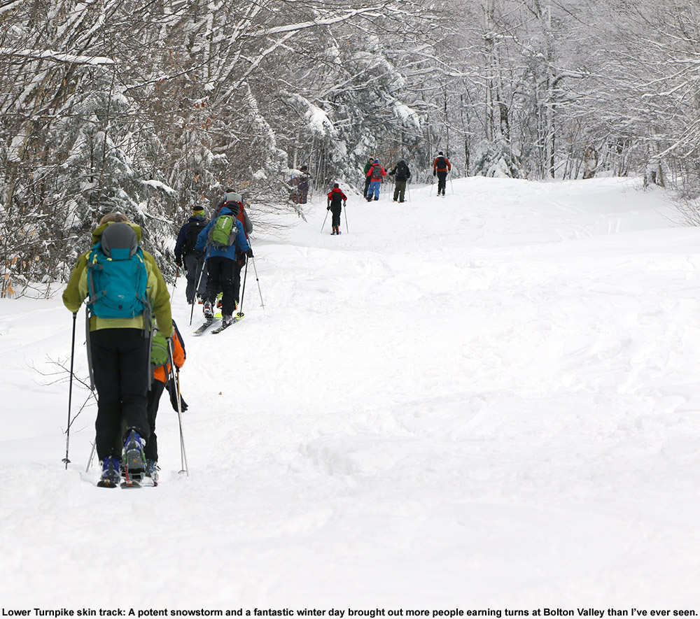
It was Winter Storm Bellamy that hit parts of the Midwest fairly hard yesterday to become TWC’s second named storm of the season, and then the system continued its eastward trek and started to affect our area by early this morning. Throughout the day it brought light snow to the area, and by the afternoon we’d picked up about an inch of accumulation in the valley. Coupled with the accumulations from the midweek system, I figured it would be worth a quick ski tour to see how the powder was building up in the higher elevations, so Ty and I headed up to Bolton Valley in the mid to late-afternoon.
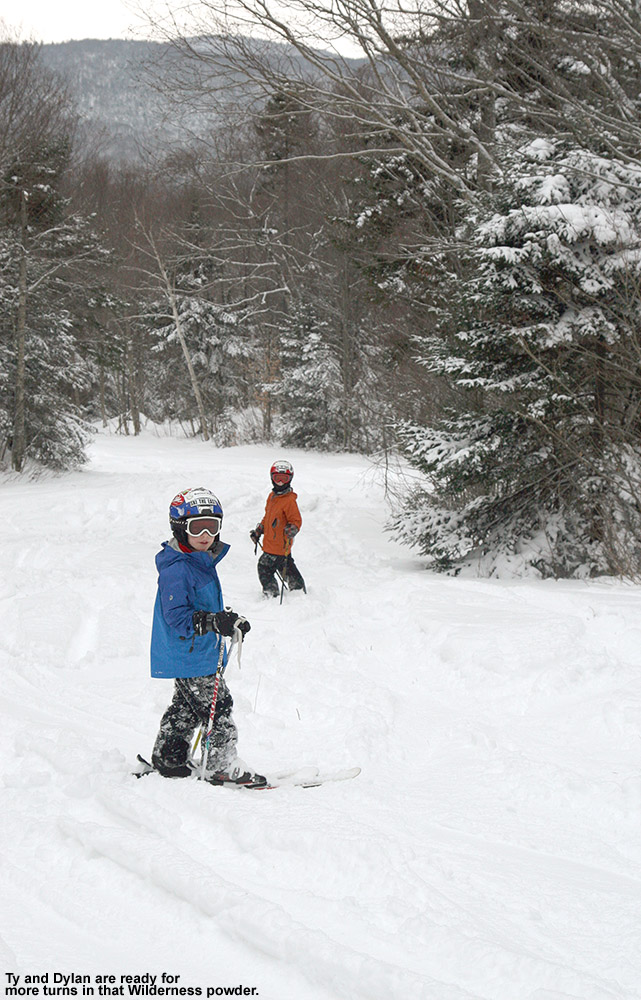
We toured on the lower 2/3 of Wilderness and found a general 3 to 4 inches of powder coating the existing base in untracked areas. That seemed about what one might expect based on picking up a couple of inches from each of these past couple of systems, and conditions were actually a bit better than I’d expected because I was worried that the wind might have blown the snow around and left us with little powder to ski. Indeed the snow was fairly light and dry (my liquid analyses from the two storms averaged out to snow in roughly the 5% H2O range for liquid equivalent), so it was nowhere near enough for a full resurfacing, but it definitely offered up some nice turns on lower angle terrain. Most turns weren’t bottomless, but you’d get some here and there where the powder had settled in a bit deeper. This was certainly a case where denser snow would have made a huge difference in resurfacing, but there was only so much liquid equivalent with these past couple of systems in this area, so they could only do so much to cover the subsurface.
The next storm in the queue has been named Winter Storm Chan, and it looks like it could add a more substantial shot of snow to the slopes – Winter Storm Warnings and Winter Weather Advisories are going up throughout the area. So, on top of the snow that’s already fallen in the past few days, it definitely holds the potential to kick the conditions up another notch.
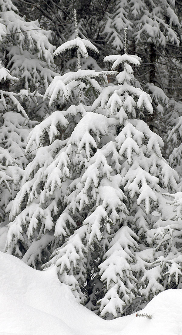
We’ve had a number of winter storms so far this November, and many evergreens in the higher elevations are already holding onto heavy accumulations of snow.
The clipper system that came through the area over the past couple of days was relatively weak, but in general agreement with the forecast, we still picked up close to 2 inches of new snow at our site down in the Winooski Valley. I was up in the Bolton Valley Village yesterday, where it was snowing at a decent clip, and as of their evening snow report, they indicated that they’d already picked up 3 inches of new snow. I’m not sure how much more they picked up overnight, but at the pace the snow was falling, it seemed like it was worth taking a tour to check things out.
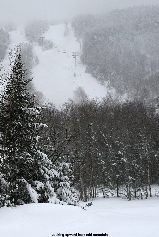
Valley temperatures were marginal for parts of the event, and as I headed up the Bolton Valley Access Road this morning, there weren’t any substantial signs of new snow until I’d reached roughly 1,000’ of elevation. After a couple of tours from Timberline’s lower base elevation over the past several days, it was clear that the better play with this system would be to start my tour up at the Village. The cloud ceiling as I ascended was around 1,800’, and above that point, everything was socked in with dense clouds and lightly falling snow.
Light 1-2″ snow accumulations and huge snowbanks greeted me as I started my ski tour in the Bolton Valley Village this morning.
At ~2,000’ in the Bolton Valley Village, I found 1-2” of new snow accumulation. From my visit to the mountain on Saturday, I knew that temperatures above freezing had affected the snowpack, at least up to the 2,500’ elevation. So, the new snow from our small system certainly wasn’t going to resurface that snowpack, but I was curious about what was going on in the higher elevations.
The accumulations of new snow did increase the higher I went, but more importantly, at some point between 2,500’ and 3,000’ you reach a level where it’s clear that the temperatures haven’t gone above freezing in quite some time. The snow quality there is excellent aside from areas affected by the wind or some sort of skier of resort vehicular traffic.
I did my best to estimate the accumulations from this latest system at various elevations, but once you get up to the point where there’s no consolidated melt layer to mark the surface of the old snowpack, it becomes difficult. In any event, here are the estimates for accumulations I found from this event at various elevations in the Bolton Valley area:
All the snow from these November storms has really been accumulating on the trees, and in places where it hasn’t gone above freezing to melt some of it off, it’s a lot of weight on the evergreens. In fact, I saw several evergreen trees that had recently fallen onto the trail along the Wilderness Uphill Route. There’s also a layer of ice on the trees that accumulated from whenever we had some mixed precipitation earlier in the month, and that is definitely adding to the weight the trees are bearing. While I was up at the Wilderness Summit, I watched a small section of trees on Ricker Mountain just collapse from the weight of the accumulated snow and tear away a large chunk of soil as they tumbled down the slope. In any case, many of the evergreens in the higher elevations are absolutely caked with midwinter levels of snow.
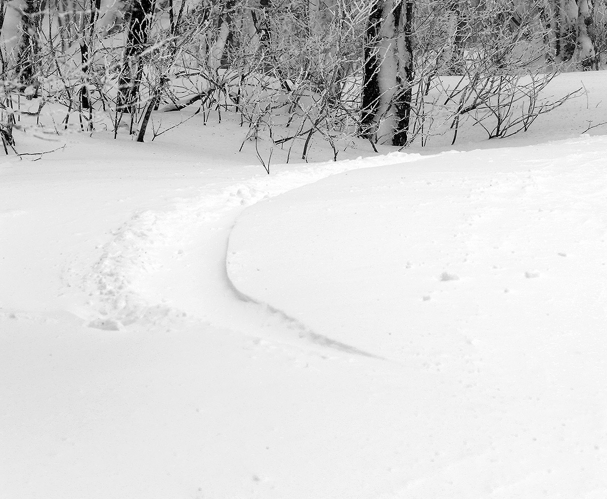
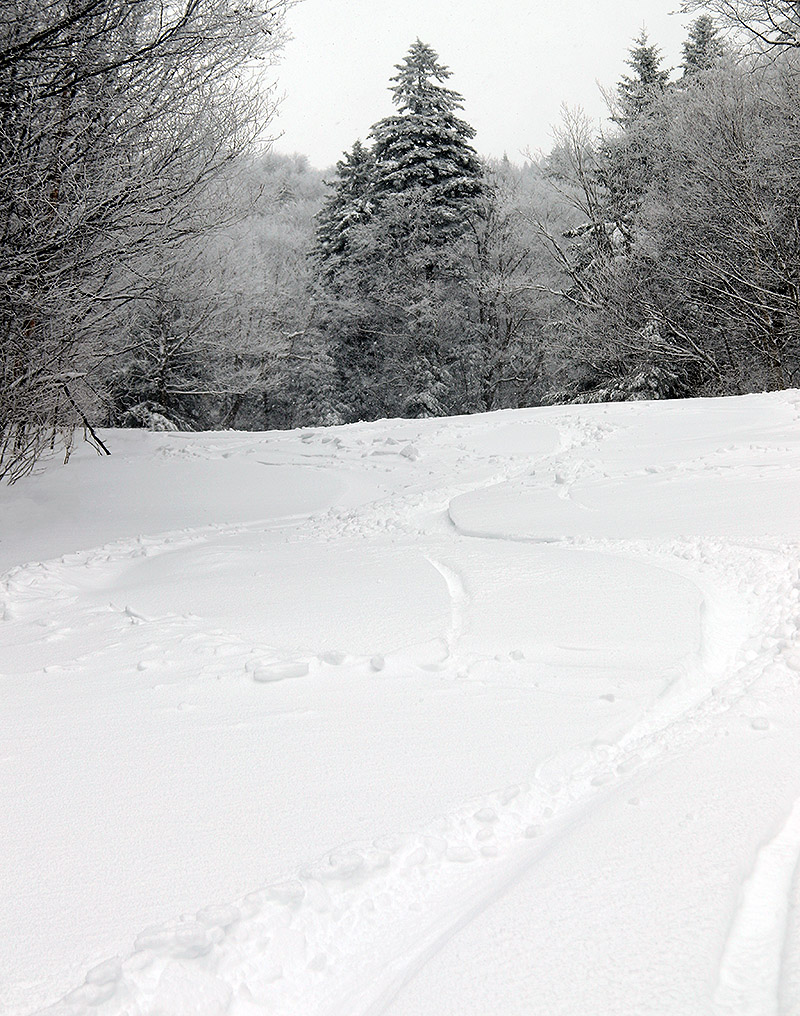
Passing through the Lower Fanny Hill area during today’s ski tour
Our current winter storm has already unloaded over a foot of snow in the mountains, and it looks like this storm cycle will continue on through the end of the week.
Our current winter storm began affecting the area yesterday, and it’s been hitting us with a decent stream of moisture in the form of snow and some rain/snow in the lower elevations. We picked up less than an inch of additional snow overnight at our site in the Winooski Valley, and the total precipitation I’d recorded from the event was less than ¼” as of this morning’s CoCoRaHS submission. So, I had no idea that we’d been clobbered with snow in the higher elevations until I saw PF’s post of the accumulation at the Stowe snow cam. I immediately checked the Bolton Valley Base Area Webcam, and although I couldn’t get a good sense for how much snow had fallen there, the scene was solidly white, and in general if Stowe has done well with snowfall, then Bolton Valley has seen something similar.
It was another snowy November morning up in the Bolton Valley Village
Snow cover was getting patchy this morning in many of the lower valleys, with marginal temperatures and a wet snow/rain mix, and that’s the way things stood at the base of the Bolton Valley Access Road when I headed up. Snow depths really started to pick up above 1,000’ though, and I found 6-9” of snow at the Timberline Base at 1,500’. Up in the Village at 2,000’, snow depths were in the 10-14” range, and there was steady moderate to heavy snowfall.
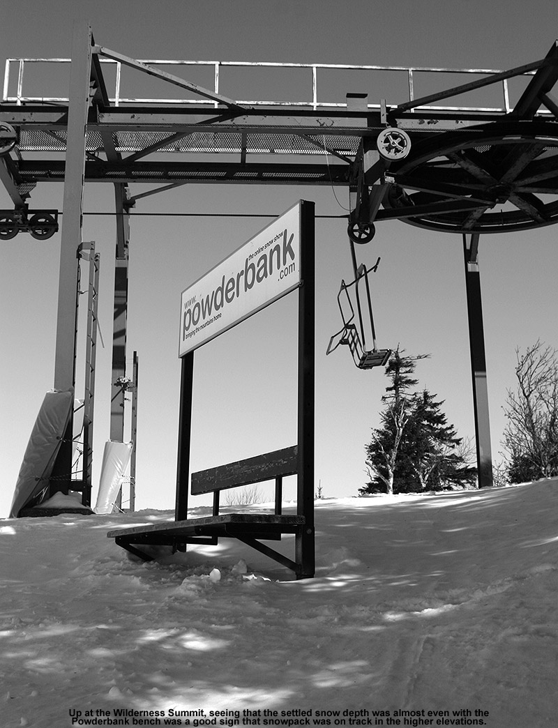
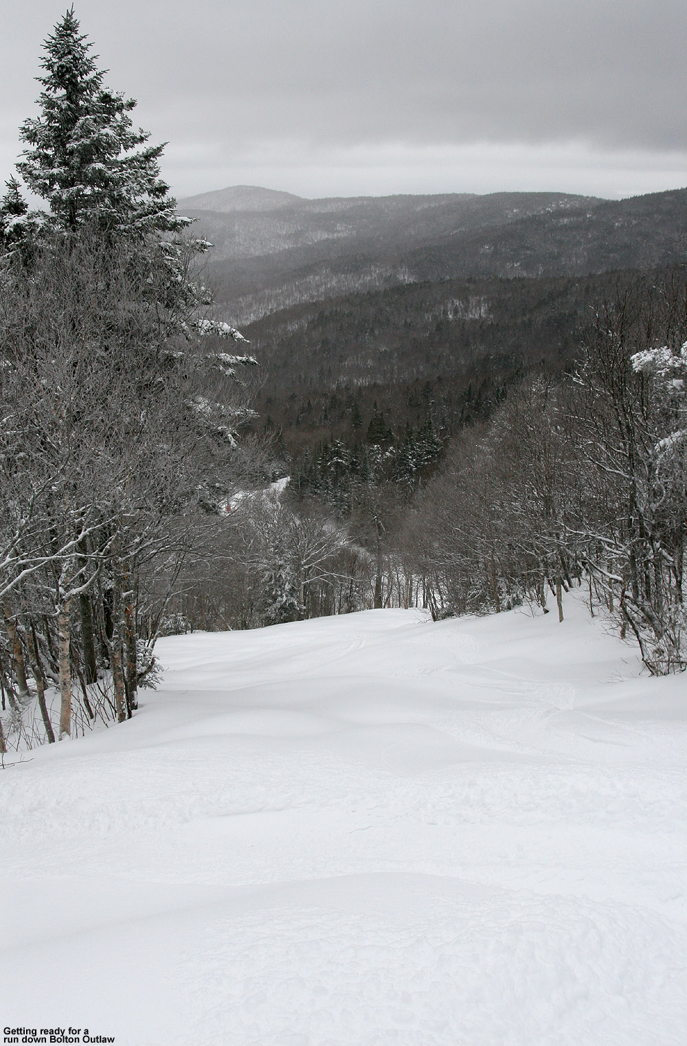
I was able to tour up to the Wilderness Summit at ~3,150’, where I measured total snow depths in the 15-24” range. That’s not all from this current system of course, but with the existing snowpack below and this fresh snow on top, it’s set up some very nice skiing. Steep terrain is certainly in play with the amount of snow out there right now, and Bolton Outlaw was in really good shape. I was on mid-fats, since I wasn’t sure of how much snow there was going to be, but if I’d known just how much was out there, and how good the coverage was in general, I would have gone with fatter skis. At least on piste as of this morning, fat skis were the way to go. The powder out there isn’t quite as dry as what fell from the November 5th storm, but the quality is quite good, and it has a lot of substance to it. With underlying base in place and this new medium to high density snow on top of it, there is absolutely some great coverage out there.
Below is the total snow depth profile I observed this morning for various elevations in the Bolton Valley area. As usual, it’s getting harder to probe the full depth of the snow in the higher elevations where the snowpack is becoming more consolidated.
It should be interesting to see where the snowpack depth comes in with the next update from the Mt. Mansfield Stake. This system looks like it should continue to deliver snow right through the end of the week, with 8-14” of additional snow shown in the forecasts. And, temperatures are expected to cool a bit and bring snow levels back down to the lower valleys, so if the snow density drops it could set up some excellent right-side-up powder conditions.
A view from the bottom of the Bolton Valley Access Road this morning – our most recent November snowstorm was somewhat notable in that it brought substantial snow accumulations all the way down into the Champlain Valley.
I had time for a quick ski tour up at Bolton today, so I can pass along a bit of beta with regard to this latest storm and conditions. I’d seen that with the warm front end of this storm, the snow had melted out in the lower elevations of the mountain, so the depths that are there now in the roughly 2,000’-2,500’ range are only from this latest event. Seeing that Jay Peak webcam image that Powderfreak posted in the American Weather forum, I’d say Bolton got hit just a bit better – it’s probably similar to what Smuggler’s Notch picked up. Here’s the elevation-based snow depth profile I observed this morning in the Bolton Valley area:
Even in down in the valley this morning, the trees were coated with a healthy layer of snow.
You can see what a weird snow depth profile that is compared to the usual – the snow depth even in the Village at ~2,000’ is basically that same as it is at 340’ at the base of the Bolton Valley Access Road or at our house at ~500’. I only had time to tour up to ~2,700’ this morning, but the snow depths don’t really start to increase until you get above ~2,500’ into the elevations that have pre-existing snowpack, so it looks like the snow accumulations from the front end of this system were pretty consistent over quite a broad range of elevations.
In terms of the quality of the turns, today was more like the skiing from the Halloween/November 1st system vs. the much higher quality turns from the November 5th system. This snow was drier than the Halloween/November 1st system, so it skied better in that regard, but going with meadow skipping terrain was definitely the optimal choice for fun turns. The number of folks that I saw out touring today at the resort wasn’t outrageous – the top tier of Bolton’s Village parking area was ~1/3 full, but you could tell the ski touring activity was a bit livelier than the past couple of systems with the way the lower valleys got in some substantial accumulations.
With this latest snowstorm bringing substantial snow accumulations in the Champlain Valley, a decent number of people had drive up to Bolton Valley, eager to get in some early turns.
There was a bit of a crust in the snowpack due to some mixed precipitation that fell at some point during the event. Thankfully, it was an interior layer because new snow had fallen on top of it, so it didn’t derail the turns like it might have had it been a surface crust.
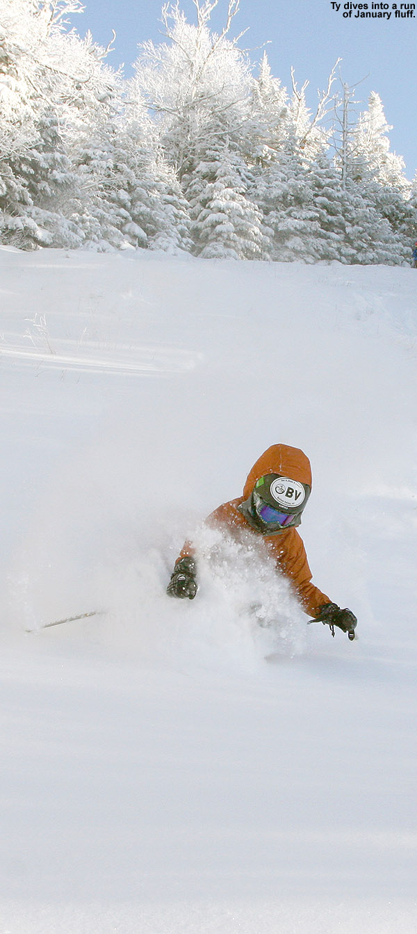
Our most recent winter storm dropped notably drier powder on top of the existing base of snowpack, so it made for great turns and the best powder skiing of the season so far!
The clipper system affecting the area yesterday into today dropped another round of snow in the mountains and we even saw snow transiently accumulating in some of the lower valleys. This system was similar to the last one that affected the area on Friday into Saturday, but temperatures seemed to be a bit colder on the back side this time around. This morning when I checked the view on Bolton Valley’s Base Lodge Webcam, the accumulations appeared to be a bit more robust than last time around. Seeing that, I knew there would be plenty of snow for using skins right from the base, so I geared up for a ski tour and headed to the mountain.
While the snow line was still fairly high with this system, the local ~2,000’ peaks around us in the Winooski Valley were coated with white for their top ~300’ of vertical, so that suggested that the snow level had dipped just a bit lower than what we’d seen over the weekend. Heading up the Bolton Valley Access Road, I saw the first traces of snow around 1,200’ just like Saturday, but Timberline showed a decent covering down to its 1,500’ base, and up in the Village at 2,000’ I found 3-6” of snow, which was more than what had accumulated Saturday morning.
Today featured very wintry scenes in the Bolton Valley Village
Temperatures were cooler today than they were on Saturday, and even at 2,000’ the temperatures were easily below freezing. The cooler temperatures meant that the powder was of much higher quality than what we had over the weekend, and with some base snow already in place, the quality of the powder skiing took a big leap forward from where it had been. Compared to what was available on Saturday, today was simply easy breezy midwinter-style powder skiing. All you had to do was lean in and carve.
When checking snow depths today, I couldn’t really differentiate the new snow from the old snow that was already present from the last system, but the updated elevation-based snow profile is below. In the list, the first depth values are what I found on Saturday, and the second depth values are what I observed today.
With every one of these storms that passes through and drops snow, the potential increases for this to be the start of the winter snowpack. If we continue with typical November temperatures, I wouldn’t expect the higher elevation snow to melt too quickly, so we’ll just have to see if there are any warm spells or big rainy systems in the future that might be able to put a dent in the snowpack.
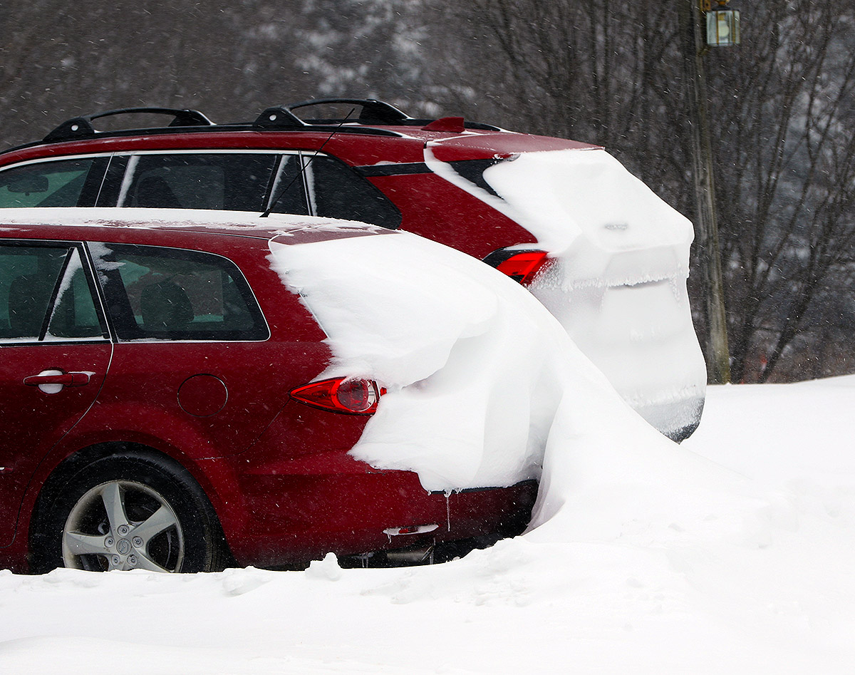
Fresh November snow adorns a car protected by a car cover in one of the Bolton Valley Village parking lots.
Snow just continues to fall, drift, settle, accumulate and get everywhere in the Bolton Valley Village as we head into February.
I headed up for some touring at Bolton Valley this morning to check out the overnight snows, and after being somewhat unimpressed with the way the powder skied on Saturday after those fresh accumulations, I was eager to see how this event affected the skiing. I’m happy to say that Sunday night’s snow led to fantastic powder skiing right from the start. The resort was indicating 4 to 6 inches of fresh snow, and that seems right in line with what I found for new accumulations on terrain that had been groomed before the storm. Liquid analyses from down at our house in the valley indicated that the overnight snow was in the 6 to 7% H2O range, so while it wasn’t super dry, it seemed dry enough to sit atop the existing snowpack and blend well with the powder to create a right-side-up gradient. Just as important in the quality of the powder skiing may have been the temperatures – unlike the single digits from Saturday or even the teens from Sunday, temperatures were in the 20s F. It had been a while since I skied in temperatures that warm, and you could definitely feel the effects of the faster, warmer snow. My skis had plenty of glide, and the powder turns immediately gave that “floating-on-a-cloud” feeling while descending in the Snow Hole area. Another enjoyable aspect of the temperatures was simply the comfort of the relative warmth. I guess it’s really only been a couple of weeks, but after a lot of cold days, I’d forgotten how enjoyable temperatures in the 20s F can be – you can ski, hang out, and do whatever, and it’s all so easy.
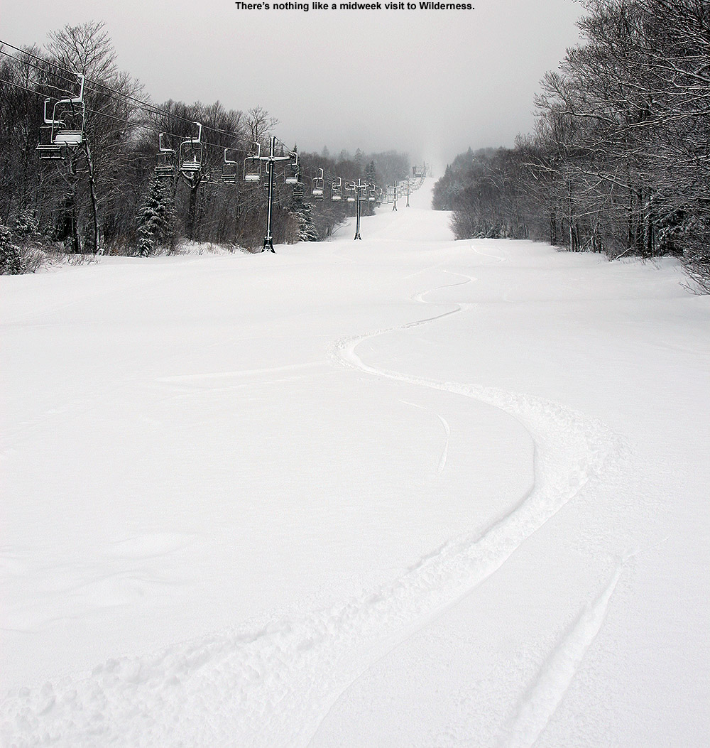
I toured via the Wilderness Uphill Route, and what made the session especially good was that there was so much more untracked powder than I’d expected. The Wilderness Chair still wasn’t running, so I assume it has to be down for mechanical reasons while they repair it, and having just the minimal midweek ski touring traffic on all those acres is certainly going to leave a lot of untouched snow to spare. The resort was getting pounded with upslope snow today on top of the denser snow that fell overnight, so hopefully that’s a recipe to set up many more days of quality powder skiing in the coming days.
Skier traffic has been reasonably light, so there’s still plenty of terrain to track up at Bolton Valley as of today.
It’s been a busy week, so I haven’t been able to get up to the mountain to check out the recent rounds of snow, but I was able to head out for some ski touring this morning. Bolton Valley was reporting 16 inches of additional snow in the past week, and while that’s probably about an average snowfall pace for the resort, the flow of moderate events that we’ve been seeing simply keeps piling on the snow. And, temperatures have been consistently wintry, so all that new snow is just encountering the usual slow midwinter consolidation.
Heading up the Bolton Valley Access Road, it was nice to see that all the recent snow seemed to be having an effect on the coverage at Timberline. The scoured areas on the lower elevation trails down by the Timberline Base were looking much better – I really had to search hard to see any areas with poor coverage as I drove by. Up at the main base area elevations in the 2,000’ to 3,000’ range, the effects of the continuing snowfall are even more pronounced. In many spots, the accumulations are taking on that deep midwinter look, with layers upon layers of snow visible on elevated surfaces from the numerous storms we’ve had over the past couple of months. Some evergreens have deep stacks of snow on them, and the ones that don’t are either in a windy location where the snow doesn’t build, or the stack just finally crashed to the ground due to its weight.
Many evergreens are virtually disappearing into the landscape now as they become encased on snow.
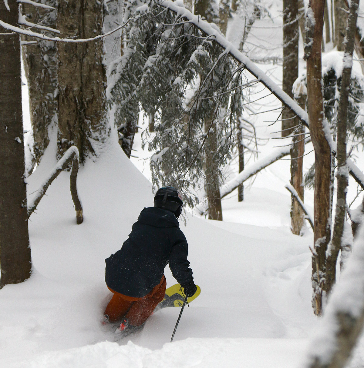
I toured in the Wilderness area, ascending via the Wilderness Uphill Route and descending via a combination of glades in the Snow Hole area before reconnecting with Lower Turnpike. I couldn’t believe my eyes with respect to how little skier traffic there had been on Wilderness. Eventually I remembered that the Wilderness Chair doesn’t run on Wednesdays and Thursdays during non-holiday periods, which explained why there were hardly any tracks around on a Friday morning before the lift was running. Anyway, that meant that untracked powder was everywhere, and the quality of that powder continues to be top notch. It’s settling naturally and setting up a beautiful right-side-up gradient of bottomless snow that ranges anywhere from 1 to 3 feet deep. There is a subsurface down there, but it’s getting buried deeper and deeper with each passing storm. There’s no need for debate with the depths and quality of the powder that are out there right now – if you’re going to be touring and hitting mostly untracked snow, just bring your fattest skis; they are the right tool for the job.
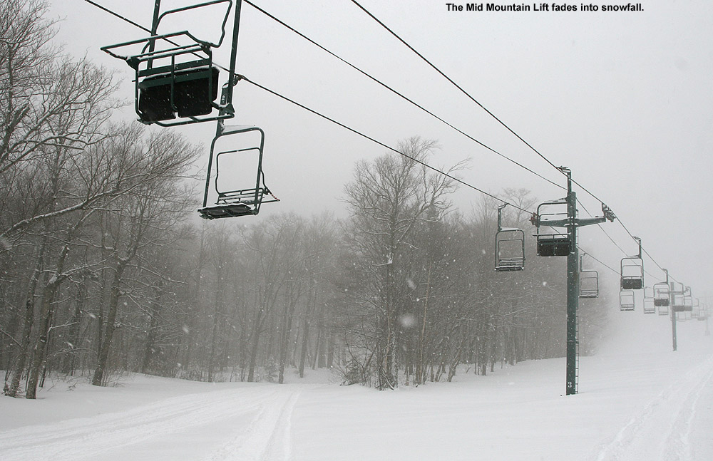
Areas protected from the wind continue to offer great powder turns as our second long-duration winter storm this month dops more snow in the local mountains.
I had time to head up to Bolton Valley for another ski tour this morning, and the weather was very much like what we’d had in the mountains for the past few days: temperatures in the single digits F with a lot of wind. Thankfully, yesterday appeared to be the coldest of the days this week, and the temperatures this morning were about 5 to 10 degrees F warmer.
Yesterday I’d done a bit of lift-served skiing after my tour, but today I decided to make my tour a bit longer instead of sitting on the lifts. On my ascent I topped out around 2,900’ on Wilderness, and I figured I’d gone high enough to get a good sampling of the snow at various elevations.
With a few more inches of snow each day, the conditions on the slopes have just continued to improve aside from those areas exposed to the wind where scouring has been incessant. Exposed areas just continued to be scoured, and I wouldn’t be surprised if some of those exposed spots had less snow than they did before this system began. Protected areas had simply fantastic snow though. Like yesterday, I typically measured 20 inches or more of powder in protected areas today, and the subsurface snow is a distant memory there. I also measured depths as great as 35 inches in some non-drifted spots, where it seemed like I was just pushing down into the older layers in the snowpack without even hitting any firm layer to differentiate the snows from these recent couple of systems. That’s a good sign about the overall quality of the snowpack though if you can’t even find a subsurface layer until you head down 35 inches into the snow.
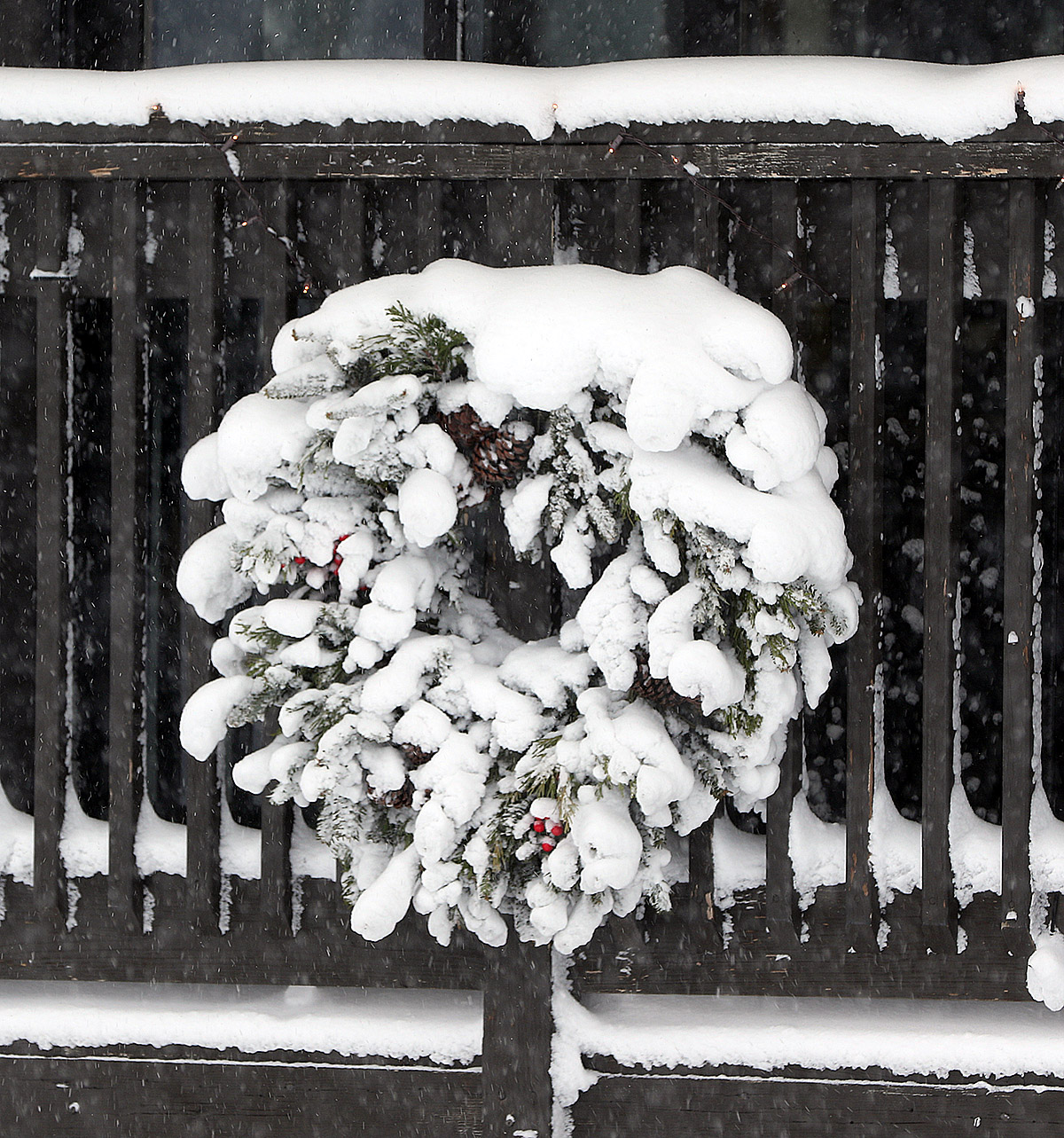
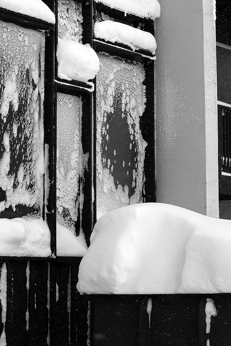
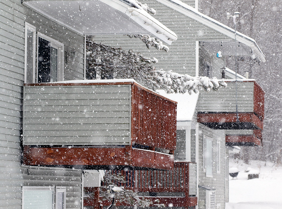
Throughout the Village, snow has been accumulating in various ways on all sorts of surfaces due to the continued wind and snow from our ongoing long-duration winter storm.
With the end of this most recent long-duration system, it looks like we could be moving into a pattern featuring some Clipper systems. The first one is coming into the area tomorrow, with another expected for Monday into Tuesday.
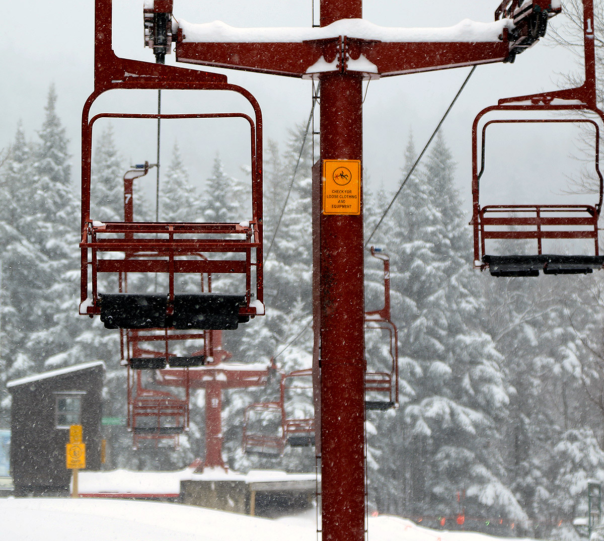
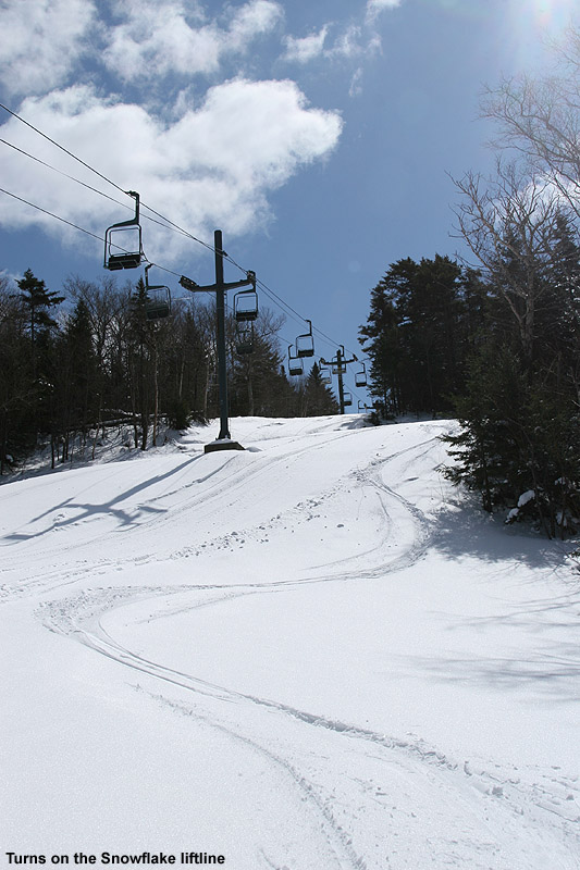
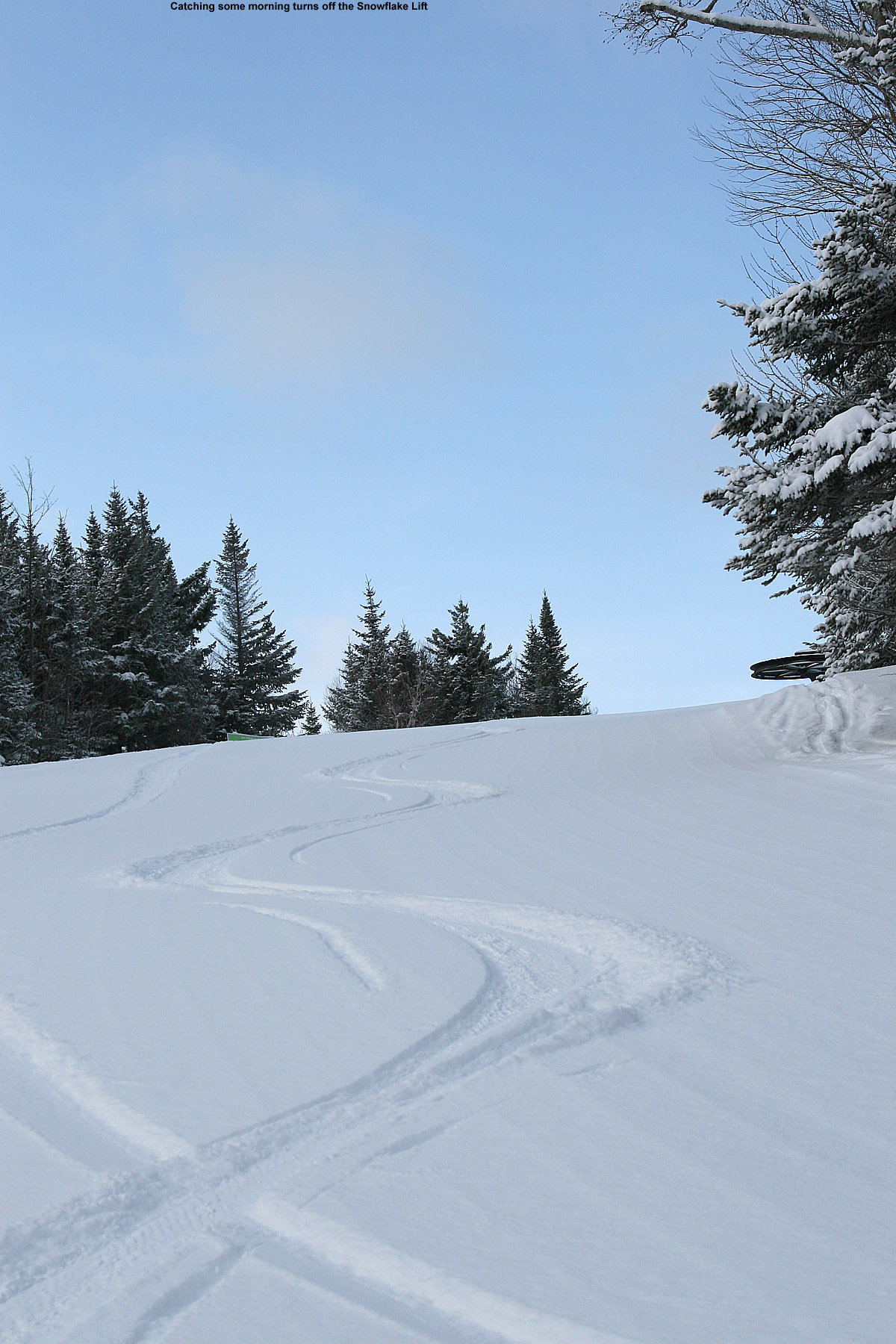
A view from near the Bolton Valley Snowflake Lift summit station amidst today’s snowfall
It was a cold one out there today; indeed, it was really a good day to just enjoy lots of indoor activities. But we did just have another storm push through the region, and the conditions on the slopes are good and keep getting better, so I still wanted to get out to see what the new snow was like and get some exercise.
Bolton’s Wilderness Chair was set to open at 10:00 A.M. again, and with the cold temperatures I definitely wanted to warm up with some touring. So, I decided to go with a session like the one on Thursday, which I kicked off with some touring before moving to lift-served turns. When I arrived midmorning in the Bolton Valley Village, it was 7 F according to the car thermometer, and single digits F is definitely midwinter cold. There wasn’t much for wind in the parking area at that moment, so I was encouraged by that while gearing up.
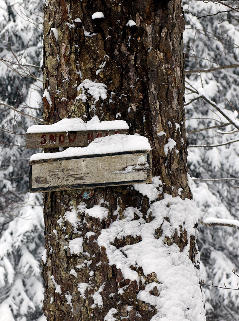
Catching sight of an old Snow Hole trail sign covered with snow along the Wilderness Uphill Route during today’s ski tour ascent
Ascending via the Wilderness Uphill Route was quite comfortable, since it’s well out of any wind, and I was generating plenty of heat. I stopped my tour at 2,500’, enjoyed a run through the powder along the edges of Lower Turnpike, and then hopped on the Wilderness Chair for a ride. My body was warmed up for the touring and Telemark turns, and the wind was happily at my back while I was on the lift, but I could tell it was pretty brutal up there at the Wilderness Summit above 3,000’. The calm conditions from below were gone, and the biting winds along the ridgelines made their presence known. After that trip, I didn’t have much interest in heading up to check out the Vista Summit, so I just stayed low and enjoyed a run off the Snowflake Chair. The warm-up touring definitely helped me stay comfortably warm for a couple of lift rides at least before I headed home.
Powder depths have obviously been bolstered by this most recent system, and conditions are good, but certainly nothing stratospheric for the Northern Greens. One factor in that assessment is that this latest storm was nice, but the snow was quite dry, and it was less of a resurfacing than the previous storm. We picked up about 0.20” of liquid equivalent from this system compared to 0.40” of liquid equivalent from the previous one, so scale those up a bit according for Bolton’s elevation and it gives you a sense for their contributions to resurfacing. The resort is opening more terrain all the time, but lift-served natural snow terrain could still use another solid resurfacing storm with an inch or two of liquid equivalent to take care of the tougher areas. Overall, the natural snow terrain that’s open is quite skiable with good coverage and quality surfaces, and there’s a decent, consolidated base above 2,000’, but you still need to pick and choose your lines somewhat in those spots exposed to wind that get scoured.
The resort was indicating 3-6” of new snow in their early morning report, and I can’t separate out accumulations from this storm specifically, but the changes in surface snow depths between Thursday and today give a sense of the contributions from this most recent event at various elevations. Thursday’s surface snow depths are on the left, and the approximate depths I observed today are on the right in bold:
So, there’s a lot of nice, fairly deep powder above 2,000’, and it’s right-side-up and skiing great thanks to this latest storm’s snow being dry. My observations from down at the house have been giving me snow densities in the 2 to 6% H2O range throughout this latest storm, so indeed it’s some quality powder. The back side of this system has actually been aided by some direct lake-effect off Lake Champlain. The bands were mostly oriented to affect the Champlain Valley earlier in the morning, but as midday approached, the bands shifted such that they were more directly hitting the mountains. That definitely helped keep it extra snowy throughout the day and boost accumulations.
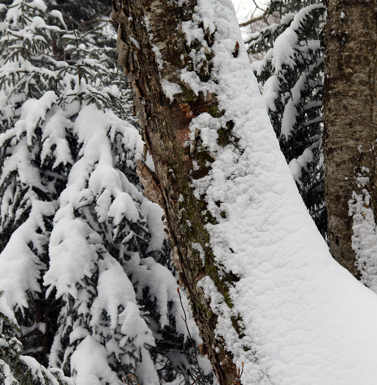
Enjoying some of the snowy trees in the Wilderness glades on my ski tour this morning at Bolton Valley
Tomorrow is supposed to be even a bit colder than today, so if I head out it will just be for a tour vs. riding any lifts. After the warming and consolidation earlier this week, it looks like Timberline is probably getting in shape to support some good touring and powder skiing again, so I may stay low and tour there if a ski session comes together. We’ll see how much additional snow the resort is reporting in the morning, but since we were getting hit at our place by those lake effect bands right into the evening today, Bolton should have been getting even more of that snow. The models suggest we’ve got another couple of clippers affecting the area over the next few days, with warmer temperatures as well, so that’s looking nice moving into the holiday week.
The mountains made out great from our most recent system and offered some nice powder for those getting out to the slopes.
Per the discussion in the NNE Winter Thread at American Weather Forums last night, our most recent winter storm system started up yesterday afternoon. Snow levels were up above 1,000’ to start, but they gradually came down in elevation, and the valleys were reporting a mix of rain and snow in the evening. By 7:00 P.M. we started getting initial slushy accumulations on elevated surfaces down here at the 500-foot elevation, and it took a bit more time for the temperatures to drop below freezing, but within a couple of hours they’d fallen enough that the accumulations really started to take hold. Although we only had an inch or two of snow accumulation in total here at our site, we picked up 0.40 inches of liquid equivalent from the system, so the snow for the local mountains probably had at least a half inch of liquid in it. That’s definitely enough to get into the realm of a modest resurfacing.
When I saw Bolton Valley’s initial early morning report of 3 to 4 inches of snow, I decided that mid-fats were the practical play for today’s skis. Dylan had the day off from work, and I’d planned to get him up if the morning snowfall numbers were substantial enough, but 3-4” was modest enough that I decided to let him sleep in and I headed up by myself to sample what the storm had brought us. Heading up the Bolton Valley Access Road, the elevation dependence of the snowfall was stark: I had ascended above 1,000’ before there was really more than a trace of new accumulation in that area. And even after that, accumulations were slow to increase; it wasn’t until I hit the Bolton Valley Village at 2,000’ that I really felt the accumulation were substantial enough that they were going to make a big impact on the skiing.
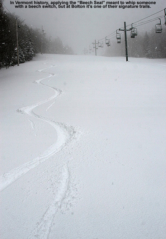
I did find 3 to 4 inches of new snow at 2,000’ when I did some checks around the Village, so that was encouraging – if the main base had that much new accumulation at that point, it was likely going to be more in the higher elevations. The Wilderness Double Chair was scheduled to start running at 10:00 A.M., so my plan was to kick off the day’s ski session with some touring before Wilderness lift access was available. I ascended up to ~2,700’ to one of my usual transition points by the time lift-service was underway, so my initial descent was from there. My descent was via a combination of Cougar and Lower Turnpike, and the powder turns were excellent. On low-angle terrain, the new snow was substantial enough that it easily provided 100% bottomless powder turns, and on medium-angle terrain I’d say it was in the range of ~80% bottomless turns. The new snow was medium weight powder in probably the 8% H2O range, and just dry enough that you could keep moving fine on even low-angle terrain.
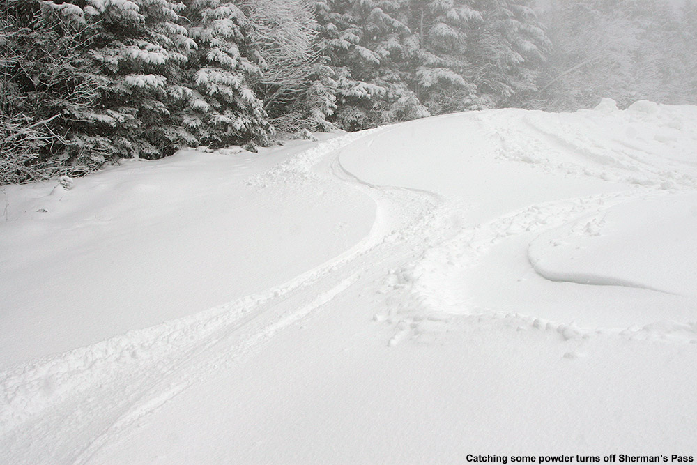
When I’d descended to the base of the Wilderness Chair it was one wind hold, and they suspected it would be about 30 minutes before it would be back up, so I checked out the other lift offerings. The Snowflake Chair provided some great turns with a few inches of powder over a groomed base on Sprig O’ Pine, and off the Mid Mountain Chair, Beech Seal had excellent natural accumulations that had resurfaced even the manmade snow on the skier’s left to a good degree. Off the Vista Quad Chair, Sherman’s Pass is finally open, so I used it to make my way back over toward the Wilderness terrain, which delivered great natural snow turns as usual. Riding the Vista Quad, I found that the winds were howling above 3,000’, and temperatures were dropping well into the 20s F. It was getting bitter up there.
In terms of snowfall and accumulations, there was at least light to moderate snowfall during my entire ski session, and it was pounding 1-2”/hour snowfall for a while just as I was starting the initial ascent of my ski tour. With continued snowfall and rates like that, it wasn’t surprising that accumulations had jumped up a bit from the initial morning report. Here’s the approximate snow accumulations profile I found from this event as of about midday when I was leaving the mountain:
Heavy snowfall in the 1 to 2-inch per hour range hit the resort today just as I was beginning my ski tour to kick off the day’s ski session.
It was really windy up at the Vista Summit, and I couldn’t get access to the usual protected spots I like to use to gauge depth, so what I’ve put down is my best estimate. Overall though, isolating depths for the snow from this most recent storm was relatively easy because we had some warmth earlier this week that consolidated the top of the snowpack. Like with the last storm though, it’s not a rock-hard subsurface – it’s a spongy interface and the new snow has bonded well to it, so that’s great for the skiing. For the elevations below 1,500’, those depths reported above are actually more than what was there when I initially ascended the access road in the morning, because the heavy snowfall during the morning had added accumulations there that hadn’t been present earlier. I was surprised that the base of Timberline at 1,500’ only had an inch or two of new snow, so even being where the precipitation fell as all snow wasn’t quite enough to get solid accumulations that would dramatically affect the resurfacing of the slopes; you really needed another 500 feet or so to get into the best stuff.
The continued snowfall today was definitely having an effect though, as evidenced by some of the midday updates to the Bolton Valley Snow Report:
10:30am Update: How’s about a couple of rope drops? Glades, Swing, Fanny and more have joined the ranks since we opened this morning, and the snow is still coming down.
12:15pm Update: The ropes keep dropping – we’re adding Bolton Outlaw, Peggy Dow’s, Cougar, Old Turnpike, and Lower crossover to the mix!
This storm was a great way to kick the conditions up some notches as we head toward Christmas, and with a couple more clippers on the way in the coming days plus cold temperatures for the foreseeable future, it looks like conditions will be improving throughout the coming week.


