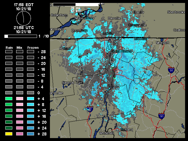
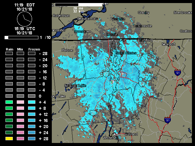
A weather radar image from midday on Sunday showing the continuous push of moisture from the northwest hitting the Northern Green Mountains and giving us continuous light snowfall.
“…once the snow showers got started in the morning, they literally kept going all day with that classic upslope flow from the northwest..”
This event was the second accumulating one at our house this month, and the fourth one for the mountains. Looking ahead, there seems to be some potential for snow in the midweek timeframe, and then again out toward the weekend.
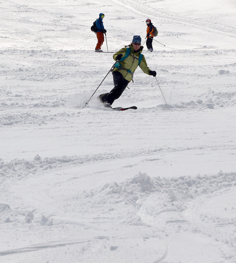
“The data suggest that our first snow of the 2018-2019 winter season from this past Saturday (October 13th) is a few days on the late side of the mean for first accumulating snow (October 10th), but overall quite typical.”
There are a couple of seasons that I couldn’t include in the statistical analysis because of gaps in the data collection early in the co-op site’s history, but there were still 62 seasons in the data set that provided useful information. The data suggest that our first snow of the 2018-2019 winter season from this past Saturday (October 13th) is a few days on the late side of the mean for first accumulating snow (October 10th), but overall quite typical. The full results from the statistical analysis are below, so have a look and think snow!
“…it looks like we’ll have more opportunities for snow this week with accumulations potentially even down to the mountain valleys.”
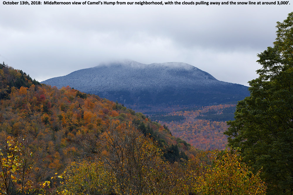
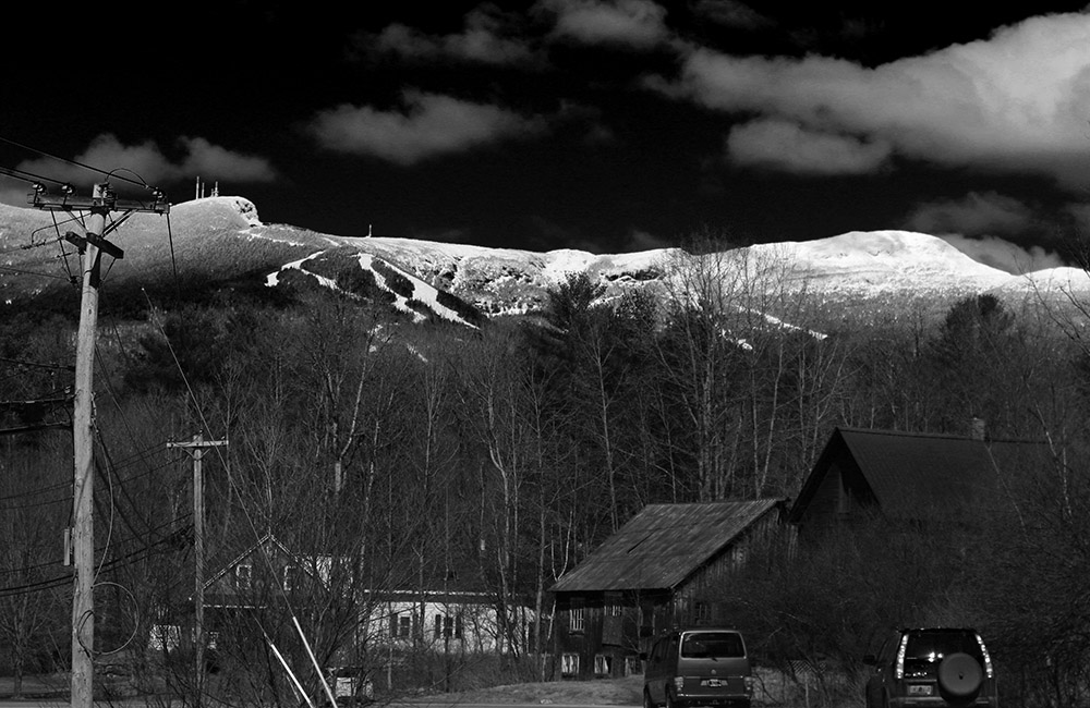
Here at our house, I did a morning check to find that the cloud ceiling was still only about 2,000 feet and there were no obvious signs of snow below that level. I gave the clouds some time to think about clearing a bit, and then headed out in the neighborhood during the mid-afternoon period to see what snow might be visible. Indeed the cloud ceiling had risen by about another 2,000’ and I was able to catch Camel’s Hump as the clouds had just about broken away. The snow line at that point looked to be around 3,000’.
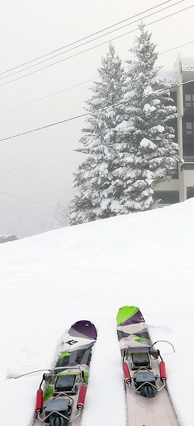
I had initially contemplated heading to Stowe for some turns in the morning, thinking the terrain above 3,000’ would really be needed to get into some good snow, but those low snow levels on the western slopes definitely had me thinking about Bolton Valley as good option. The overnight didn’t seem to bring about any substantial changes, so I stuck with that plan and headed to Bolton for a ski tour this morning.
“I could tell right away as I began my descent that the density and consistency of the snow called for steep terrain, so I dove right down Spillway and that really hit the spot.”
Low clouds were obscuring the mountains by our house, but it seemed like the snow line this morning was down around 1,000’. On my drive, the first signs of fresh snow accumulations were indeed right around the 1,000’ elevation on the Bolton Valley Access Road, and then the world just got whiter and whiter as I headed up.
I started my ski tour at the Bolton Valley Village, which is a bit above 2,000’, so with the way this storm accumulated that meant decent coverage from there on up to the summits. At the base elevations this morning the temperature was just edging above freezing in the 7:30 -8:00 A.M. timeframe, and the snow was definitely dense. The fresh snow was wet, but not slushy or sopping at that point. It was gradually falling of the trees on my ascent as the temperatures rose. I headed up into cooler temperatures, but it was still warming all the way to the summit and I bet temperatures in the mid-30s F tracked with me as I ascended.
Bolton Valley Village today
Here’s a summary of the accumulations I found this morning for various elevations:
The larger range I’m reporting at the 2,000’ level was simply because I had time to get a sense for accumulations atop the different surfaces, with the low end being on paved or gravel surfaces, and the high end being on the existing snowpack, elevated surfaces, etc.
In terms of what was out there on the trails for new snow, the numbers above show that there really wasn’t a huge bump in accumulations above 2,000’, so I’d say those elevations did fairly well in terms of maximizing whatever snow they were going to get out of the available moisture. We had ~¾” of liquid in the rain gauge at the house this morning, so presumably the mountains are somewhere north of that.
“Even with 115 mm fat skis I was still touching the subsurface at times, but this snow was definitely dense enough to hold up pretty well on steep, aggressive turns.”
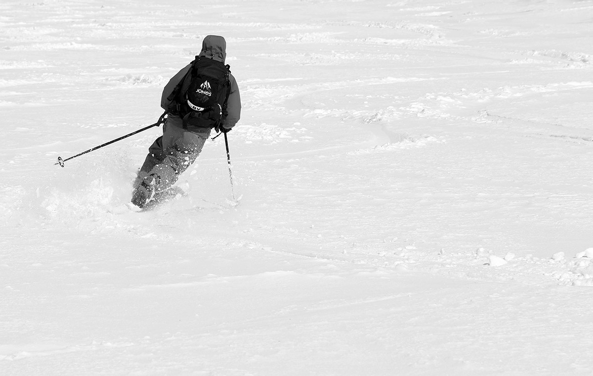
Although it can’t compare to the drier snow we had with last weekend’s storm, the turns were actually pretty sweet today. I could tell right away as I began my descent that the density and consistency of the snow called for steep terrain, so I dove right down Spillway and that really hit the spot. Even with 115 mm fat skis I was still touching the subsurface at times, but this snow was definitely dense enough to hold up pretty well on steep, aggressive turns. I stuck with Beech Seal on the lower half of the mountain, and the pitch there was also quite sufficient for a lot of good turns.
Starting off the descent with some powder turns on Spillway Lane
Today was the last day of April, but it’s certainly been a decent one for snow. It’s time to move on to May and see what it delivers for turns!
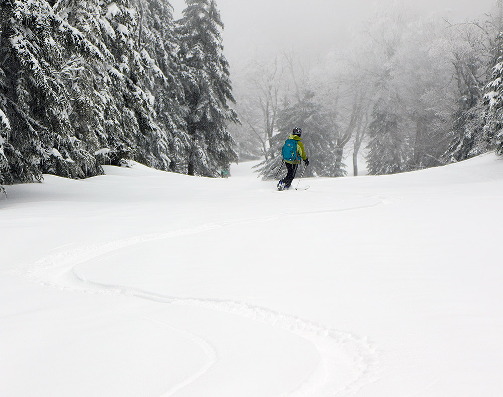
Today we were able to get out into some of the powder from our recent upslope snowstorm on the slopes of Mt. Mansfield, topped off with a convenient stay right at the Stowe Mountain Lodge.
Since school was out of session due to vacation week, E’s been thinking about some sort of getaway for the family. Quebec City and Maine came up as possible destinations, but with the Green Mountains having just reeled in some great powder due to our recent upslope event, doing something more local seemed like an obvious choice. That decision was heavily reinforced after E and I skied some great powder at Bolton Valley yesterday, and after weighing a number of options we ultimately decided to head to Stowe for some earned turns and a stay at the Stowe Mountain Lodge. They’ve got some fantastic amenities, and the rates this time of year are great because they’re in between the winter and summer seasons.
The fresh snow on Mt. Mansfield was astonishingly white today in the late April sunshine.
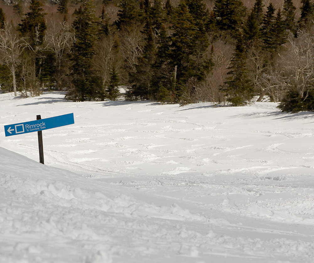
We kicked things off this morning with a start at the Midway Lot, which had dozens of vehicles in it from folks with similar ideas. It was approaching mid-morning when we arrived, so I was surprised at how many people were heading right up Gondolier in the sun. With that morning sun and warming temperatures, I was leery of how well the winter snow would hold on the Gondola side. E and the boys and I opted to head toward Nosedive, which generally has much more protected snow when sun and warmth are a concern. The Nosedive area had certainly seen some skier and rider traffic already, and there was a nice double skin track in place that made for easy conversation and passing options during the ascent. Ty was feeling really good on the climb and cruised ahead of the rest of us, eventually waiting for us up around the 3,000’ mark. We joined up and topped out at the 3,300’ plateau just below the Nosedive switchbacks.
Nosedive today
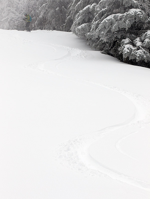
We stopped below the switchbacks because the snow quality was good, and the narrow width of the trail above that elevation meant that the snow was pretty much tracked out. The consistency of the snow had definitely changed substantially over the course of the ascent. At base elevations it was already getting rather wet with the rising temperatures, and by the time we finished our ascent it was fairly dry, dense powder. There wasn’t any sharp transition zone for the snow consistency, it had just changed ever so gradually with each step we’d ascended.
“The broad upper slopes of Nosedive definitely held the best snow we found today. The powder was dense, but dry, and there were plenty of areas of untracked snow to crank out some nice turns.”
The broad upper slopes of Nosedive definitely held the best snow we found today. The powder was dense, but dry, and there were plenty of areas of untracked snow to crank out some nice turns. The whole descent was definitely fun, although the last few hundred vertical feet, where we’d actually switched over to Lower National to get to some snow that had seen less traffic, held snow that had gotten pretty wet in the warming temperatures. The best snow could be found on the shady side of the trails, and I even jumped into the trees in several spots on the lower half of the run and found some excellent turns.
E and the boys out in some of the fresh snow on Nosedive today
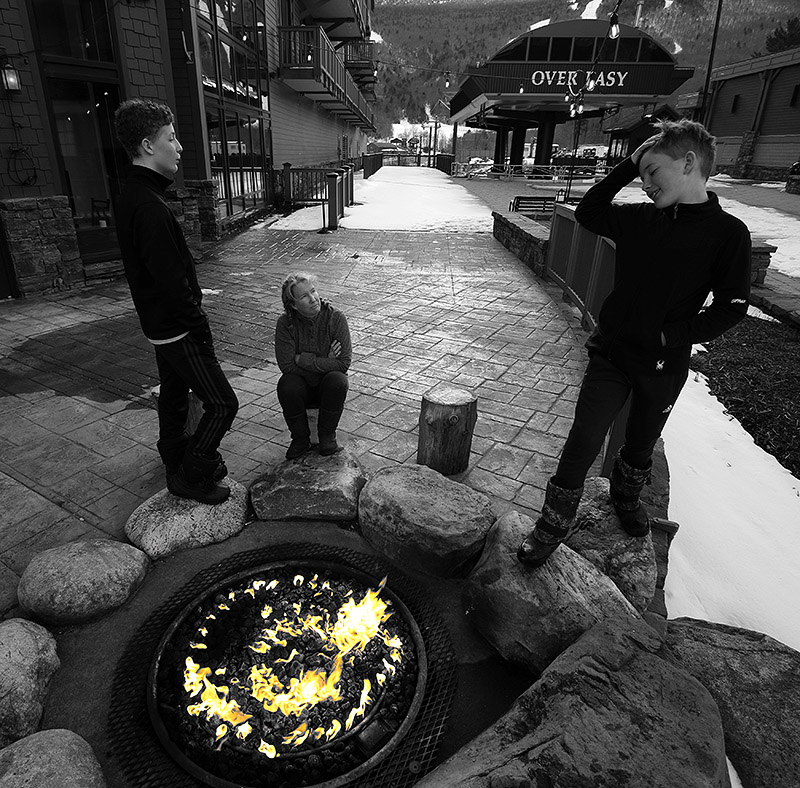
When the skiing was done, we checked in at the Stowe Mountain Lodge and had some appetizers at the Hourglass Lounge. E and the boys did some swimming, and we had dinner at Solstice, which was a real treat. They were taking part in Vermont Restaurant Week, and my first course was an amazing smoky tomato soup. The boys and I headed out later in the evening for some night swimming, which was definitely a bit thrilling in the chill of a cold clear evening. Naturally we spent a good amount of time in one of the hot tubs, although the pool was also a nice temperature for cooling back down a bit after that heat.
I think everyone would be up for doing a similar trip again in the future, especially if we can order up some of these late season April snowstorms atop such a deep snowpack!
Our latest April storm brought another heaping helping of midwinter powder to the slopes of Bolton Valley.
April temperatures have been running several degrees below average here in Northern Vermont, and for those awaiting warmth, the winter weather must feel simply interminable. Some of us don’t have a whisper of complaint though, since we know when we’ve got a good thing going. While average April temperatures around here can bring snow, below average temperatures typically bring more snow, drier snow, and preserve the snowpack. With the approach of the current storm, the National Weather Service in Burlington was already talking about the potential for the snowpack at the Mt. Mansfield Stake to get back up to 100 inches, and as of this evening’s co-op report, indeed it’s there. The snowpack is essentially wall-to-wall everywhere in the local mountains here, so topping that off with fresh powder is a recipe for some awesome skiing and riding.
“Well let’s just say, the turns were fantastic – we had medium to moderately dense midwinter powder covering everything, temperatures near 30 F, and an almost fully untracked resort to ski.”
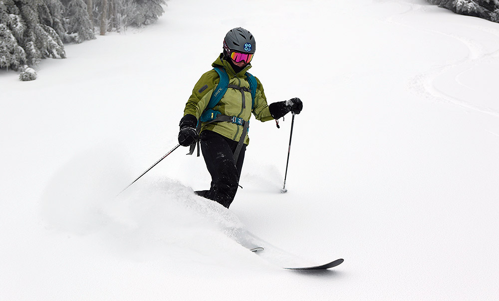
It’s spring vacation week for E and the boys, so E was able to join me this morning for a tour in the new snow up at Bolton Valley. We’ve had substantial accumulations of snow all the way to the valley floors with this latest storm, so I knew the potential was there for some dry, winter-style snow up at elevation. We headed out this morning amidst light snow at the house, and arrived in the Bolton Valley Village to steady snow and temperatures in the upper 20s F. A quick check on the new snow in the parking lot around 2,000’ revealed accumulations of 5 to 6 inches.
We started skinning right from the car up the Lower Turnpike ascent route, and found a decent skin track in place with just a couple inches of additional snow in it. We eventually worked our way over toward Vista and the depth of the new snow continued to steadily increase with elevation. By the time we topped out above 3,000’ on Alta Vista, my depth checks on the powder were revealing 10 to 11 inches. We de-skinned by the trees out of the wind, and E was pretty slick with her ski-on skin removal.
Looking up Alta Vista with a fresh blanket of whiteE throwing around some of today’s powder at Bolton Valley.
On the entire ascent the snow quality was looking really good, but you never quite know how things are going to ski until you drop. Well let’s just say, the turns were fantastic – we had medium to moderately dense midwinter powder covering everything, temperatures near 30 F, and an almost fully untracked resort to ski. Wind effects were pretty minimal on much of the mountain so it really was a dense, velvety resurfacing that skied like a dream. It’s definitely a good time to get out there and enjoy those uncrowded slopes with all this new snow.
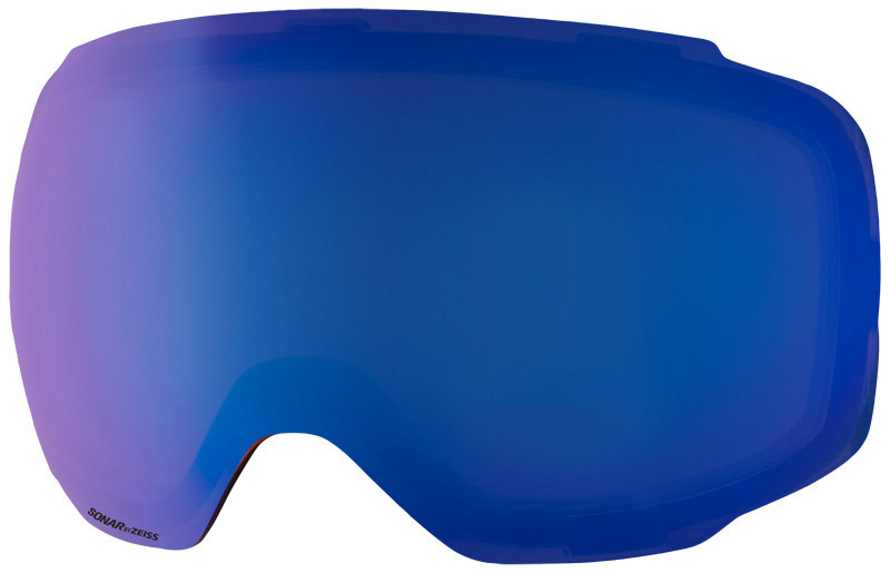
With the continuing snowfall during today’s tour, I went with our Sonar Blue lenses for my Anon M2 Goggles. They’ve got 46% visible light transmission and are recommended for graybird days and tree skiing, but they were definitely a good fit for today even with snowfall since we’re talking late-April light.
In an update from this afternoon, eyewall noted that he encountered about 7 inches of new snow at the Bolton Valley Village elevation, so it sounds like they’d picked up another inch or two with the additional snow since E and I had left. That would put accumulations near the summits around a foot, so it’s definitely been a nice April event for the mountains around here.
Enjoying the snowy April views from the valley – cool temperatures have brought snow accumulations all the way to the valley bottoms with this latest storm.
Powder turns today during explorations in the lower elevations of the Woodward Mountain Trail
Wind chills were forecast to approach -30 F today on the upper elevations of Mt. Mansfield at Stowe Mountain Resort, so E did a “soft cancel” of our BJAMS ski program. The program was still on, and families could go if they wanted to, but no coaches were required to go, and students wouldn’t have to deal with those potentially frigid temperatures.
Although I was glad to not have to battle the nasty wind chills up in the higher elevations, it was still a gorgeous late-winter day out there, so I thought about heading out for a ski tour on something local, relatively low elevation, and sheltered from the wind. Eventually, an exploration of the lower elevations of the Woodward Mountain Trail came to mind. The base of the trail is just a couple miles from our house in Waterbury, and with the healthy snowpack that extends all the way to the bottom of the local mountain valleys, the ski conditions there should be outstanding.
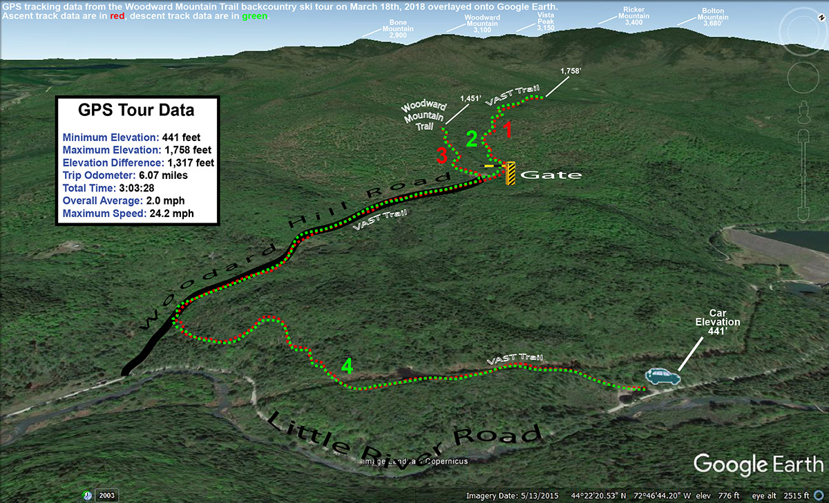
The Woodward Mountain Trail is quite a route, running six miles and dropping over 2,500 vertical feet in elevation. The traditional way to ski the trail is to spot a car at the VAST parking area (450’) at the bottom on Little River Road near the Waterbury Reservoir, then drive up to Bolton Valley Resort and use the Vista Quad to get to the top of Vista Peak (3,150’). From there, you ski southward along the ridge between Vista Peak and Woodward Mountain, before descending eastward off the flanks of Woodward Mountain itself down to Little River Road in the Waterbury Reservoir and Little River State Park area. I’ve skied the upper elevations of the trail before, but I’ve heard route finding for the ending (and middle for that matter) portions of the trail can get a bit tricky. At some point it would be great to get family and friends together for a full run of the trail, so my goal with today’s outing was to orient myself to the twists and turns at the bottom of the trail to hopefully make that experience a bit more efficient. And with the great snowpack and plenty of powder out there, I hoped to get in some good turns in the process.
“…my goal with today’s outing was to orient myself to the twists and turns at the bottom of the trail to hopefully make that experience a bit more efficient.”
I used my copy of David Goodman’s classing backcountry guidebook “Backcountry Skiing Adventures: Vermont and New York” to get myself oriented with respect to the lower regions of the route. His book has a nice description of where to park, as well as a topographic map with the route outlined. The guide is excellent, with just one problem in my case – the guide is built for following the trail down, so it’s not perfect for guiding you up from the base of the trail if you want to try that approach. In any event, with the map from the guidebook and my GPS in hand, I knew I’d be able to orient myself reasonably well to what the bottom of the trail held in store, and I’d always be able to come back again if necessary on a future trip with my own first experience in hand.
Temperatures were probably around 20 F when I parked at the VAST lot on the west side of Little River Road. There were a few cars there, most with snowmobile trailers of course, although one car looked like it might be backcountry skiers waiting to pick someone up. Starting from the parking lot, you’re immediately on the VAST trail, and it climbs a steep pitch before leveling out and going through some fields along the power line leading up to the dam. It was easy to see from the map in the guidebook that this part of the trail is a bit circuitous – you’re doing a big loop that doesn’t immediately bring you toward the rest of the Woodward Mountain Trail. This is due to the layout of the VAST trails, but with the topography of the ridges, valleys and streams down there, you’d probably just waste a ton of time trying to break trail through the snow if you wanted to follow more direct route from the parking area anyway. It’s hard to put a price on having a packed, well-marked trail to get you through the backcountry, even if the route is a bit indirect. The energy-saving and route-finding efficiency of having an established packed trail are simply huge. I was a bit dismayed to find that there was one fairly substantial downhill section (which of course means uphill on the way out) on the route in. I’m talking about a substantial enough slope that you’re likely going to have to take off your skis and walk, or put your skins on to deal with it.
After 0.9 miles on the well-packed VAST trail, I came to a T junction. The trail I was intersecting was part of the VAST system, but it was also a road, Woodard Hill Road. It had actually been groomed (and apparently even plowed) down in that area, so the snow cover was a bit thin in spots. I headed upward and to the right on Woodard Hill Road, which was the obvious route to take based on the guidebook map. I passed a couple of hunting camps on the left, and eventually at 1.75 miles into the route I came to a gate that seems to be the one indicated on David Goodman’s route. This is where the utility of the map in his guidebook broke down a bit for the ascent. His route appears to be shown passing through the gate, but it’s also shown staying to the south of the main drainage in that area. If you go through that gate, you’re crossing a bridge to the northerly side of that drainage, so those two pieces of information don’t line up. On the south side of the drainage there is a clearing that had seen some snowmobile activity, but I didn’t see any obvious ski tracks coming down from there to suggest it was near the Woodward Mountain Trail.
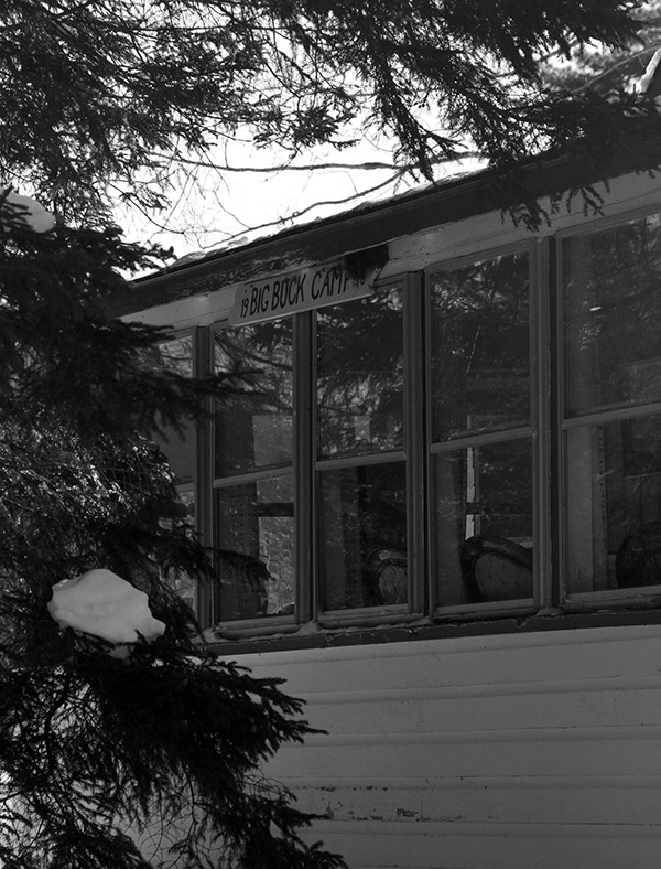
One of the hunting camps seen during my ski tour along Woodard Hill Road
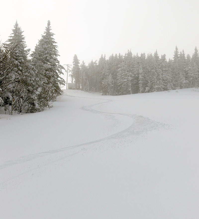
I decided to play it safe on my first look and simply follow the VAST trail through the gate to see if any obvious trails branched off from it. The “safe” aspect of this choice was that I could continue to follow a well-packed, well-marked trail for a while, wherever it was going to take me. At 2.65 miles and an elevation of ~1,750’, I hit the local peak of that VAST trail and hadn’t seen any obvious trails converging on it, so it was time to see what potential the clearing on the other side of the drainage held. I de-skinned and switched to descent mode, and actually had some fun turns in the terrain off the sides of the VAST trail.
“At the very start of my tour down around 450’, the powder was generally 8 to 12 inches deep, but up in the 1,500’ to 2,000’ range where I topped out it was in excess of 20 inches deep. So there were a lot of good turns today at all elevations.”
Coming back down to the gate and bridge area, I headed up into the clearing and could see what had to be the outlet of the Woodward Mountain Trail. The clearing was full of powder, and the reason I hadn’t seen any ski tracks coming out among the snowmobile tracks was simply due to the fact that the last person to use the trail had done so before our recent bout of snowfall had stopped. Once I looked up the trail, I could see that there was an obvious ski/skin track. I put my skins back on and started up the trail. Fortunately, only about 6 to 7 inches of light fluffy snow had accumulated since the last person’s track, so breaking trail wasn’t really too much of a chore. I ascended for a bit within what my schedule allowed, and then had a nice ski back down that section of the trail with some smooth powder turns.
Back at the VAST trails, I descended until I hit the VAST stop sign at the junction of the final leg back to the parking lot. I was reading Ski Maven’s report of her trip on the Woodward Mountain Trail, and it sounds like her group went right through this junction, which left them at the base of Woodard Hill Road about a mile from the parking lot where they had spotted their car. This meant that they had to walk that distance back on Little River Road to get to where they’d parked. Froom that VAST trail junction though, it’s really a short downhill jaunt (just a couple tenths of a mile) to get to the base of Woodard Hill Road. This would actually be a much better place to park a car for finishing the Woodward Mountain Trail. Unfortunately, there’s not the expansive VAST parking area that you get following the other route, but I’ve seen cars parked down at the base of Woodard Hill Road, and I’m sure that’s why. I can tell you, having returned the 0.9 miles to the main parking lot on my tour today via the standard route in the guidebook, with its one substantial uphill and extensive flat sections, that continuing down on Woodard Hill Road would be tremendously more fun and efficient. It shortens the travel at the end of the route by almost a mile, and it’s all downhill. Even if parking isn’t available at the bottom of Woodard Hill Road, and you had to park at the VAST lot, you could still have everyone in your party continue that way and have one strong member follow the regular route and pick the rest of the party up at the road. It would honestly give people a much more enjoyable finish to their tour.
A Google Earth map with GPS tracking data showing today’s tour on the Woodward Mountain Trail
At the very start of my tour down around 450’, the powder was generally 8 to 12 inches deep, but up in the 1,500’ to 2,000’ range where I topped out it was in excess of 20 inches deep. So there were a lot of good turns today at all elevations. At some point I’d like to get to the middle portions of the Woodward Mountain Trail, but I’ve now learned a lot about the layout of the upper and lower sections, and would definitely feel comfortable guiding people in those areas. The middle portion of the route is supposed to have a lot of fun glades though, so I can’t wait to check those out.
Today at Brandon Gap I was greeted by more than 30 inches of feather weight powder, and fantastic ski terrain and access that have been meticulously crafted thanks to the Rochester/Randolph Area Sport Trail Alliance.
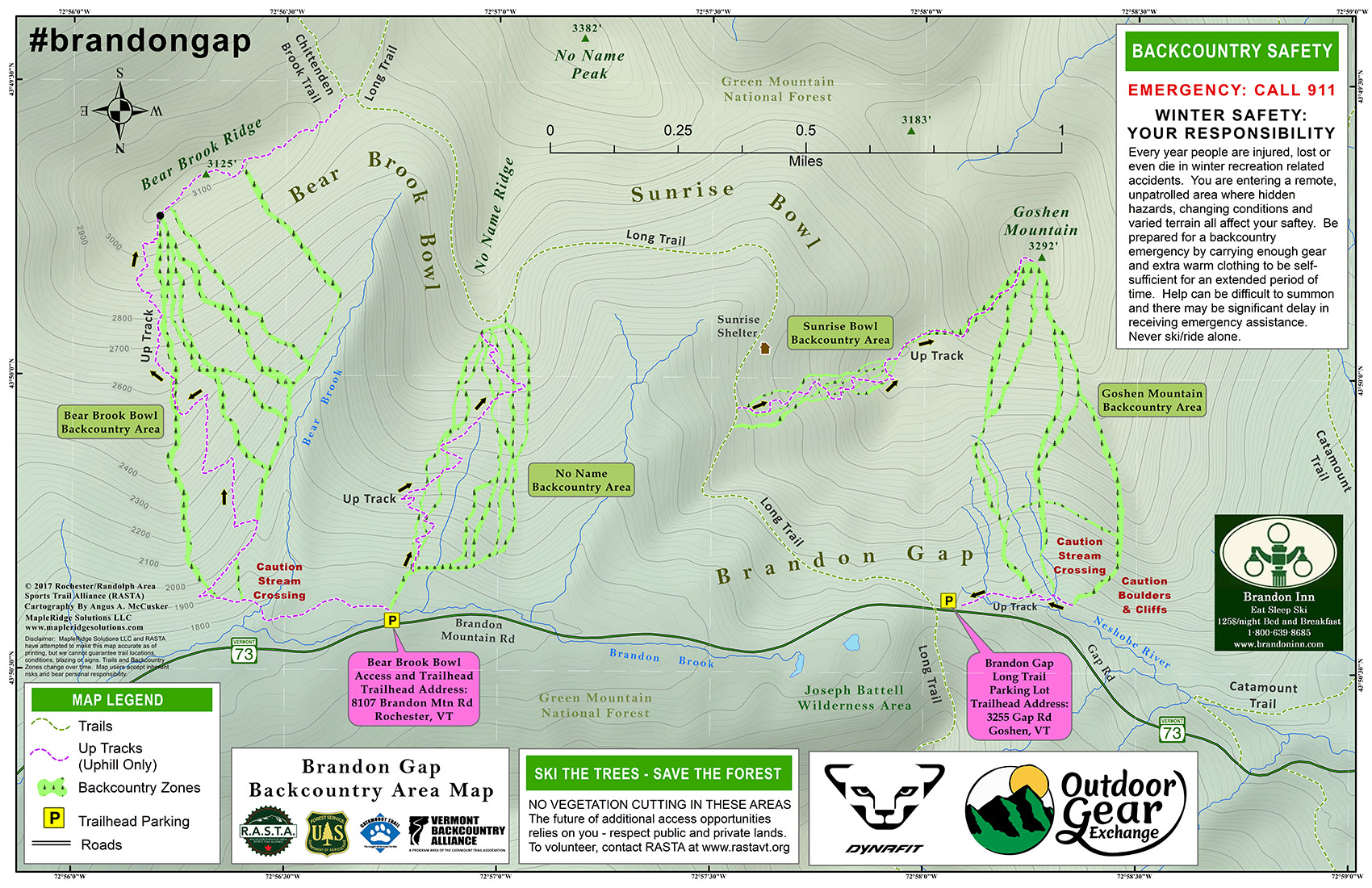
A copy of RASTA’s detailed map for the Brandon Gap backcountry area. Please visit RASTA’s website for a full-size version of the map
“Imagine more than 30 inches of feather-light champagne powder, and enough pitch to do it justice, and that’s what was going on at Brandon Gap today.”
The RASTA backcountry ski trails at Brandon Gap have been in the news for a while, and as soon as I first heard about them, I was eager to go on a tour and check them out. It’s not always easy to find an appropriate hole in one’s schedule that coincides with great snowpack and conditions though, so it’s taken a while to get me down there. I had time in the afternoon today though, and even though I was busy at work longer than I’d expected, I was still able to make it down to Brandon Gap.
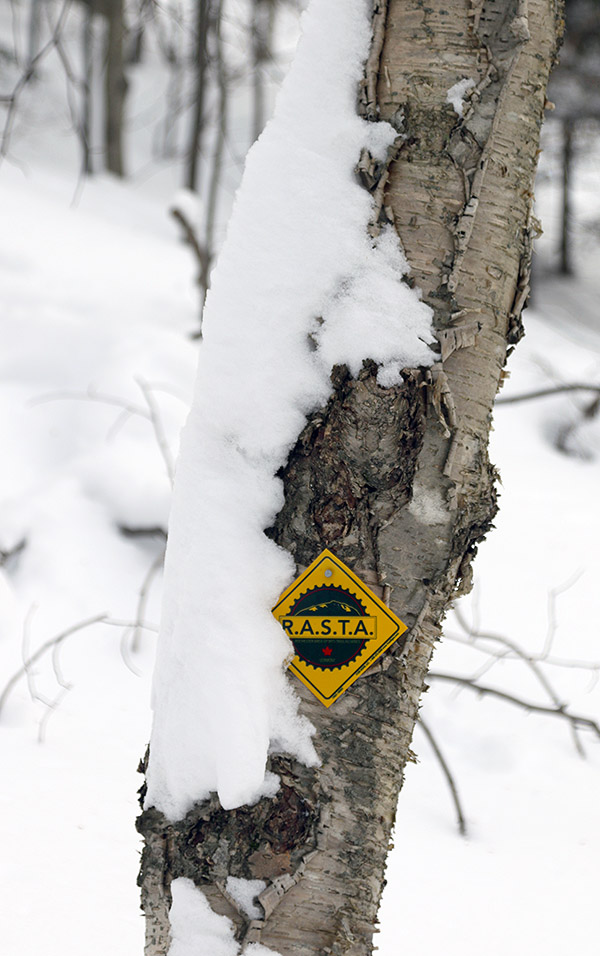
One of the plentiful RASTA trail markers along the skin track
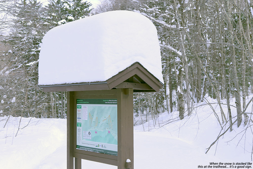
Although I didn’t know exactly how much snow the Brandon Gap area had picked up relative to the rest of the state, everyone has been getting substantial snows due to the remnants of Winter Storm Skylar. Ski resorts in the northern part of the state have picked up as much as six feet of snow in the past week or so. I could see that there wasn’t much to worry about at Brandon Gap when I caught sight of the massive stack of snow atop the map sign at the trailhead. The snow situation was looking very good.
I was somewhat short on time, so I opted to tour in the No Name Backcountry Area today. You really can’t ask for much easier access to great backcountry skiing. For the No Name area you literally hit the trailhead, and within moments you start going right up on your ascent. The skin track is nicely interwoven among the various glades in the area, so you can get a look at a lot of the potential ski options. The skin track is well established, beautifully laid out, and extremely well marked with RASTA blazes and directional arrows. I’ve never seen a skin track so clearly marked, it’s just one of those things about the area that make it so efficient and professional looking.
“We’re talking “hold onto your head as you descend because this is going to blow your mind” type of conditions.”
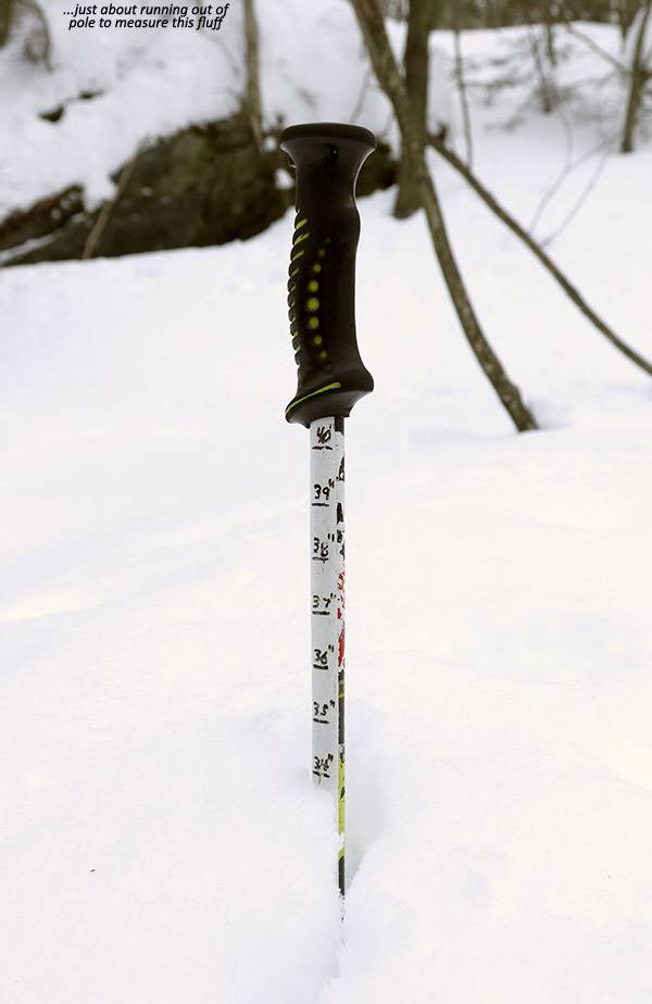
The ascent was extremely pleasant with such a beautiful skin track underfoot, and before I knew it I’d reached the top of the area where I found a nice packed out area for de-skinning, and another copy of the map displayed. I didn’t know exactly what to expect on the descent, but my depth checks on the way up had revealed that there was more than 30 inches of absolutely feather-weight powder covering the base snow. In many cases that would simply be too much snow, since you need some rather steep pitches to accommodate it, but that wasn’t a problem in the No Name area – the pitches there are generally at least black diamond.
With my gear set for the descent, I headed off to skiers left where I’d seen a glade that was essentially untracked. I dove in, and the powder skiing was simply insane. Imagine more than 30 inches of feather-light champagne powder, and enough pitch to do it justice, and that’s what was going on at Brandon Gap today. We’re talking “hold onto your head as you descend because this is going to blow your mind” type of conditions. Wow, just… wow! One of the more fun aspects of the descent was simply adjusting the pitch of my front leg in my Telemark stance to determine how much of my body was under the snow and adjust my speed. You know the snow is deep when that’s your main mechanism for controlling your speed. Got fat skis? Good, you’ll want ‘em.
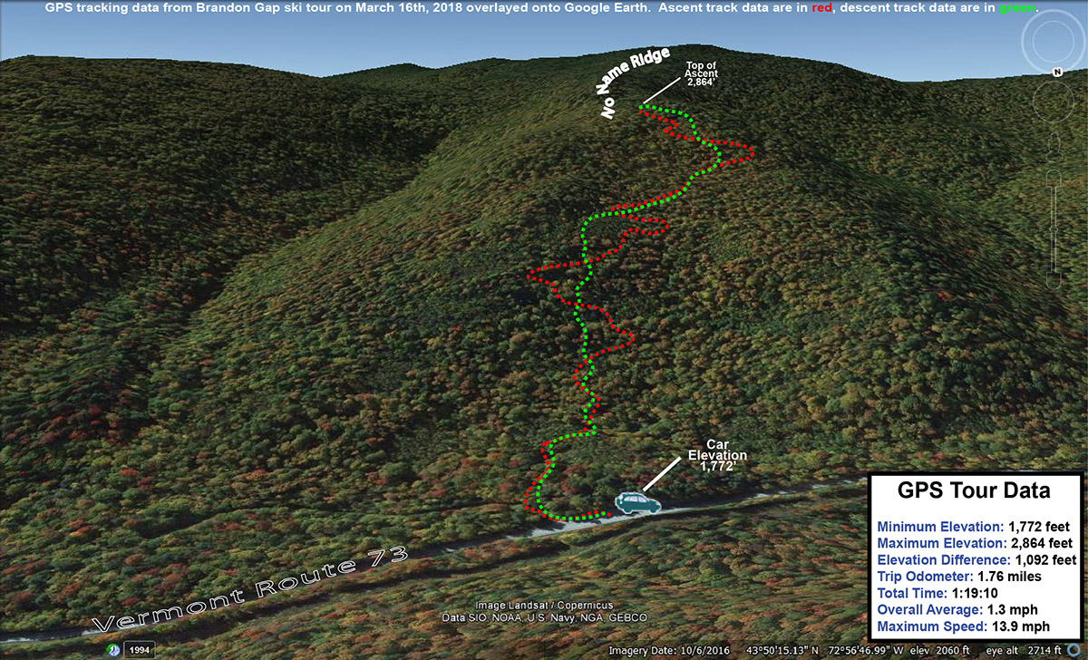
A Google Earth Map with GPS tracking data showing the path of today’s tour in the No Name area at Brandon Gap
It’s so funny how different the snow was today compared to the dense snow yesterday at Bolton Valley, but that’s the way storms go. Sometimes you have the right conditions in the dendritic grown zone to produce those massive, fluffy crystal, and sometimes you get small, baking powder flakes. Brandon Gap definitely got the goods over the past few days. It looks like we’ve got cold, midwinter conditions going into the weekend however, so the current state of the snow should be maintained for everyone getting out to enjoy the bounty of the recent big storms.
Winter Storm Skylar just continues to churn out the snow in the Northern Greens, so Dave stayed around for some additional powder fun today at Bolton Valley
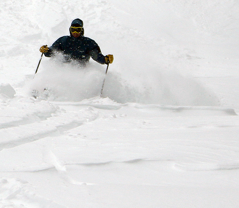
Being in the midst of this impressive storm cycle here in Northern Vermont, Dave decided to stick around for a bit more skiing today. We’d had an absolutely fantastic outing at Stowe yesterday with the family, and today the goal was to visit Bolton Valley for some runs. Like other local resorts, Bolton has been putting up some impressive snowfall numbers in the past several days, with 42 inches in the past 48 hours, and 62 inches in the past week. Another interesting note was that the Timberline Quad was slated to open today at 10:00 A.M. – for the first time this week. That had us intrigued.
“Like other local resorts, Bolton has been putting up some impressive snowfall numbers in the past several days, with 42 inches in the past 48 hours, and 62 inches in the past week.”
Although it was calm down at the house with huge fluffy flakes falling from the sky, I was definitely concerned about lift operations on the mountain with the anticipated winds. Dave had checked the snow report as we were heading out, and there was no note of any lift issues, but once we got up to the resort we found that the Vista Quad was on wind hold. The Timberline opening looked delayed about a half hour due to the time required to remove all the new snow from the lift terminals, but we were able to keep ourselves busy with some runs off the Snowflake and Mid Mountain chairs while we waited. The mountain had indeed picked up another good shot of snow overnight, but it was notably denser than what we were skiing yesterday at Stowe. You were still getting down in the powder to some degree, but you were definitely skiing much more “on” it at times as well.
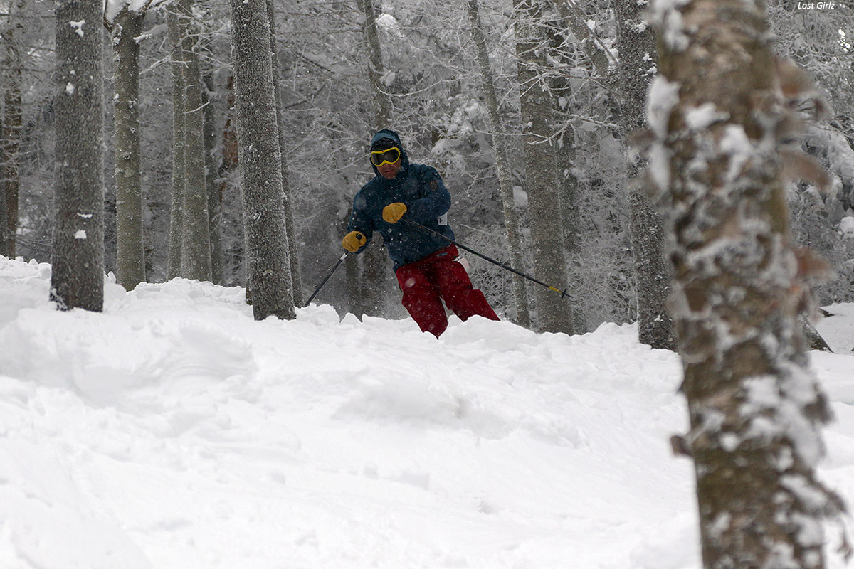
Dave working his way through the upper section of Lost Girlz as Winter Storm Skylar has finally put enough snow in there to provide good conditions.
When it was time to head over to Timberline, we caught first tracks on Tattle Tale. Indeed the new snow was dense, but it was a lot of fun planing our way down through the untracked expanse of white. Dave was definitely excited to get some of that feel today at Bolton, vs. the much busier slopes of Stowe from yesterday. We spent the rest of the morning there, hitting lots of other favorites like Spell Binder, Brandywine, Adam’s Solitude, Lost Boyz, Lost Girlz, etc. We headed back to the main mountain a bit after noon, and I headed out, but Dave was planning on a few more runs before heading on his trip back to Boston.
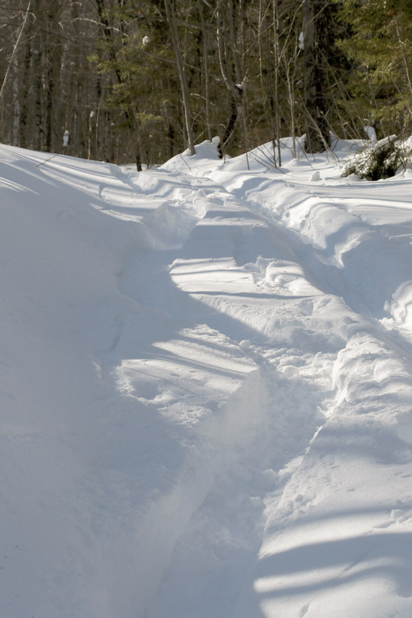
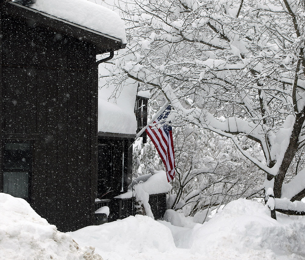
Down in the sheltered areas along the Bolton Valley Access Road there were some nice snowy scenes
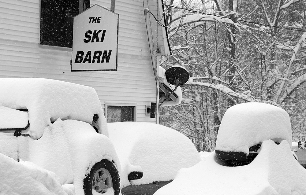
I got home to a driveway which needed to be cleared with the snow thrower again, after just having cleared it late yesterday evening. We’ve passed two feet of accumulation now with Winter Storm Skylar here at the house, and it just keeps snowing. We’re looking at some potentially great conditions continuing right into the weekend with snow showers around in the mountains.


