
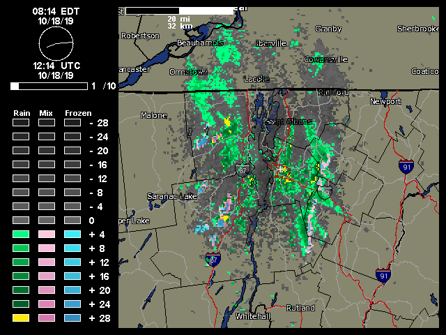
Although we did have some reports of frozen precipitation around the area back in the beginning of the month, the bombing cyclone that’s moved through New England over the past couple of days has brought the first real snows of the season to the Green Mountains. As the system moved by yesterday, the summit areas of Killington picked up an inch or two of snow. There wasn’t much going on with respect to snowfall in the northern part of Vermont at that point, but snow levels finally dropped overnight and we started to see accumulations in the higher elevations around here. Although I wasn’t out in the mountains today, the view from my office in Burlington showed that classic look of upslope precipitation along the spine of the Northern Greens. A quick check on the local radar showed that classic signature of moisture streaming into the spine of the Greens, with snow and mixed precipitation along the peaks. Powderfreak sent in pictures to the Northern New England thread at the American Weather Forums, revealing snow accumulations down to roughly 2,400’ at the Gondola, and a couple of inches of accumulation at the top of the Fourrunner Quad. At the end of the day, Powderfreak passed along one more photo that showed accumulating snow levels at around 2,300’ at the Gondola, and commented on how snow levels were somewhat lower on that part of the mountain below The Chin. Winter’s first salvo of snow is now in the books, and we may see a bit more near the end of the month based on what the weather models are showing for that period.