I recieved an update from Joyce Holsten this morning that the current sale of the large chunk of Bolton’s Nordic/backcountry terrain is not going through, although the parcel is still up for sale.
Bolton Valley Nordic & Backcountry, VT 21FEB2011
Temperatures warmed up above freezing at all elevations in Northern Vermont at the end of last week, so we waited for the powder to build up over the long weekend before finally heading out this afternoon for turns. We had three small systems that dropped snow over the holiday weekend; down at the house we picked up 3.7 inches of snow in the form of 0.21 inches of liquid, and Bolton was reporting 5 inches of snow in the higher elevations. The new powder at the house had settled down to about 2 to 3 inches over the old base, so we knew there would be at least that much up on the mountain. Temperatures wound up being colder than we thought, but the powder was nice – we found 3 to 4 inches of settled powder in the lower village portion of the network at around 2,000’, and up at the Bryant Cabin elevation (~2,700’) the depths of new snow were 4 to 5 inches. It turned out to be plenty of fluff for the low and moderate angle pitches, so many nice powder turns were had, and it was also the first time that the boys had skinned all the way up to the cabin. Dylan had some binding issues near the bottom of the run, so I had to help him through and he got quite a ride. Read about the entire adventure in the full backcountry trip report from today.
Bolton Valley Nordic & Backcountry Network, Vermont 22JAN2011
After a great powdery outing with Dave up on Bolton’s Nordic/backcountry network on MLK Monday, our next snow event began the following day. It was one of those low pressure systems in the Great Lakes that redevelops as a coastal, and as has been the trend this season, Northern New England was outside of the areas of heaviest precipitation. However, we did manage to get some snow out of the event. While there was no snow falling in Waterbury at the house when I left in the morning on Tuesday, a couple of hours later it had started up in Burlington. When I got home that evening I found 4.2 inches of new snow on the snowboard, and it turned out to be some reasonably dense, base-building material.
In the valley we wound up with 6.5 inches of snow comprised of 0.63 inches of liquid with that event, and then a similar system came in for yesterday. We were even farther out of that one though, and would up with just 1.6 inches of total snow at the house. As expected, the mountains did somewhat better, and Bolton had picked up over a foot of snow for the week.
The big weather event for this weekend isn’t snow however, it’s the cold. Highs are expected to be around 10 F today, and then perhaps not even get above zero tomorrow. E and the boys decided not to ski based on the cold forecast, but today’s temperatures seemed like they would be pretty nice for a backcountry tour. I waited until about midday for the temperatures to warm, and warm they had! Driving toward Bolton, the temperature was almost 20 F in the valley, and it seemed quite a bit warmer than initially thought. Even up in the village above 2,000’, the temperature was already 10 F and rising.
Kicking off my tour, I headed up Bryant as usual, and was treated to blue skies and lots of white trees. I could feel that the temperature was cooling down as I gained elevation, but I still had my hat off at times to keep cool. Once I reached the Bryant Cabin I assessed some tour options. Ty was having some friends over for a birthday party starting at 4:00 P.M., and I still had to do some grocery shopping on my trip home, but it looked like I had time for a longer tour that just a Bryant lap. I decided to head out north for a bit along the Bolton-Trapp/Catamount Trail and catch some turns off there.
The trip through the flats to the North of the cabin was fairly quiet, with more white trees and lots of deep snow visible on the steep slopes to the east. I saw one other skier in the flats on what looked like lighter touring gear, and then I saw another pair of skiers at the top of the drop in for the Cotton Brook trail. I kept going and assessed some glade options on the high side of the trail. There were a few tracks, but plenty of lines that hadn’t been visited, and the powder looked fantastic both above and below. To read about the descent and see all the pictures from the day, head to the full report from the Bolton Valley Nordic & Backcountry Network today.
Bolton Valley Nordic & Backcountry, VT 17JAN2011
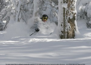
Dave stayed over through today, and the plan was to get in another day of skiing. With the amazing powder conditions I’d encountered on Thursday, Saturday and Sunday, combined with additional snowfall, it was a no brainer to try and make some turns on the holiday. We had contemplated lift-served skiing at Bolton or Stowe, but with the forecast high of roughly 10 F in the valley, E and the boys decided to take the day off from skiing, and Dave and I ultimately decided that it was a day to avoid sitting on lifts. The plan was set for another round of skiing on Bolton Valley’s Nordic/backcountry network.
I’d brought Dave for his first tour in the Bryant region of the trail network back on January 1st, and since the warm weather had turned the powder to mush at that point, the touring was actually the focus, and the ski descent was more peripheral. The skiing at that point, while still fun, was really more useful as an efficient way to get around. On that earlier outing though, I specifically told Dave to envision what the area would be like if it was filled with powder, because that’s that way it is most of the time. With the efficient setup of trails, skin tracks, and glades, along with the incredibly convenient access from the village, it’s quite an amazing resource. This time around, Dave was going to have the chance to see the area in top form.
Up at the village, we stopped in at the Nordic/Sports Center so Dave could grab a Nordic ticket. Having a season’s pass, I only stop in the sports center occasionally, and hadn’t noticed what a nice place it is in terms of a day lodge. There’s a snack bar, and lots of space to change. I saw a mother and daughter changing in there, and they had the entire place to themselves. Dave and I had already planned to gear up at the car, but it made me think about using the area in the future, especially with the boys. E has been planning to bring the boys up there for swimming etc., but in a total coincidence in terms of my visit, Johannes was also up there today with his mom and sister doing just that. Johannes wrote about his experience at the Sports Center on VTSkiReport.com in an article entitled “When it’s too cold to ski…”, so for those that are interested in learning more about the options at the sports center, check that out. With the way Bolton’s season’s passes are including access to everything this season, it’s a great perk.
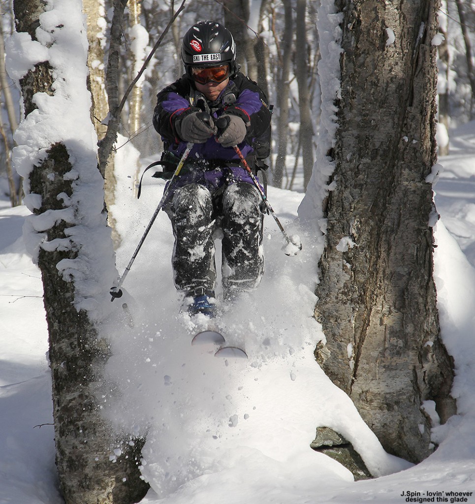
For our part, Dave and I decided that it wasn’t too cold to ski, especially when powering our own ascents. We headed over to the usual tennis court parking along the edge of the trail network at about 2,050’, prepped our gear, and got skinning. Although my car thermometer was reading in the low single digits, there was no wind, and the sunshine was really doing its thing. We hadn’t been long on the trail before we were heating up and removing clothing. Dave even had to take his hat off. We had a fairly quick and steady ascent up to the Bryant Cabin (2,690’) checking out some of the glades along the way. We could see that there were descent tracks on some of the more popular runs, but plenty of fresh powder was waiting. Check out all the text and deep powder pictures by clicking through to the full report from Bolton Valley today.
Bolton Valley Nordic & Backcountry, VT 08JAN2011
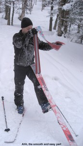
I checked out Bolton’s snow situation and alpine trail offerings in the middle of the day today, and after heading home, I filled E and the boys in on what I’d found. Since there was plenty of powder, but not a ton of lift-served trail options were available, we decided to head up to get in some backcountry skiing for the end of the day. Dave and I had found that the amount of base snow was excellent when we’d headed up to the Bryant Cabin the previous Saturday, so we were expecting great things with all the fresh stuff on top of it. Our 3:00 P.M. start resulted in twilight turns through the powder in the areas below Bryant Cabin, so it was quite an adventure for everyone. To see all the pictures and read the whole story, click through to the full backountry trip report from this evening.
Bolton Valley, VT Nordic & Backcountry 01JAN2011
We’d found that temperatures had cooled down a bit yesterday afternoon at the end of our Bolton outing, and slopes that were not in the sun had begun to tighten up. In general though, temperatures stayed relatively warm, and there was no new snowfall through this morning. We hung out at the house in the A.M., and as skies brightened a bit in the afternoon, Dave and I headed up to Bolton. Since there weren’t going to be any substantial changes in the spring-like snow conditions we’d experienced yesterday, and some of the natural snow trails were going to be closed due to the warmth, we decided to do a tour on the Nordic/backcountry trail network. Dave had never been on Bolton’s backcountry network, so he needed to at least get a taste of the plentiful options for turns.
Up in the village, there was one other car in the corner of the tennis lot providing quickest access to the Broadway area, so I’m guessing they had the same idea as us. In general though, things were quiet aside from a few Nordic skiers moving around the trails. We skinned the skis and headed toward World Cup where we found a group of patrollers checking passes. I can’t recall the last time I had my pass checked on the Nordic network, but I’ve heard the mountain is doing it more frequently this season so that’s nice to see. We chatted with the patrollers for a bit – they were initially wondering if we were planning to stay at the cabin, but we let them know we were just out for a quick tour.
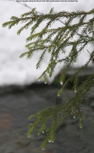
We headed up the Bryant trail and it was a really pleasant ascent. Temperatures were in the 40s F so we stopped frequently for photography to capture the sights. At one photography stop, a couple of patrollers stopped by and we talked for a while. We chatted about skis, cameras, and some of the new glades, and then they headed on their way up to take care of a tree that had fallen onto one of the trails. Coverage on Bryant and in the surrounding backcountry was excellent, with generally a couple feet of settled snow. We did see a couple of small openings in streams along the side of the trail, but they were more an opportunity for photos than anything. Any stream crossings on Bryant were in fine shape and there was no open water across the trail. To check out the rest of the text, images, and GPS track, continue on to the full Bolton Valley Nordic/Backcountry report from today.
Bald Hill, VT 23JAN2010
Saturday was another potentially good day for some backcountry skiing in Northern/Central Vermont, since snowfall had again been rather minimal in the area during the preceding week. At the house in Waterbury, we’d picked up just 1.4 inches of snow in the Sunday/Monday range from a storm that favored parts of Maine and Southern New Hampshire with up to a foot, and then 1.6 inches of snow in the Tuesday/Wednesday timeframe from an upper level low coming out of the Great Lakes. As for the mountains, I saw accumulations topping out in the 4 to 5 inch range for the Bolton through Sugarbush stretch, with amounts tapering off to the north. The forecast on Saturday called for a cold start in the 0 F range, but brilliant sunshine and eventual temperatures in the 20s F. Weather wise, it was an excellent time to get outside.
“The combination of settling
and the thin breakable
crust in some spots made
things tricky at times,
but it was all soft and fun.”
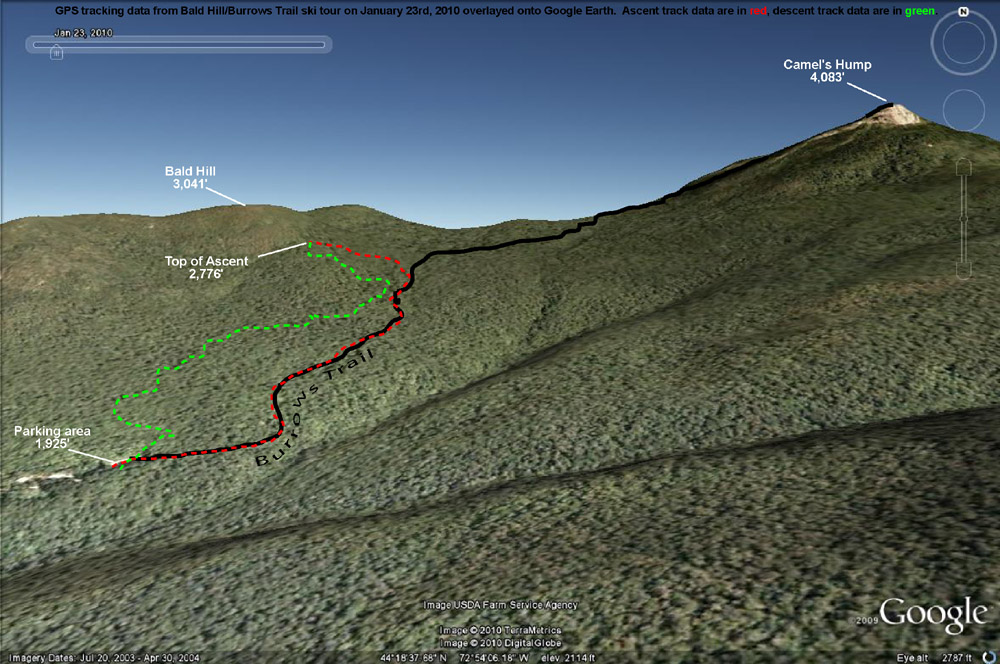
With the snowfall thoughts in mind, the plan was to do some skiing off the west side of the Camel’s Hump/Mt. Ethan Allen area. Unfortunately, on Friday we found out that Tom had tweaked his knee and ankle at soccer, so the ski group for the day was going to be just James, Ty, and myself. We met up with James in Huntington Center a bit after 9:00 A.M., and decided on an initial plan of heading up the Forest City Trail to do some skiing on the lower flanks of Mt. Ethan Allen (3,674’), the next prominent peak south of Camel’s Hump. We headed up Camel’s Hump Road, finding that the access to the Forest City trailhead was going to be difficult because the road there wasn’t plowed in the winter. There was a little room along the snowbank to potentially park a couple of cars, but a more important factor in our case was the added distance to get to the trailhead. Ty’s backcountry range is not that great yet, so we weren’t looking for a big approach. There was the option to connect over to the Forest City Trail from the Burrows Trailhead area, but we decided to just do something simple off the Burrows Trail. James had commented to me earlier that there was going to be a temperature inversion in effect, and that was indeed what we saw on our ascent of Camel’s Hump Road. From down in Huntington Center (690’) where the temperature was somewhere in the middle single digits, the temperature was up around 10-11 F at the trailhead parking area (~1,900’). The lot was about half full, and while we geared up, we could see that several parties of people were heading out for hikes on snowshoes.
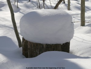
Starting up on the Burrows Trail, I checked the snowpack and found a couple inches of fluff on top of a generally thin crust, atop a lot more settled powder. A few of the lower elevation stream crossings on the trail were open with small gaps, and that represented a bit of a challenge for Ty, but he managed well. We didn’t have any lofty goals in mind other than getting in a little skiing, since our ultimate destination would likely be affected by Ty’s mood and stamina. Our pace was pretty slow with Ty taking his time, but it was an easy go, and everyone’s skins were working well on the packed trail. There were lots of dogs, lots of people on snowshoes (including a bigger group that seemed to be from the UVM Outing Club), and we also saw a party of about four skiers that passed us on their way up the trail. One of the more interesting sights was a woman coming down trail at breakneck speed on a sled that looked like a booster seat. We made sure to move out of her way, but she seemed to be very conscious of the uphill traffic and stopped easily. James inquired about how her sled worked, and she demonstrated that for braking, you just lean back. I know that people like to use those Mad River Rocket-style sleds on the trail and elsewhere, but this was the first time I’d seen what this woman had.
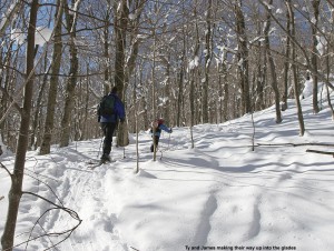
Up to about the 2,300’ elevation mark the surrounding vegetation was on the brushy side, but above that point it began to thin out and the potential for skiable lines looked a little better. Off to our right, we could see some open, moderate angle slopes across the big gully that had begun to parallel the trail, and off to the left we could see the more obvious lines that steepened on the way up to Bald Hill (3,041’). Ty had some good bursts of skinning speed when we kept him motivated, but as inquiries about how far we were going and when we would get to ski became more frequent, we decided it was time to think about our descent route. Heading off to the left for the lower slopes of Bald Hill was going to make things easiest for getting back to the trailhead for Ty, so a bit above 2,500’ when we hit one of the skin tracks breaking off the Burrows Trail and going in that direction, we took it. The change of scene was enough to keep Ty motivated for a little bit longer, since we were able to tell him that we’d be able to descend soon.
We headed up into the glades a little farther, reaching an elevation of about 2,700’ before Ty seemed to be getting just a bit too antsy. There were plenty of good lines available with untracked snow, but we could see that taking them would mean dropping right back down to the Burrows Trail almost immediately. So, we continued to contour westward to get something that might drop a little more directly to the trailhead. We could only traverse so far though, since Ty knew we were close to skiing and his inquiries started up again. When we finally called it on the traverse, James and I skinned up a little farther to catch a nice looking line, while Ty waited just below us.
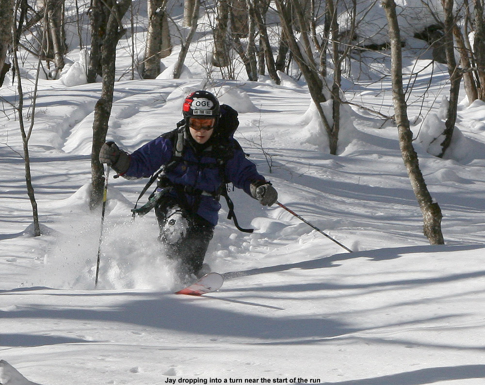
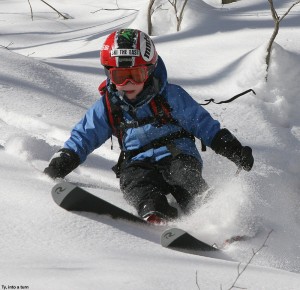
The skiing was good, and definitely worth the hike, but certainly not perfect or quite up to what I’d found off the Monroe Trail the previous weekend. The combination of settling and the thin breakable crust in some spots made things tricky at times, but it was all soft and fun. Ty stuck with just alpine turns, but had a lot of fun catching air and working on his jumping technique. Our extra traversing had bought us a little longer descent, but we still dropped back to the Burrows Trail pretty quickly. Instead of trying to ski on and near the trail, we took a traverse out to the west with the aim of eventually dropping back down to the parking lot to finish our run. I used the GPS for route finding, and as is often the case, James went by his natural sense of direction. The biggest issue with the traverse was that like on the Burrows Trail itself, a few streams were still open from the previous warm weather. They weren’t too hard to cross since there were still snow bridges around, but Ty’s smaller skis definitely set him at a disadvantage for spanning some gaps. We helped him across when needed. Even with the aid of the GPS, I overshot the parking area by about 100 feet or so and had to swing back during my final descent, while James nailed it right on.
Camel’s Hump – Monroe Trail, VT 17JAN2010
From what I’d been hearing, ski conditions were generally decent around the area this week, but new snowfall was sparse. Subsequent to the 9 inches of snow that Bolton picked up last weekend, they’d only reported 2 to 3 inches of additional accumulation. Down at the house in Waterbury (495’), we picked up 4.8 inches of snow from that weekend event, and then smaller events on Monday and Wednesday dropped 1.2 inches each. It was enough to keep things fresh, but it was rather dry snow that probably didn’t add too much new substance to the snowpack.
The end of the week also saw an increase in temperatures, with our location in the valley getting up to around 40 F at times. It was a little hard to get a sense of what had gone on with the weather in the mountains, since I heard talk of a crust in the Mt. Mansfield area, but Paul Terwilliger’s report from Central Vermont suggested that the powder was great down there. Unsure of whether I was going to encounter, powder, crust, mush, or who knows what, I chose to keep it simple and earn some turns close to home. I decided to check out some terrain right across the Winooski in North Duxbury below Camel’s Hump. From the Winooski Valley, at an elevation of about 400’ or so, the Camel’s Hump Road heads southward up into the mountains for several miles to an elevation of about 1,500’ where there is access to Camel’s Hump State Park and various hiking trails. My friend Weston used to live right up near the top of the road, and told me that there were plenty of glades up above him along the route to Camel’s Hump. I took a peek at my copy of David Goodman’s backcountry skiing book for Vermont, and he also speaks of the various glade skiing options along the Monroe Trail.
 This was actually my first time driving up Camel’s Hump Road in the winter, so it was neat to get the perspective with the snow. The drive offered great views of Ridley Brook, which flows near the road throughout the drive. I always get a kick out of some of the funky houses along the road: some that seem to be accessed by unique bridges, and others with their own quirks, like one that seems to be some sort of partially underground structure with a flat roof. At this time of the year, the very top part of the road is closed, so I had to park in the winter parking area at ~1,200’. From a temperature of ~38-39 F down at the house, the temperature dropped to ~36 F at the parking area, and in terms of snow conditions, I hoped that the temperature would continue to drop as I ascended.
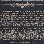 With skins on, I quickly made it up the rest of the snow-covered road to the main parking area and trailhead at around 1,500’. I checked out the plaque near the trailhead commemorating the 1944 bomber crash on the mountain, and then I was on my way up the trail. I began checking the consistency of the snow, and it seemed like the powder was dense, but not really wet, and there was no detectable crust. Within a few minutes of being on the Monroe Trail, I began to see obvious glades up above me as Weston had suggested. The Monroe Trail didn’t really attack the fall line, instead it seemed to gradually contour up and to the left in a southwesterly direction. I figured that one approach to skiing the glades would be to see if I could gain some elevation on the Monroe Trail and eventually traverse back in a northeasterly direction for a fall-line style descent back to the trail, but I wanted to see where the Monroe Trail would take me on its own before I started breaking snow on a new route. The trail was well packed, and plenty wide as David Goodman suggests in his book, so it’s really easy to cruise along with skins. I was happy to have full-width skins in a few spots where the trail gets steep, but one could certainly make due with less as long as the snow consistency supported good grip. There were a few ski tracks where skiers had come out of some of the glades, and tracks suggested that a few more folks seemed to have skied on and around the trail, but I didn’t see any skiers during my tour. I did see a lot of people on snowshoes: one group of 6 to 8 people, a few couples, and a couple of other groups.
The trail continued it’s mostly gradual, southwesterly ascent, and at around 1,800’ I noticed that the trees seemed to have more brush in them than I’d seen in the earlier part of the climb. At 2,300’ in elevation, I reached the junction of the Monroe and Dean Trails, and direction-wise, continuing on the Monroe Trail was the obvious choice for what I wanted to ski. The Monroe Trail had been starting to wrap around toward a more northwesterly direction, getting more in line with my efforts to eventually head to the northeast, while the Dean Trail headed southwest. Not far above the junction, the forest began to turn into a beautiful combination of birches and evergreens, and I could see some nice ski lines for folks that opted for the skiing in the trail area. Then, a little above the 2,500’ elevation mark, I hit the frost line and everything began to turn white, changing the look of things again. Ascending farther, the forest transformed back into more hardwoods again with some decent open ski lines paralleling the trail, and I could see that a few people had used them. Finally, as I approached the 2,800’ level, the trail was actually starting to almost make a north/northeasterly jog and far above I could see huge cliffs on the eastern face of Camel’s Hump directly ahead of me. The forest quickly transformed yet again into an area of almost exclusively evergreens.
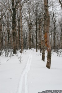
It was after 3:00 P.M. by that point, and as I didn’t want to push the available daylight, I began to look for the best route to traverse northeastward for my descent. I followed the Monroe Trail for as far as it seemed to jive with my plan, and when it really seemed to head southward I had to begin my traverse. I traversed north/northeastward among the evergreens, and down below the cliffs the trees were often quite open. If the snow was elevation-dependent, or if one wanted to simply stick in this terrain, I could easily see this area being used for some great laps of skiing. Indeed, I saw various tracks of previous skiers scattered around, suggest that folks had had some fun. As I made my traverse through the evergreen forest, I came across various tracks of people that had either been descending or ascending, but I eventually picked up a skin track that seemed to be very much in line with my plan. I followed the track through the evergreens until it broke back out into a lot of birches, crossing what looked like an interesting trail marked with blue flagging tape. That blue-flagged route looked intriguing, but it ran literally perpendicular to where I wanted to go, so I had to pass it by and chock it up to future exploration. I checked several times with my GPS compass to ensure that the track I was following was legitimate, and not something left over by somebody that had simply been lost, but it stayed on course.
After another couple of minutes of traveling through some flat, very open terrain, I noticed that the skier/rider before me had started to make a couple of turns, so I decided it was time to take of my skins and focus on the descent. I was excited about the skiing prospects, even if only due to the snow depths and consistency I’d see on the ascent. I had little idea about what I might find for slope continuity or vegetation below. In terms of snow quality, there had been no sign of a crust aside from a couple of isolated spots that had a thin coating that must have been from the sun. And, throughout the trip I’d been checking on snow depths, finding anywhere from 14 to 26 inches of settled powder atop the base snow.
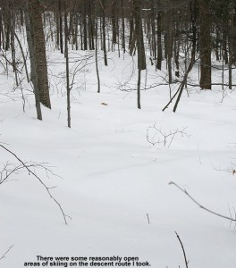
You don’t always know quite how snow is going to ski until you actually get on it, but as soon as I dropped that first knee into a turn all questions were answered. The powder was dense as expected, and I was only sinking in about 4 to 5 inches, but the density made the turns really smooth. I continued on with turns, checking my GPS every couple hundred vertical or so to ensure that I was on track to hit the glades near the start of the Monroe Trail. There were some steeper options off to my left (north) but with the tree spacing they would be best for deeper/lighter powder. I found the conditions perfect for the moderate and low angle slopes that I encountered. Ultimately, my descent was not as fall line as I was initially hoping for, and I really had to keep pulling left throughout the descent to stay on target, but I was pretty happy with it for a first shot. I occasionally saw a couple of other tracks in the area as our paths crisscrossed, so obviously some others (presumably at least that track I’d followed) had done something similar. As far as tree spacing went, it wasn’t a brush-fest, and there were a few more open areas, but nothing extraordinary relative to what I’ve seen around here for what appears to be nature taking its typical course. If one didn’t have to check on or correct their route, most competent tree skiers could enjoy a fairly continuous ride without having to constantly hit the brakes for brush. A couple more feet of base would help a little on the bush front, but not too much from what I could see, and it’s certainly not needed in terms of coverage. With the base snow plus all the settled powder, coverage was absolutely bomber on everything I found on my ascent. I was able to pop off small boulders etc. and never heard a thing from my skis. The most consistently open glades on my descent were the terrain I’d seen down near the Monroe Trail, and I actually still came up just shy of one of the shots I’d been aiming for. Looking at my GPS/Google Earth plot, I can see that a longer traverse up high would be needed for a more direct fall line descent, but that’s something to strive for in a future trip. It does remind me of a quote from David Goodman’s chapter on the Monroe Trail, where he says “The quest for the perfect glade run will keep you coming back to Camel’s Hump time and again…”
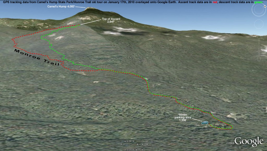
So, both the base and ski conditions in the Monroe Trail section of Camel’s Hump State Park were great as of yesterday at all elevations I skied off piste (1,500’ – 2,800’). We picked up 1.4 inches of snow from last night’s activity, so that area should have picked up something in the 1 to 3 inch range as well, and I can’t imagine that would be anything but a positive on top of the conditions I experienced.
Stowe & Mt. Mansfield Chin, VT 25APR2009
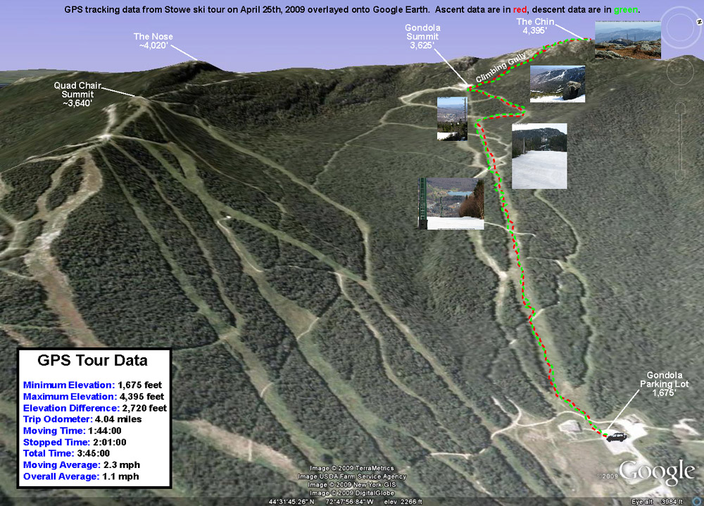
The boys were more interested in planting flowers with Mom on Saturday than skiing, so unfortunately I couldn’t interest them in going out for some turns. This meant that I was on a solo outing, but the upside was that I’d be able to do a much bigger tour than I would have been able to with Ty, or especially with Dylan. The skies were clear and blue all Saturday morning on what was likely our warmest day of the spring up to that point. The temperature was already around 80 F when I pulled into Stowe’s Midway lot (~1,700’) in the early afternoon, and with the forecast for temperatures in that range, I hadn’t been too optimistic about the snow quality. My major goal was to at least get in a good workout, so I was willing to negotiate some sloppy snow on the descent if that was the way it had to be.
Snow was available right from the Midway Lodge elevation, with just a couple hundred feet of fairly flat walking on grass to get on it from the parking lot. I was immediately surprised when I got on the snow and found that it wasn’t sloppy at all; it was all corn with just the top inch or so loosened up. That’s the sort of corn that seems to provide some of the easiest turns, so I was immediately enthusiastic about the potential for a quality descent. There wasn’t much of a breeze in the lower elevations, but the snow helped keep the air temperature a bit cooler and the ascent was very enjoyable. For ascent attire I’d gone about as minimally as I felt comfortable doing, with a short sleeve polypropylene T-shirt and my ski pants with the side zippers fully open, and that worked out to be a comfortable setup for the temperature. I hadn’t made a non-powder ascent on skins in a while, and I was quickly reminded how the lightness of Telemark gear allows you to simply fly up the slopes. Before I knew it I was up at the Cliff House (3,625’) and feeling great, so I decided to keep going up into the alpine.
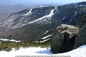
I set my skis onto my pack and hit the climbing gully. There was a bit of rotten snow in spots, and as I didn’t immediately find a boot ladder, I had visions of an inefficient, sloppy climb with lots of post-holing. I’d already post-holed a few times in the outskirts of the gully (it only took one of those to remind me to get my ski pants zipped up at least halfway) but fortunately, about 50 feet up the climbing gully I found a boot ladder made by some nice big feet. That made the going fairly smooth, and the views of the Green and White Mountains continued to improve with each step. Near the top of the gully, I ran into a guy about to descend. He had spent an overnight or two on the mountain, and said that he’d been amazed to find fresh powder on Friday morning when he’d started skiing. It sounds like along with Thursday morning, Friday morning had also been good in the higher elevations with regard to fresh snow. The downside of the fresh snow was that conditions in the alpine were still a bit sloppy. The new snow had not yet cycled to corn in the highest elevations, so it just wasn’t going to provide an optimal surface. By the time I departed from my conversation in the gully, I was moments from the Mansfield ridge line. Up on the ridge I enjoyed the new westerly views of the Champlain Valley and Adirondacks, and decided to stop in at the top of The Chin (4,395’) since I was so close. There was a small group of college students enjoying the popular leeward side of the summit, and there was a pleasant breeze of probably 15 MPH or so. The high temperature for the day at the Mt. Mansfield Stake came in at 67 F, so I suspect that the summit maximum temperature was probably close to that. Getting an April day like that at the top of The Chin is certainly a treat.
For my descent, I wasn’t able to ski right in the summit or the West Chin area due to lack of snow, but I was able to ski down the gully where the Long Trail drops away from The Chin as it heads south. It was quite a perspective to see the snow create a flat surface through the gully, when in the off season it’s a 10-foot deep chasm containing the hiking trail. I had to remove my skis to descend the very top of the climbing gully, but below that point one could keep them on continuously. As expected, the new snow up high that hadn’t fully cycled to corn wasn’t as nice as the corn snow on the bottom 2,000’, but I actually had some fun turns in the climbing gully, and it let me work on Telemark turns in steeper, tighter confines. I still had to make some alpine turns and throw in some side slipping up there since some areas were just so tight, but overall the gully allowed a good mix of styles. The crème de la crème of snow surfaces for the day was probably the top half of the Gondolier descent. There must have been very little traffic up there because most of the snow surface was just a smooth layer of ripe corn. The lower half of Gondolier still had nice corn snow, but the surface wasn’t as smooth as the top half of trail. Perhaps the lower elevations had experienced more melting that started forming aberrations in the surface. Based on my GPS data, it looks like my descent was 2,720’, not quite what you can get for vertical in the winter when you head all the way back down to Route 108, but still a decent run. There were still about 7 feet of snow at the stake on Saturday, and even though that level has dropped some with the recent warmth we’ve had, skiing should available on Mt. Mansfield for a while.
Bolton Valley Backcountry, VT 11FEB2007
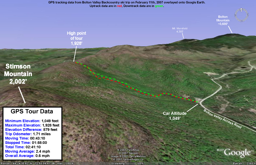
Today I headed out for some backcountry exploration in the Bolton area. I was sure that James would still be resting his ankle, so once again I made it a solo outing. After exploring part of the Cotton Brook drainage the previous week, I decided to switch it up and check out something on the other side of the valley. A convenient starting area for reaching the terrain on the western side of the valley is one of the VAST (Vermont Association of Snow Travelers) access points. The ample parking lot sits at an elevation of roughly 1,000 feet on the Bolton Valley Access Road. My plan was to start out on the VAST trail that heads west from the parking area, and make my way up to the ridge line that extends north from Stimson Mountain. The summit of Stimson Mountain is at 2,002 feet, and the ridge maintains roughly that elevation for several miles as it heads northward toward the Bolton Mountain area. If I was able to find a suitable route to the ridge, and the terrain was appropriate, the tour would provide about 1,000 vertical feet of skiing.
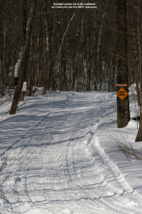
I arrived at the trailhead in late morning to sunny skies and a temperature of 19 degrees F. There was only one snowmobile trailer in the lot at that time, so the lot looked pretty deserted. I started skinning westward on the nicely maintained VAST trail, which at first had a fairly gradual slope. Then, I crossed a large bridge, and the trail steepened. After maybe 50-100 vertical feet, the trail flattened out and turned to the south. At that point I decided to break away from the VAST trail and head westward up the ridge. The going would be slower once I had to get off the trail and break my own way through the powder, but as far as I could tell without a VAST map, the VAST trail headed more southward and was not going to get me up the ridge where I wanted to be. I finally broke off the VAST trail at the intersection with an old logging road. There was a sign indicating that the logging road was not open for VAST travel.
Despite breaking my own trail, the going was pretty smooth. I’d checked the depth of the powder just after I started my hike, and found it to be 9 inches over whatever thicker layer was below it. At the bottom of the logging road, the snow was still in the 9-12-inch range, so I wasn’t bogged down by too much depth. I continued upward, following a network of logging roads and taking the route that seemed to best direct me toward my destination on the ridge. I spied plenty of great ski lines along the way, and I marked a few of the more attractive ones on my GPS. The logging road seemed to have been maintained and it made for quick travel; at least it appeared that way with the snowpack at the time. If there was a forest of saplings growing on the road, they were long buried under the snowpack. There was only one obstacle that forced me to detour from the logging roads, a huge tree that lay across the trail near the middle of the hike. It took a few extra minutes to work my way around that one. Currently, with the additional 3 to 4 feet of new snow from Wednesday’s storm, that tree is probably not even an issue.
My route took me generally westward up the ridge, with a bit of northward movement toward the end. About 2/3 of the way through the hike, I came across a large flat area, and above it was some of the steepest terrain I’d seen on the day. The terrain there actually looked a bit too steep and rocky for skiing, so the slight northward trend worked well to keep me in more skiable terrain. Near the top of the hike I attained nice views of the Timberline area across the valley. I could even hear the announcer for the ski race that was taking place over there. The race was presumably a continuation of the event that Ty and I had seen the previous day. High clouds had been building in throughout my trip, so at that point the sunshine was no longer as brilliant as it had been when I started the hike.
After several minutes of additional climbing, I finally hit the ridge. While the powder just below the ridge had built up to a depth of around 15 inches, on the ridge itself, the snow was heavily compacted and drifted. In some places, the snow had been scoured down to just a few inches in depth. Small trees all across the ridgeline had been bent over and snapped by the strong prevailing winds that raked the area. To the west below me was Bolton Notch, and I could see what looked like some skiable lines dropping eastward toward the Bolton Notch Road. I actually thought I heard the voices of a couple of people below me in the notch, but it was very faint and I couldn’t get a fix on their location. I hiked around the summit ridge for a bit while I had a snack and a drink, then removed my skins and started down.
To ensure that I’d be able to get right back to the car without having to do any hiking along the access road, I followed a downhill route in the same general area as my skin track. Sometimes I traversed out above my skin track and skied back down to it, but for much of the run I was able to stay off to the skier’s left of my skin track and follow the natural contour of the terrain. Even with the snowpack below average (as gauged by the snow depth at the stake on Mt. Mansfield being at only ~54 inches), one could pretty much ski anywhere in the area I explored. There were always some lines that seemed to be the pick of the crop, but there were few areas where the vegetation was too thick for turns. There was plenty of powder for bottomless turns throughout the descent, and the depth of the base let me tackle the lines with a fair degree of confidence. With the potential for 3 to 4 feet of snow from the storm this coming Wednesday, I suspect there will be even more wide open lines. A storm of the size expected would likely bring the snow depth at the Mt. Mansfield stake close to 80 inches, which would actually be above average for this time of year.
For the final pitch down to the VAST trail, I actually skied the last part of the logging road I’d ascended. It was steep enough that it made for some pretty nice turns. The Avocet recorded 920 vertical feet of descent and the Suunto recorded 958 vertical feet of descent, a difference of 4.0%. The high clouds had continued to build in throughout the tour, so the temperature at the end of my run was pretty much the same as it had been when I started skinning. It was a fun and easy trip with great access.
